
Gros Morne National Park where the Earth’s mantle meets the sea
Published on 08/21/2026 at 18:34 | Editorial responsibility: Rafael Müller, Editor-in-Chief AD HOC NEWS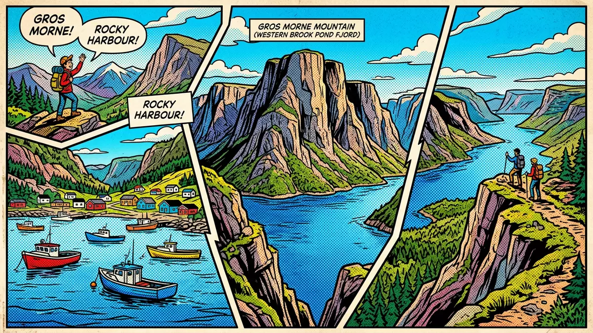
Gros Morne National Park on Newfoundland’s west coast sets Rocky Harbour against a landscape where deep ocean crust, Earth’s mantle and glacier-carved fjords sit side by side. Inscribed as a UNESCO World Heritage Site in 1987, it links ancient continental rocks with landlocked waterways in a single coastal park that makes plate tectonics visible on foot.
Where continents, ocean crust and fjords share one coastal park
Gros Morne National Park lies on the western side of Newfoundland in the province of Newfoundland and Labrador, facing the Gulf of St Lawrence and centred on communities such as Rocky Harbour and Norris Point. Within its boundaries, visitors move from low coastal plains into the Long Range Mountains, a northern extension of the Appalachian system that exposes Precambrian gneiss and granite thought to date from more than a billion years ago.Long Range Mountains These highlands frame glacier-cut valleys and cliffs, giving Gros Morne a mix of alpine plateaux and deep troughs close to the Atlantic coast.
The park’s designation as a World Heritage Site recognises this combination of geology and scenery. UNESCO notes that Gros Morne presents an internationally significant illustration of continental drift, where a relocated portion of oceanic crust and ocean floor sediments now sits beside ancient continental rocks along the former margin of North America.UNESCO World Heritage Site The coastal landscape adds glacier-sourced headlands and fjords to this geological cross-section, turning the park into a broad outdoor textbook on how oceans open and close.
The Tablelands: walking beside Earth’s mantle
The Tablelands form one of Gros Morne’s most striking features, a rust-coloured plateau between Trout River and Woody Point where mantle rocks stand exposed at the surface. The rock here is largely peridotite, an ultramafic material from Earth’s upper mantle that was thrust upwards roughly 500 million years ago when the Iapetus Ocean began to close and oceanic crust was driven onto the continental margin.Tablelands plateau Its chemistry, rich in iron and other metals, produces the bronze-orange tone and supports sparse vegetation, giving the area a barren appearance that contrasts strongly with neighbouring slopes.
Across the Tablelands, footpaths and roadside viewpoints reveal how this mantle rock sits beside more typical continental formations. The orange-brown plateaux stand against the green-grey of surrounding mountains built from metamorphic gneiss and granite, highlighting the meeting line between deep ocean lithosphere and continental crust.mantle rock at the surface Walking here means tracing the boundary where two ancient plates collided and an ocean vanished, a rare chance to see the materials of the mantle, crust and sedimentary cover in a single landscape.
Long Range highlands, Western Brook Pond and exposed ocean crust
Beyond the Tablelands, Gros Morne’s Long Range Mountains rise as high plateaux with steep sides, exposing rocks that record more than a billion years of continental history. Their gneiss and granite cores belong to the ancient North American basement, pushed up during mountain-building episodes such as the Grenville Orogeny and later modified by glacial erosion.Long Range plateau In some valleys, sedimentary layers from continental shelf and slope settings overlie this basement, adding shale, limestone conglomerate and fossil-bearing carbonates to the cross-section of rocks visible in the park.
Western Brook Pond, a landlocked freshwater fjord in the northern part of Gros Morne, shows what glacial erosion did to this ancient terrain. Glaciers cut a deep U-shaped valley into the Long Range Mountains, then rising land isolated the fjord from the sea and turned it into a lake ringed by near-vertical cliffs.Western Brook Pond fjord Here, boat trips and shoreline walks reveal waterfalls dropping from the plateau and the depth of the gorge, while the surrounding coastal lowlands show softer scenery of bogs and barrens reaching towards the Gulf.
Visiting Gros Morne National Park: what travellers from Western Europe should know
- Gros Morne National Park lies in western Newfoundland in the province of Newfoundland and Labrador, with Rocky Harbour and Norris Point among the communities near its central fjords and coastal lowlands.
- The terrain combines low coastal plains with high plateaux and steep-sided valleys, so routes may include sustained gradients on mountain paths and longer approaches on foot across open barrens.
- Road access runs along the coast and inland valleys, linking trailheads for areas such as the Tablelands, Western Brook Pond and the Long Range plateau, with parking areas at several starting points.
- Weather in this Atlantic region can be changeable at any time of year, and exposed sections on the plateaux and coastal headlands offer little shelter from wind or rain.
- The official language is English and the currency is the Canadian dollar; entry requirements depend on your nationality, UK travellers can check the FCDO travel advice at gov.uk/foreign-travel-advice, Irish travellers the Department of Foreign Affairs at ireland.ie.
Searching for Gros Morne National Park on social platforms
These links open searches for Gros Morne National Park on each platform.
Frequently asked questions about Gros Morne National Park
Where is Gros Morne National Park and how is it linked to Rocky Harbour?
Gros Morne National Park sits on the west coast of Newfoundland in Newfoundland and Labrador, with Rocky Harbour located near its central coastal section and fjord-backed lowlands.
What should visitors expect when exploring Gros Morne?
Visitors encounter a mix of low coastal plains, high plateaux, glacier-cut valleys and rust-coloured mantle rocks at the Tablelands, along with landlocked fjords such as Western Brook Pond framed by steep cliffs.
What makes Gros Morne National Park distinctive among Canadian landscapes?
Gros Morne combines exposed oceanic crust and mantle rocks with ancient continental formations and glacier-carved fjords, a rare geological cross-section that helped secure its UNESCO World Heritage status in 1987.


