
Gros Morne National Park’s ancient geology around Rocky Harbour
Published on 09/19/2026 at 20:21 | Editorial responsibility: Rafael Müller, Editor-in-Chief AD HOC NEWS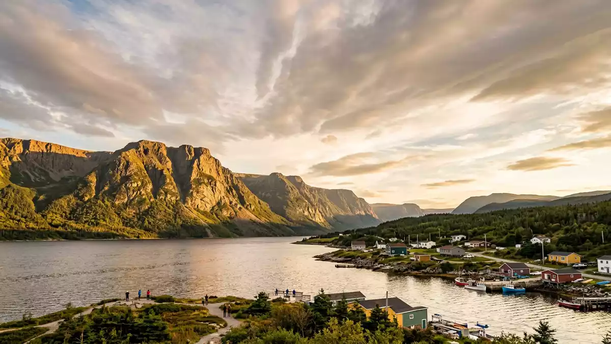
Gros Morne National Park on the west coast of Newfoundland, near the small community of Rocky Harbour, is a landscape where geology is laid bare in front of the Atlantic skies. In this Canadian park, visitors move between coastal lowlands, deep fjords and stark mantle rock, reading hundreds of millions of years of Earth history in the cliffs and plateaus around them.
A park shaped by deep time and drifting continents
Gros Morne National Park was formally established as a national park in 1973, securing a swathe of western Newfoundland that already fascinated geologists.Established in 1973 The park gained global recognition in 1987 when it was inscribed on the UNESCO World Heritage List for both its geological history and its scenery carved by ice.UNESCO inscription in 1987
The park covers an area of around 1,805 square kilometres (697 sq mi), bringing together coastal plains, high plateaus and mountain massifs in a single protected region.1,805 square kilometres Much of it lies within the Long Range Mountains, a subrange of the Canadian Appalachians whose crystalline gneiss and granite peaks trace back more than a billion years.Long Range Mountains geology Mount Gros Morne itself rises to 806 m (2,644 ft), one of the highest summits in Newfoundland, built from ancient basement rocks capped by quartzite.Gros Morne Mountain height
Tablelands and mantle rock on the surface
Among the park’s most striking features, the Tablelands form an ochre-coloured plateau in the southern section, near the coast. This massif is composed largely of peridotite and serpentinite, ultramafic rocks that originated in Earth’s upper mantle several kilometres below the crust.Peridotite mantle rocks Here, mantle material has been pushed to the surface during ancient plate collisions, leaving a bare, rust-toned landscape where vegetation is sparse because of the rock’s chemistry.Tablelands description
The Tablelands rise to around 720 m (2,362 ft) and extend across an area of roughly 100 square kilometres, creating a broad plateau above green valleys and forest.Tablelands dimensions Within this massif, the contact between mantle peridotites and crustal gabbros marks the Mohorovi?i? discontinuity, or Moho, a boundary usually hidden deep beneath the surface.Exposed Moho boundary Walking across this landscape, visitors encounter mantle rocks, ancient oceanic crust and sedimentary layers in close succession, a rare cross-section of the Earth’s interior assembled in one accessible area.
Fjords, cliffs and glacial landforms
Gros Morne National Park is equally defined by the work of ice, which sculpted deep troughs, steep-sided valleys and coastal terraces during successive glaciations.Glacial landforms One of the park’s best-known features, Western Brook Pond, is a landlocked freshwater fjord where near-vertical rock walls rise hundreds of metres above a long, narrow basin.Western Brook Pond fjord
Glaciers carved this fjord tens of thousands of years ago, then retreated and left the rock walls towering above the water.Glacial carving Raised beaches, moraines and rock slumps elsewhere in the park add to this glacial story, including the Lookout Hills rock slump, described as one of the largest known in Canada.Lookout Hills rock slump Together, these landforms show how advancing and retreating ice reshaped the plateau surfaces and valleys, cutting into the older rocks exposed by tectonic movements.
Visiting Gros Morne National Park: what travellers from Western Europe should know
- Gros Morne National Park lies on Newfoundland’s west coast in the Canadian province of Newfoundland and Labrador, with Rocky Harbour serving as a local hub for services and park information.
- The terrain ranges from low coastal plains to steep mountain slopes, with some routes including sustained uphill sections on rocky paths and exposed plateaus above treeline.
- The park is reached overland on Newfoundland, with road access to communities such as Rocky Harbour and signed approaches to major viewpoints and trailheads.
- Within the park, some areas overlook coastal wetlands and inland lakes, while others traverse barren ultramafic rock where vegetation is limited.
- The official language is English and the currency is the Canadian dollar. Entry requirements depend on your nationality; UK travellers can check the FCDO travel advice at gov.uk/foreign-travel-advice, Irish travellers the Department of Foreign Affairs at ireland.ie.
Searching for Gros Morne National Park on social platforms
These links open searches for Gros Morne National Park on each platform.
Frequently asked questions about Gros Morne National Park
Where is Gros Morne National Park?
Gros Morne National Park is on the west coast of Newfoundland in eastern Canada, with Rocky Harbour located near its central coastal section.
What should visitors expect on a visit?
Visitors encounter a varied terrain of coastal lowlands, high plateaus, fjord-like valleys and areas of bare mantle rock on the Tablelands, along with signed routes and viewpoints.
What makes Gros Morne National Park distinctive?
The park is distinctive for its exposed oceanic crust and mantle rocks at the surface, its UNESCO World Heritage status and its combination of deep fjords with ancient Appalachian geology.


