
Gorges du Verdon and the limestone canyon at Moustiers
Published on 09/04/2026 at 07:24 | Editorial responsibility: Rafael Müller, Editor-in-Chief AD HOC NEWS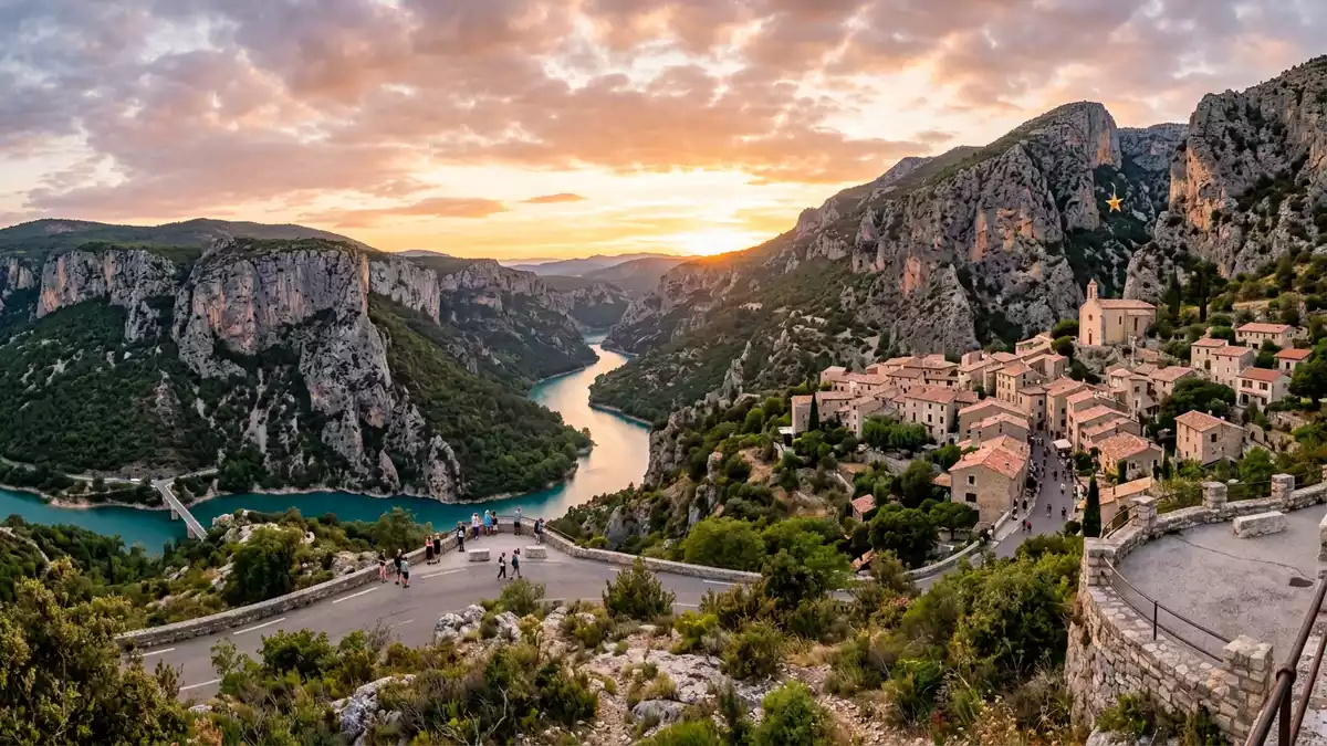
Gorges du Verdon is the great limestone canyon beside Moustiers-Sainte-Marie in southeastern France. It cuts between the Alpes-de-Haute-Provence and Var departments, and its walls rise to around 700 metres.
The gorge is part of the landscape that many travellers first meet through Moustiers-Sainte-Marie, one of the gates to the area. Its broad scale and pale rock make the canyon easy to read from roads, bridges and viewpoints around the rim.
The Verdon river and the canyon walls
The Verdon river carved the gorge through limestone, leaving a long trench of cliffs and narrow bends. In French, the place is called Gorges du Verdon; in English, many writers call it the Verdon Gorge.
The main canyon runs for about 25 km, though the wider gorge country spreads beyond the tightest section. A limestone plateau forms the backdrop, and the rock gives the whole area a hard, pale character.
Moustiers-Sainte-Marie and the gorge edge
Moustiers-Sainte-Marie sits at the western edge of the gorge country and serves as a natural base for exploring the area. The village is linked in local travel writing with the canyon, the roads around it and the valley routes beyond.
Moustiers-Sainte-Marie is one of the gateways to Gorges du Verdon, and the road circuit around the area runs through places such as Castellane, Aiguines, La Palud-sur-Verdon and Trigance. The village name matters here because the gorge and the settlement are read together in the same Provençal landscape.
A landscape of height, depth and distance
The gorge is often remembered for its depth as much as for its length. Those two figures define the place better than any decorative label: a long canyon, cut deeply into limestone, with vertical walls in places.
The Verdon Natural Regional Park gives the area a protected setting, and the terrain remains the central attraction of the whole region. The cliffs, river and rim roads form a clear geographical unit.
Visiting Gorges du Verdon: what travellers from Western Europe should know
- The gorge lies in Provence, between the Alpes-de-Haute-Provence and Var departments. Moustiers-Sainte-Marie stands on its edge and works well as a named reference point for the northern side.
- The main interest is the terrain itself: limestone cliffs, river bends, bridges and rim roads. The scale is large, and the depths and heights are visible in the same frame.
- Road loops around the gorge pass through several villages and viewpoints. Castellane, Aiguines, La Palud-sur-Verdon and Trigance are among the places tied to the circuit.
- The area belongs to the Verdon Natural Regional Park. That status links the canyon to a wider protected landscape rather than to a single monument.
Searching for Gorges du Verdon on social platforms
These links open searches for Gorges du Verdon on each platform.
Frequently asked questions about Gorges du Verdon
Where is Gorges du Verdon?
It lies in Provence in southeastern France, between the Alpes-de-Haute-Provence and Var departments. Moustiers-Sainte-Marie sits on the gorge edge and is closely tied to the area.
What does a visit involve?
The place is about roads, cliffs, bridges and wide views over a deep limestone canyon. The landscape is spread out, with several named villages around the rim.
What makes it distinctive?
The combination of limestone walls, river-cut depth and a long canyon form defines Gorges du Verdon. The scale and the pale rock give the gorge a clear physical identity.


