
Glacier National Park’s high country around West Glacier
Published on 08/31/2026 at 18:32 | Editorial responsibility: Rafael Müller, Editor-in-Chief AD HOC NEWS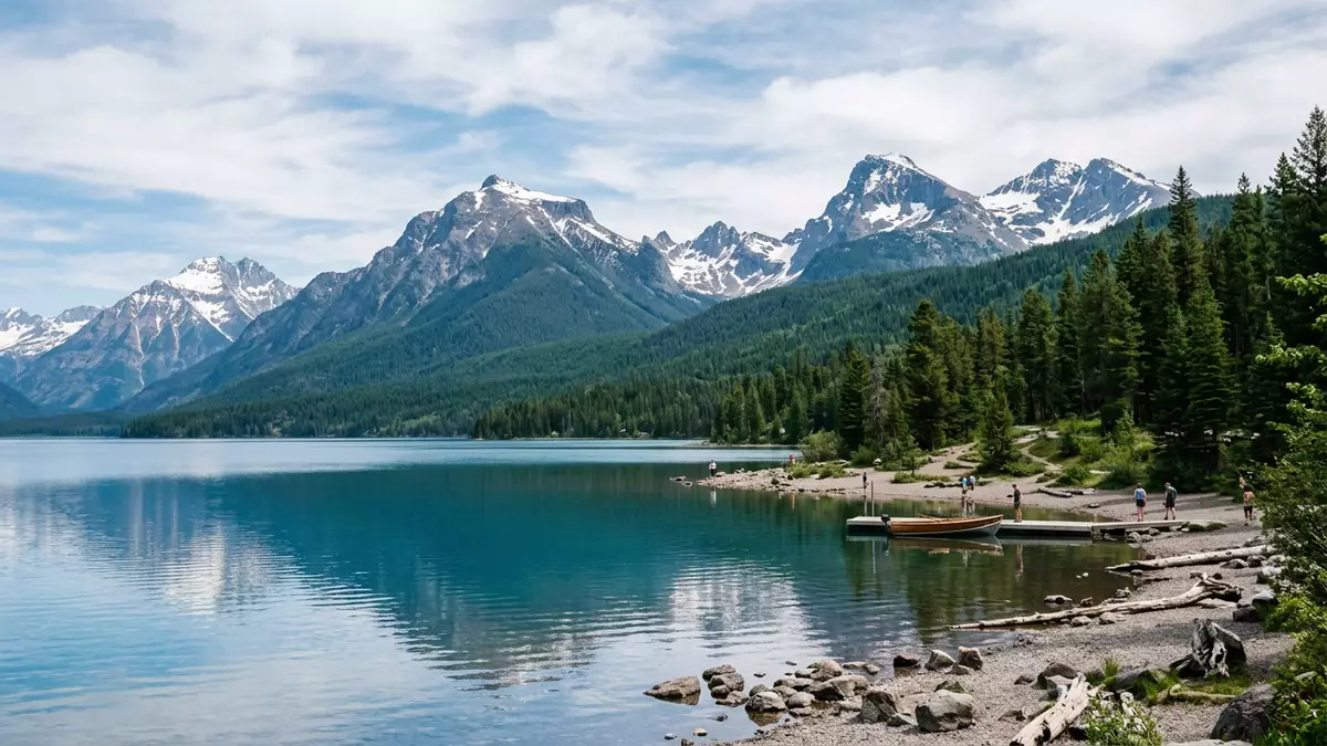
Glacier National Park in Montana reaches into the northern Rocky Mountains, with its administrative headquarters at West Glacier marking one of the main entrances into the park’s high country. Established as a national park in 1910, it protects a broad sweep of peaks, valleys and forests along the border between the United States and Canada, forming a vast mountain landscape that has shaped travel here for more than a century.
Rocky Mountain terrain on the border with Canada
Glacier National Park lies in Flathead and Glacier counties in the far north-west of Montana, along the international boundary with Canada where the Rocky Mountains cross between the two countries.Flathead and Glacier counties The park covers just over 1,013,000 acres, taking in steep ridges, high passes and the sources of several rivers that drain both towards the Pacific and towards Hudson Bay.1,013,572 acres It sits at a junction of watersheds where the Continental Divide crosses the park, creating dramatic differences between valleys that face east and those that open west.
The highest mountain in Glacier National Park is Mount Cleveland, which rises to 3,189 m (10,466 ft) and dominates the northern skyline above deep glacial valleys.Mount Cleveland 10,466 ft At the other end of the scale, the park’s lowest point lies near the junction of the Middle and North Forks of the Flathead River at around 960 m (3,150 ft), giving Glacier National Park an impressive overall relief between valley floor and summit. Within this range stand a series of named glaciers, including Blackfoot Glacier, which is recorded as one of the larger ice masses still present inside the park’s boundaries.Blackfoot Glacier as largest glacier
Going-to-the-Sun Road and West Glacier
From West Glacier, travellers enter Glacier National Park at the western gateway and join the route of Going-to-the-Sun Road, the historic mountain road that carries vehicles from the park’s west side across to the east. The road was first funded by the United States Congress in 1921, and its construction continued for more than a decade before completion and dedication in July 1933.Congress provided the first appropriation in 1921 Designed as an early National Park Service roadway for motorists, it became the only continuous road that crosses Glacier National Park from west to east.
The western terminus of Going-to-the-Sun Road meets U.S. Route 2 at West Glacier, where the park’s headquarters complex is also located.western terminus at U.S. Route 2 in West Glacier From there the road runs for roughly 80 km (50 miles) through lake-filled valleys and up to Logan Pass, a high point on the Continental Divide recorded at 2,026 m (6,646 ft) above sea level.Logan Pass 6,646 ft Travelling this route gives direct views of sharp rock walls, hanging valleys and alpine meadows, with stretches of roadway cut into steep slopes and sections passing beside deep lakes such as Lake McDonald.
A landscape of glaciers, forests and high passes
Glacier National Park takes its name from the collection of glaciers and glacier-carved features spread across its mountains. Historic records indicate that several dozen named glaciers lie within the park, and the landforms they created include U-shaped valleys, cirques and knife-edge ridges that frame the main routes.number of glaciers 30 to 40 The park’s valleys hold lakes formed in former glacial hollows, while slopes support forests that change in character between lower elevations and the subalpine zones close to the tree line.
The broader setting includes the neighbouring Waterton Lakes National Park across the border in Alberta, and together the two parks form an International Peace Park dating from 1932.International Peace Park 1932 Within Glacier National Park, trail networks and backcountry campgrounds link valleys and passes, while the Continental Divide Trail follows a long route through the park’s interior over high ground and through remote basins.Continental Divide Trail mileage The combination of high mountains, extensive forests and open alpine areas provides varied habitats, supporting a recorded range of fish species in lakes and rivers as well as larger mammals in the uplands.
Visiting Glacier National Park: what travellers from Western Europe should know
- Glacier National Park’s headquarters and a main entrance sit at West Glacier in Montana, reached by road on U.S. Route 2 from towns such as Kalispell further south.
- The terrain inside the park ranges from valley floors near the Flathead River to high passes such as Logan Pass at over 2,000 m (6,646 ft), with steep gradients and narrow mountain roads in places.
- Glacier National Park lies in the United States; the official language is English and the currency is the US dollar.
- Entry requirements depend on your nationality; UK travellers can check the FCDO travel advice at gov.uk/foreign-travel-advice, Irish travellers the Department of Foreign Affairs at ireland.ie.
Searching for Glacier National Park on social platforms
These links open searches for Glacier National Park on each platform.
Frequently asked questions about Glacier National Park
Where is Glacier National Park and how is West Glacier involved?
Glacier National Park lies in north-western Montana along the border with Canada, with its headquarters and a main entrance located at West Glacier.
What kind of landscape should visitors expect inside the park?
Visitors encounter steep Rocky Mountain terrain with high peaks such as Mount Cleveland, deep glacial valleys, lakes and forests spread across more than 1,000,000 acres.
What makes Glacier National Park distinctive compared with other mountain areas?
The combination of an early twentieth-century national park designation, the historic Going-to-the-Sun Road from West Glacier to the east side and the shared International Peace Park with Waterton Lakes gives Glacier National Park a particular character.


