
Glacier National Park’s carved peaks and lakes of northern Montana
Published on 09/12/2026 at 15:59 | Editorial responsibility: Rafael Müller, Editor-in-Chief AD HOC NEWS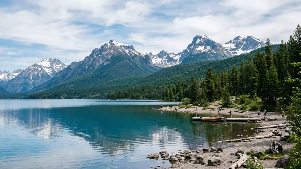
Glacier National Park in northern Montana is a vast Rocky Mountain landscape of carved peaks, deep valleys and clear lakes, centred around the small gateway settlement of West Glacier. Established as a national park on 11 May 1910, it preserves more than 1,000,000 acres (over 4,100 sq km) of high ridges, forested slopes and alpine basins on the border between the United States and Canada.
Where Glacier National Park sits on the Continental Divide
Glacier National Park occupies a stretch of the northern Rocky Mountains in Montana, sharing its northern boundary with Canada’s Waterton Lakes National Park and straddling the Continental Divide between Pacific and Atlantic drainage systems.northern Rocky Mountains in northwestern Montana The park lies in Flathead and Glacier counties, with West Glacier at the south-western edge near the Middle Fork of the Flathead River, where lowland forest gives way to steeper mountain slopes.Flathead and Glacier counties, Montana
The protected area covers about 1,013,000 acres, equivalent to roughly 1,583 sq miles, making it larger than the US state of Rhode Island and placing it among the more extensive national parks of the country.more than 1 million acres Much of that area rises above the timberline, with a series of mountain ranges forming sub?ranges of the Rockies and reaching their highest point at Mount Cleveland, whose summit stands at over 3,180 m (around 10,448 ft).Mt. Cleveland at 10,448 ft
Ice?shaped valleys, lakes and shrinking glaciers
The defining character of Glacier National Park lies in the way ice has shaped its terrain, cutting cirques and U?shaped valleys that are now occupied by lakes and forests. Glacial erosion over millions of years carved steep headwalls and over?deepened basins, leaving hanging valleys that drop towards larger troughs and creating a dramatic contrast between flat valley floors and towering rock faces.
Scattered across the park are hundreds of lakes fed by snowmelt and mountain streams, with around 130 of them carrying established names and many more remaining unnamed.more than 130 named lakes Lake McDonald, on the western side near West Glacier, is the largest of these, stretching about 15 km (9.4 miles) along the valley and reaching a depth of more than 140 m (around 464 ft).Lake McDonald 9.4 miles long Above the lakes and forests, named glaciers cling to high cirques and ridges, though surveys show that their area has been decreasing and that many are now much smaller than they were in the mid?twentieth century.26 named glaciers counted in 2015
History, designations and the Going?to?the?Sun Road
Glacier National Park entered the United States’ national park system on 11 May 1910, signed into being during the administration of President William Howard Taft.established on 11 May 1910 The neighbouring Waterton Lakes National Park in Canada dates from the nineteenth century, and in 1932 the two parks were formally linked as the Waterton?Glacier International Peace Park, an arrangement later recognised by UNESCO as a World Heritage site.Waterton-Glacier International Peace Park World Heritage Site
Within the American park, one of the most distinctive built features is the Going?to?the?Sun Road, a two?lane mountain road completed in 1932 that crosses the park from west to east and reaches its high point at Logan Pass.Going-to-the-Sun Road completed in 1932 This route climbs from the forests near West Glacier to an elevation of about 2,025 m (6,646 ft) at the pass, where snowfields and alpine meadows sit close to the Continental Divide and steep slopes drop away towards glacial valleys.Logan Pass 6,646 feet
Visiting Glacier National Park: what travellers from Western Europe should know
- Glacier National Park lies in northern Montana along the border with Canada, with West Glacier at the western entrance near the Middle Fork of the Flathead River; the park is reached by road from regional towns and by rail to West Glacier station.
- Terrain in Glacier National Park ranges from river valleys around 980 m (around 3,215 ft) near West Glacier to summits over 3,180 m (about 10,448 ft); trails and viewpoints often involve steep gradients and long walks on uneven mountain paths.
- The Continental Divide runs through the park, and viewpoints along the Going?to?the?Sun Road and near Logan Pass give access to high?altitude environments where weather and temperature can change quickly compared with the lowlands.
- The official language is English and the currency is the US dollar.
- Entry requirements depend on your nationality; UK travellers can check the FCDO travel advice at gov.uk/foreign-travel-advice, Irish travellers the Department of Foreign Affairs at ireland.ie.
Searching for Glacier National Park on social platforms
These links open searches for Glacier National Park on each platform.
Frequently asked questions about Glacier National Park
Where is Glacier National Park and what is West Glacier?
Glacier National Park is in northern Montana along the Canada–United States border, with West Glacier as a western gateway near the Middle Fork of the Flathead River.
What kind of landscape can visitors expect in the park?
Visitors encounter a high?mountain landscape shaped by glaciers, with steep Rocky Mountain peaks, forested valleys, numerous lakes and named glaciers occupying cirques and ridges.
What makes Glacier National Park distinctive among mountain parks?
Glacier National Park combines Continental Divide scenery, extensive acreage, the international link with Waterton Lakes National Park and the mountain?crossing Going?to?the?Sun Road completed in 1932.


