
Glacier National Park and the road that crosses the Continental Divide
Published on 08/20/2026 at 15:27 | Editorial responsibility: Rafael Müller, Editor-in-Chief AD HOC NEWS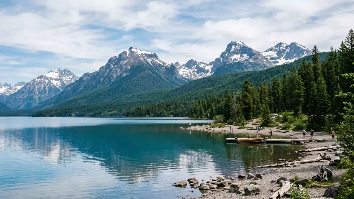
Glacier National Park in Montana is a landscape of high peaks, carved valleys and cold lakes, anchored by the single road that crosses its spine between West Glacier and St. Mary. The park was designated as a biosphere reserve under UNESCO’s Man and the Biosphere Programme in 1976, reflecting its importance for conservation and research in the northern Rocky Mountains. Set along the United States–Canada border, it forms the American half of the Waterton-Glacier International Peace Park, which is recognised as a World Heritage Site together with its Canadian neighbour.
A Rocky Mountain park shaped by ice
Glacier National Park lies in north-western Montana and is part of the Rocky Mountains, with the Going-to-the-Sun Road threading across its central ranges. The park’s terrain shows classic glacial forms: broad U-shaped valleys, hanging side valleys and steep cirque basins cut into ridges above the main valley floors. Alpine meadows sit above bands of forest, with rock higher up and patches of remnant ice and snow in shaded hollows. The international designation as a biosphere reserve under UNESCO’s programme recognises the diversity of biotic communities and the genetic variety of species conserved within the park’s boundaries.biosphere reserve under UNESCO The same landscape underpins the Waterton-Glacier International Peace Park, which links Glacier National Park with Waterton Lakes National Park across the border as a combined World Heritage Site.Waterton-Glacier International Peace Park
The park’s lakes occupy long, narrow basins carved by ice, with Lake McDonald on the western side and St. Mary Lake further east along the primary valley system. Above them, mountain summits form serrated ridges, with passes such as Logan Pass marking points where a crossing is possible by road. Vegetation zones shift with altitude, grades and aspect, from dense coniferous forest at lower elevations to open subalpine meadows and bare rock at higher levels. Wildlife ranges from smaller mammals and birds in the forests and meadows to larger species that move across wider territories within and beyond the park.
Going-to-the-Sun Road: crossing the Continental Divide
The Going-to-the-Sun Road is the single road that traverses Glacier National Park from west to east, crossing the Continental Divide at Logan Pass. Completed in 1932, it is a paved two-lane highway of about 50 miles that spans the width of the park, connecting the West Glacier entrance with the St. Mary entrance.spectacular 50 mile paved highway Logan Pass, reached by the road, lies at an elevation of 2,026 m (6,646 ft) and marks the highest point accessible by vehicle in the park.Logan Pass is the highest point From its western terminus near U.S. Route 2 at West Glacier to its eastern terminus at U.S. Route 89 in St. Mary, the road threads through foothills, main valley floors and high alpine slopes.western and eastern termini of the road
The route is recognised as an engineering achievement and a National Historic Landmark, because it carries traffic across steep, unstable mountain terrain using cut benches, retaining walls and bridges anchored into the rock.engineering marvel and National Historic Landmark Lower sections of the road at valley level remain open through the year and provide access to areas near Lake McDonald and the western entrance, while the alpine portion around Logan Pass follows a seasonal pattern of opening and closing that depends on snow and weather conditions.lower elevation sections remain open all year As the road climbs towards Logan Pass, views expand over valleys, mountain ridges and waterfalls, and roadside pull-outs mark places where traffic can pause at specific vantage points.
West Glacier and the western approach
West Glacier serves as a gateway community for Glacier National Park, sitting near the west entrance and the junction with U.S. Route 2. From the west, the Montana communities of Kalispell, Whitefish and Columbia Falls provide access by road to Park Headquarters, the Apgar Visitor Center, the Lake McDonald area and the start of the Going-to-the-Sun Road.access from Kalispell to West Glacier At the valley floor near West Glacier, the Middle Fork of the Flathead River marks part of the park boundary, and forested slopes rise from the river corridor towards the higher ridges within the protected area.
The western part of the park combines lakeside landscapes around Lake McDonald, wooded valleys and trailheads that climb towards alpine basins. The Going-to-the-Sun Road follows the northern shore of Lake McDonald for part of its length, then begins to climb through a sequence of bends, short tunnels and cut sections in rock towards its highest point. Along this approach, bridges span streams and waterfalls that drain the upper basins, and the road passes below cliffs and steep slopes where snow can linger at higher elevations long into the warm season. Pull-outs and parking areas are spaced along the route, providing starting points for hikes into valleys and towards viewpoints.
Visiting Glacier National Park: what travellers from Western Europe should know
- Glacier National Park lies in north-western Montana in the United States, with West Glacier marking the primary western entrance connected to U.S. Route 2 and to regional communities such as Kalispell.
- The terrain in the park ranges from forested valleys and lakeshores to steep mountain slopes and high passes; approaches on foot can involve significant gradients and long paths, and some routes use narrow stairways or rocky sections.
- Logan Pass on the Going-to-the-Sun Road reaches 2,026 m (6,646 ft), so visits to its surroundings involve alpine conditions and thinner air than at valley level, which some travellers may feel on longer walks.
- The official language is English and the currency is the United States dollar.
- Entry requirements depend on your nationality; UK travellers can check the FCDO travel advice at gov.uk/foreign-travel-advice, Irish travellers the Department of Foreign Affairs at ireland.ie.
Searching for Glacier National Park on social platforms
These links open searches for Glacier National Park on each platform.
Frequently asked questions about Glacier National Park
Where is Glacier National Park and how is West Glacier involved?
Glacier National Park is in north-western Montana in the United States, with West Glacier acting as a gateway near the west entrance and its junction with U.S. Route 2.
What should travellers expect on a visit to Glacier National Park?
Travellers encounter a mountainous park with lakes, valleys and high passes, including the Going-to-the-Sun Road crossing the Continental Divide at Logan Pass and providing access to alpine terrain.
What makes Glacier National Park distinctive among mountain parks?
Its combination of Rocky Mountain landscapes, the single transmountain road, and international recognition as a UNESCO biosphere reserve within the Waterton-Glacier International Peace Park make it distinctive.


