
Glacier National Park and the Continental Divide above West Glacier
Published on 09/08/2026 at 07:48 | Editorial responsibility: Rafael Müller, Editor-in-Chief AD HOC NEWS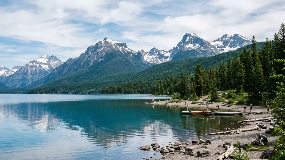
Glacier National Park in Montana is a landscape built on height and water, and nowhere is that clearer than around West Glacier and the line of the Continental Divide that runs through the park. Established as a national park by an Act of the United States Congress in 1910, it lies along the border with Canada and forms part of the Waterton-Glacier International Peace Park, recognised as a World Heritage Site in 1995.Waterton-Glacier International Peace Park
Mountains, lakes and the line of the Continental Divide
Glacier National Park stretches across the Rocky Mountains in north-western Montana, with its headquarters and western entrance at West Glacier.national park of the United States located in northwestern Montana The park’s core landscape is a combination of high peaks, deep valleys and clear lakes, cut by glaciers that once occupied many of its basins. The Continental Divide runs through the park, and that ridge line separates river systems flowing towards the Pacific from those heading towards the Gulf of Mexico and Hudson Bay.
Standing near West Glacier, visitors enter a terrain where the valley of the Middle Fork of the Flathead River gives way to uplands that rise towards Logan Pass on the Divide. As the ground climbs, dense forests around Lake McDonald soften into montane slopes, then into alpine meadows near the summit of the road. On clear days the crest of the Divide forms a visible horizon, with snow patches lingering in sheltered hollows well into the warmer months.
The Going-to-the-Sun Road across the park
The Going-to-the-Sun Road is the single route that crosses Glacier National Park from west to east, linking West Glacier with the community of St. Mary.scenic mountain road in the Rocky Mountains Planned and built over more than two decades, the road was completed in 1933 and quickly became central to how visitors experience the park’s different landscapes.completion of the Going-to-the-Sun Road on July 15, 1933 From West Glacier the route climbs past Lake McDonald and Avalanche Creek before reaching the high point at Logan Pass on the Continental Divide.
The road’s western terminus lies at U.S. Route 2 in West Glacier, and its eastern end connects with U.S. Route 89 at St. Mary.western terminus of the road is at U.S. Route 2 in West Glacier Over roughly 80 km (50 miles) it traverses cedar forests, cliffs and high valleys, crossing the Divide through Logan Pass at about 2,026 m (6,646 ft). The route is recognised as a National Historic Landmark, and many viewpoints along it look directly into glacially carved basins and towards peaks that form the park’s skyline.cresting the Continental Divide at Logan Pass
A protected landscape shared with Waterton Lakes
Glacier National Park forms the southern half of the Waterton-Glacier International Peace Park, joined with Waterton Lakes National Park across the border in Alberta.creation of Waterton-Glacier International Peace Park The combined area was designated the world’s first International Peace Park in 1932 and later inscribed on the World Heritage List in 1995 for its mountain scenery and ecological value.designated Waterton-Glacier International Peace Park a World Heritage Site The park is also recognised as a Biosphere Reserve under UNESCO’s Man and the Biosphere Programme.
This protected status reflects the range of habitats found between West Glacier and the high country, from valley-floor forests and lakes to alpine plants near the Divide. Wildlife in the wider park includes species adapted to these different zones, and the terrain itself displays the marks of glacial erosion in cirques, hanging valleys and over-deepened lakes. From some viewpoints along the Going-to-the-Sun Road, the border mountains towards Waterton Lakes are visible, underlining how the landscape extends beyond the line on the map.
Visiting Glacier National Park: what travellers from Western Europe should know
- Glacier National Park lies in north-western Montana in the United States, with the primary western entrance and park headquarters at West Glacier, close to U.S. Route 2.
- The terrain around West Glacier includes river valleys, forested slopes and high mountain passes; reaching Logan Pass involves a substantial climb on roads with steep drop-offs and numerous bends.
- St. Mary and the eastern entrance stand on the far side of the Continental Divide from West Glacier, and the Going-to-the-Sun Road links the two sides in a single mountain crossing.
- The official language is English and the currency is the United States dollar.
- Entry requirements depend on your nationality; UK travellers can check the FCDO travel advice at gov.uk/foreign-travel-advice, Irish travellers the Department of Foreign Affairs at ireland.ie.
Searching for Glacier National Park on social platforms
These links open searches for Glacier National Park on each platform.
Frequently asked questions about Glacier National Park
Where is Glacier National Park in relation to West Glacier?
Glacier National Park is in north-western Montana, with West Glacier serving as the main western gateway and location of the park’s headquarters.
What kind of landscape should visitors expect?
The park combines river valleys, forested slopes, clear lakes and alpine meadows, rising towards the Continental Divide and the high point at Logan Pass.
What makes Glacier National Park distinctive among mountain parks?
Its position on the Continental Divide, the route of the Going-to-the-Sun Road and its joint designation with Waterton Lakes as an International Peace Park give it a particularly layered character.


