
Geirangerfjorden, a steep-sided World Heritage fjord
Published on 08/20/2026 at 07:59 | Editorial responsibility: Rafael Müller, Editor-in-Chief AD HOC NEWS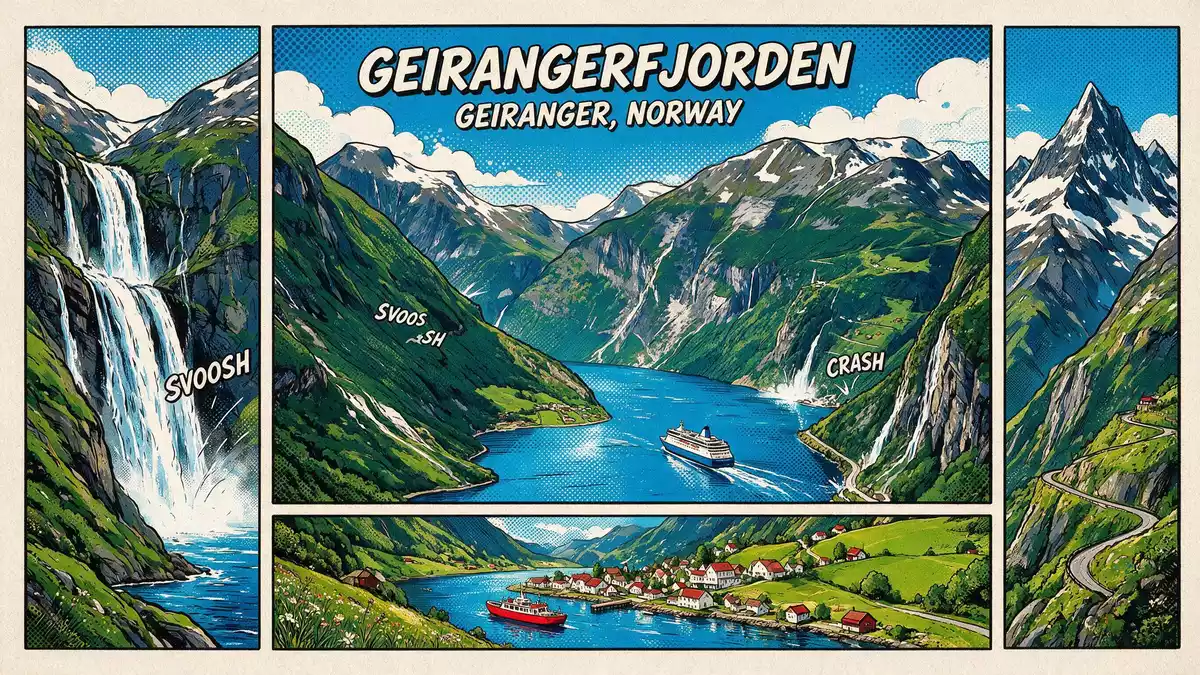
Geirangerfjorden is a steep, narrow fjord reaching into the mountains above the village of Geiranger in western Norway, recognised as part of the West Norwegian Fjords World Heritage site since 2005. Its combination of deep water, high rock walls and scattered farms on ledges has made this arm of Storfjorden a compact example of Norway’s classic fjord landscape.
Geirangerfjorden in the West Norwegian Fjords
Geirangerfjorden lies in the Sunnmøre region of Møre og Romsdal county, forming an inner branch of the larger Storfjorden system and ending at Geiranger.Sunnmøre region in Møre og Romsdal The fjord is part of the serial World Heritage property “West Norwegian Fjords – Geirangerfjord and Nærøyfjord”, the only natural World Heritage inscription in Norway.West Norwegian Fjords World Heritage The UNESCO designation covers the inner fjord areas and surrounding mountains, with the Geirangerfjord component mapped as a protected landscape of tens of thousands of hectares.
As part of this World Heritage area, Geirangerfjorden is noted for the way sea and high mountain meet in a relatively untouched setting, with water surfaces near sea level lying below peaks that rise well over 1,000 m (3,281 ft).contrasting sea and mountain elevations The form of the fjord reflects glacial carving, leaving very steep rock faces and narrow shelves where farms and paths cling to the slopes.
Scale, depth and the small village at the end
Geirangerfjorden runs for about 15 km (9 miles) from the junction with Sunnylvsfjorden near Hellesylt to the basin at Geiranger, making it a relatively short but visually concentrated fjord arm.around 15 km in length Depth soundings show maximum values near 260 m (853 ft), while the surrounding mountains rise far higher above the water, emphasising the vertical scale of the landscape.maximum depth near 260 metres Seen from the water, the fjord appears framed by high walls cut by numerous gullies and ledges.
At the inner end of Geirangerfjorden lies Geiranger, a small village in Stranda Municipality with a cluster of buildings along the shore and on low terraces above it.Geiranger village at the fjord end The settlement sits where the valley floor meets the fjord, giving a sense of shelter compared with the sheer rock faces along much of the shoreline. Roads and quays concentrate here, so many visits to Geirangerfjorden begin or end in this small basin, with boats, buses and paths spreading out into the surrounding landscape.
Cliffs, farms and viewpoints above deep water
The slopes around Geirangerfjorden carry abandoned and active farmsteads on shelves cut into the rock, reflecting a long history of settlement in places that are only accessible by steep paths or from the water.farms on ledges above the fjord These farms stand above cliffs that fall almost directly into the fjord, with drops that can reach more than 1,000 m (3,281 ft) from the highest ridges to the water. The contrast between cultivated patches and bare rock gives visitors clear visual markers of human use in a landscape shaped mainly by ice and gravity.
Along the fjord and in the Geiranger area, viewpoints on the road network and at dedicated platforms offer broad panoramas over the water surface, the surrounding peaks and the lines of waterfalls that cut down the cliffs.panoramic views of the fjord and cliffs From these vantage points the fjord appears as a winding corridor of water framed by high rock, with occasional glimpses of farm buildings and boats below. The sense of height is reinforced by the free drop from roadside terraces and platforms down to the dark water far beneath.
Visiting Geirangerfjorden: what travellers from Western Europe should know
- Geirangerfjorden lies in western Norway’s Møre og Romsdal county, with Geiranger at its inner end, reached by mountain roads and regular boat services along the fjord.
- The terrain around the fjord is steep, with roads climbing through hairpin bends and footpaths using stairways and sloping tracks on rock and soil above deep water.
- Viewpoints on the surrounding hills sit at higher elevations than the fjord surface, so visiting them involves exposure to height and, in places, unfenced drops beside secure paths or platforms.
- The official language is Norwegian and the currency is the Norwegian krone.
- Entry requirements depend on your nationality; UK travellers can check the FCDO travel advice at gov.uk/foreign-travel-advice, Irish travellers the Department of Foreign Affairs at ireland.ie.
Searching for Geirangerfjorden on social platforms
These links open searches for Geirangerfjorden on each platform.
Frequently asked questions about Geirangerfjorden
Where is Geirangerfjorden located?
Geirangerfjorden is in western Norway, in the Sunnmøre region of Møre og Romsdal county, forming an inner branch of Storfjorden with Geiranger at its end.
What should visitors expect on a visit to Geirangerfjorden?
Visitors encounter a narrow fjord with deep water, very steep rock walls, scattered farms on ledges and viewpoints high above the surface reached by mountain roads and paths.
What makes Geirangerfjorden distinctive among Norway’s fjords?
Geirangerfjorden combines marked depth and height over a short length, with a World Heritage designation and a small village at the fjord’s inner end concentrating access and views.


