
Freedom Trail in Boston, a red line through revolutionary history
Published on 09/16/2026 at 12:03 | Editorial responsibility: Rafael Müller, Editor-in-Chief AD HOC NEWS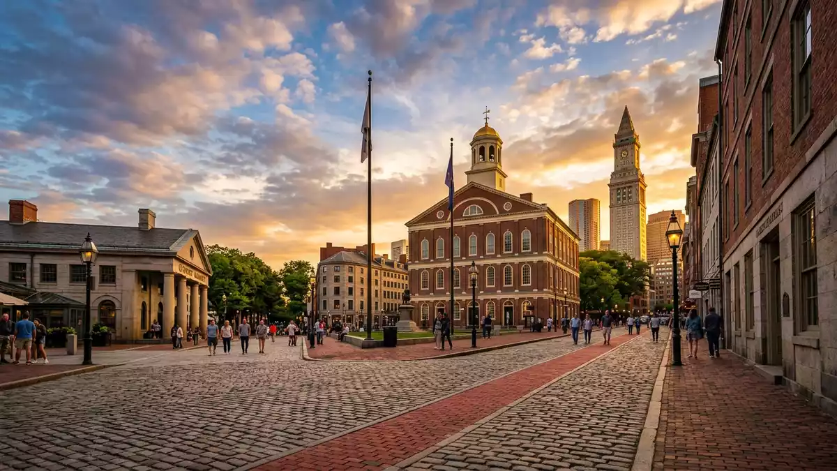
Freedom Trail in Boston is a marked route through the city’s streets, guiding visitors along a red line from Boston Common to Charlestown and linking pivotal sites from the era of the American Revolution. Conceived in the mid?twentieth century and extended over time, it weaves together churches, meeting houses, memorials and naval heritage into a single walkable story of how a colonial port became a centre of resistance.The Freedom Trail originated in 1951
A red line across Boston’s historic core
At its simplest, Freedom Trail is a line of contrasting bricks or paint set into Boston’s pavements, running for about 4 km (2.5 miles) through downtown, the North End and Charlestown.Boston's iconic 2.5 mile Freedom Trail connects 16 sites The route begins on the edge of Boston Common, the city’s central public park, and winds past civic buildings and burial grounds before crossing the Charles River to the heights above the harbour.It runs from Boston Common through downtown to Charlestown
The core of the trail consists of 16 officially recognised historic sites that together trace Boston’s role in the struggle against British rule and the formation of the United States.The Freedom Trail is a 2.5 mile walking trail connecting 16 sites The idea of marking a continuous path was first proposed in the early 1950s, and by 1958 a red brick line had been laid through the streets to make the route tangible underfoot.The red brick line was added in 1958 and later extended Over later decades, the trail was extended to take in Bunker Hill Monument and the USS Constitution, broadening its reach from the town centre to the naval yards.
Churches, meeting houses and burial grounds along the way
Walking north from Boston Common, the line leads to the Massachusetts State House and Park Street Church, placing nineteenth?century civic architecture beside an early nineteenth?century place of worship at the edge of the park.Boston Common and the Massachusetts State House are among the official sites Just beyond lie Granary Burying Ground and King’s Chapel Burying Ground, where slate and stone markers record names from the colonial period, including figures associated with the revolution and the city’s early political life.An official brochure lists burial grounds among the 16 sites
Further along the route, Old South Meeting House and Old State House stand close to street junctions that once formed the heart of colonial Boston’s civic and commercial activity.Old South Meeting House and Old State House are on the trail Near these buildings, the site of the Boston Massacre is marked, drawing attention to a confrontation that became part of the narrative leading to independence. The path continues to Faneuil Hall, long used as a market and meeting place, and into the North End, where narrow streets frame the Paul Revere House and Old North Church, linking the story of resistance to domestic and religious spaces.The 16 sites include churches, halls and the Boston Massacre site
From the waterfront to Bunker Hill Monument and USS Constitution
Beyond the North End, Freedom Trail crosses to Charlestown, where the brick line leads uphill to Bunker Hill Monument, a granite obelisk commemorating one of the earliest battles of the American War of Independence.Bunker Hill Monument and USS Constitution mark the northern end Nearby stands the Charlestown Navy Yard, home to USS Constitution, the wooden?hulled frigate launched in the late eighteenth century and preserved as a commissioned ship of the United States Navy.USS Constitution and the Charlestown Navy Yard visitor resources
Together, the monument and the ship extend the trail’s sequence beyond town squares and meeting houses to the landscapes of battle and maritime defence. The line on the pavement ties them back to Boston Common, making it possible to move in a single walk from the city’s oldest park through civic and religious buildings to fortifications and a naval yard that span the eighteenth and nineteenth centuries.The Freedom Trail forms part of Boston National Historical Park
Visiting Freedom Trail: what travellers from Western Europe should know
- Freedom Trail runs through central Boston, beginning at Boston Common and continuing through downtown, the North End and across to Charlestown, and is followed on foot along city pavements.
- The route includes several sections of ordinary city streets, with kerbs, crossings and some gradual inclines, as well as interior staircases within historic buildings and the climb inside Bunker Hill Monument.
- The official language is English and the currency is the US dollar.
- Entry requirements depend on your nationality; UK travellers can check the FCDO travel advice at gov.uk/foreign-travel-advice, Irish travellers the Department of Foreign Affairs at ireland.ie.
Searching for Freedom Trail on social platforms
These links open searches for Freedom Trail on each platform.
Frequently asked questions about Freedom Trail
Where is Freedom Trail and how long is it?
Freedom Trail runs through central Boston in the United States, forming a marked route of about 4 km (2.5 miles) between Boston Common and Charlestown.
What can visitors expect when walking the trail?
Visitors follow a red line through city streets to historic buildings, burial grounds, memorial sites and the Charlestown Navy Yard, with the option to enter selected sites along the way.
What makes Freedom Trail distinctive among historic walks?
Its combination of a continuous marked path, a compact sequence of 16 officially recognised sites and the link from town squares to Bunker Hill Monument and USS Constitution gives Freedom Trail a clear, coherent structure.


