
Freedom Trail as Boston’s red-brick story of revolution
Published on 09/10/2026 at 13:31 | Editorial responsibility: Rafael Müller, Editor-in-Chief AD HOC NEWS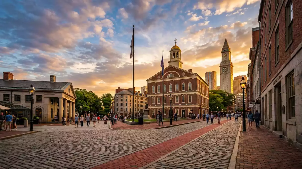
Freedom Trail in Boston is a marked walking route that turns a sequence of streets, squares and waterfronts into a continuous red-brick story of the American Revolution. Laid out through central Boston and Charlestown, it links key churches, meeting houses, burying grounds and public buildings that shaped the early history of the United States, and has been formally recognised as a National Millennium Trail since 1999.National Millennium Trail
A red line from Boston Common to Charlestown
The defining feature of Freedom Trail is the red-brick line set into the pavements, guiding walkers from Boston Common across the city towards Charlestown. The trail was first established in the early 1950s as an organised route through historic Boston and later extended north across the Charles River to bring in the waterfront and hilltop sites at Charlestown.early 1950s trail At full length it runs for about 4.0 km (2.5 miles), a distance that places most of central Boston’s major Revolutionary-era landmarks within a single, manageable walk.2.5-mile walking trail
The traditional starting point is Boston Common, the city’s central park and one of the oldest public spaces in the United States.starts at Boston Common From there the red bricks climb past the Massachusetts State House on Beacon Hill, a neoclassical state capitol completed in the early nineteenth century, before turning towards Park Street Church and the Granary Burying Ground with its dense collection of slate and stone markers. The route threads into downtown streets, crosses older commercial blocks and follows narrow lanes towards the waterfront, then continues over the river to reach the Charlestown Navy Yard and Bunker Hill.
Sixteen sites that frame the Revolution
Freedom Trail is structured around 16 official historic sites, selected for their significance to the period in which the Thirteen Colonies moved towards independence.16 official historic sites They include religious buildings such as Park Street Church and King’s Chapel, civic structures like Faneuil Hall, and several burying grounds where colonial-era figures are commemorated. Boston Common itself, with its broad lawns and mature trees, marks the start, while the Massachusetts State House and adjacent Boston Latin School site introduce political and educational themes from the city’s past.official list of sites
Further along the trail, Old South Meeting House and the Old State House stand on streets that once formed the core of colonial Boston’s commercial and political life. The Boston Massacre Site is marked near the Old State House, recalling an event that became a turning point in relations between residents and British troops. The line continues to Faneuil Hall, Paul Revere House and Old North Church in the North End, linking timber houses, brick churches and cobbled streets in a compact waterfront neighbourhood.sequence of historic sites Beyond the inner city, the trail reaches Copp’s Hill Burying Ground, the Charlestown Navy Yard with the preserved wooden frigate USS Constitution, and finally the Bunker Hill Monument, an obelisk commemorating one of the earliest major battles of the Revolutionary War.
Design, designation and how the trail is maintained
Freedom Trail was formally established in 1951 as a coherent path through Boston’s historic core, emerging out of mid-twentieth-century efforts to highlight and preserve sites linked to the founding period of the United States.established in 1951 In 1958 the distinctive red-brick line was added, replacing earlier painted markings and giving the trail a permanent physical presence underfoot.red brick line added in 1958 The route was later extended in 1972 to include Bunker Hill Monument and USS Constitution, drawing Charlestown’s hilltop memorial and naval heritage into the same walk.
Today the trail links public and private museums, churches and historic landscapes that work with Boston National Historical Park to keep the sites open and interpreted for visitors.Boston National Historical Park The Freedom Trail Foundation and partner organisations offer guided walks that follow sections of the route, while the National Park Service provides maps and an audio tour for those who prefer to move at their own pace.Walk the Freedom Trail The surface itself is largely urban pavement, with brick and stone underfoot, and the marked line passes through busy streets, quiet burial grounds and harbour-side paths that together sketch a layered picture of Boston’s role in the Revolution.
Visiting Freedom Trail: what travellers from Western Europe should know
- Freedom Trail runs through central Boston in the state of Massachusetts, beginning at Boston Common and reaching Charlestown across the Charles River; it is best approached on foot from downtown streets and public transport stops.
- The route follows city pavements, with sections over gradual slopes and stairways, particularly around Beacon Hill and the approach to Bunker Hill Monument, so walking involves extended time on hard surfaces and some climbing.
- The trail passes near the waterfront in the Charlestown Navy Yard, where open quays and harbour structures form part of the setting; conditions reflect an urban maritime environment with exposed spaces.
- The official language is English and the currency is the United States dollar.
- Entry requirements depend on your nationality; UK travellers can check the FCDO travel advice at gov.uk/foreign-travel-advice, Irish travellers the Department of Foreign Affairs at ireland.ie.
Searching for Freedom Trail on social platforms
These links open searches for Freedom Trail on each platform.
Frequently asked questions about Freedom Trail
Where is Freedom Trail and how long is it?
Freedom Trail is in Boston, Massachusetts, extending from Boston Common to Charlestown. The marked path is about 4.0 km (2.5 miles) in length.trail length and location
What can visitors expect when walking the trail?
Visitors follow a red-brick line through city streets, parks and burial grounds, passing 16 historic sites connected with the American Revolution and early United States history.
What makes Freedom Trail distinctive among historic walks?
Its continuous pavement marking, mid-twentieth-century design and combination of churches, meeting houses, cemeteries, a naval yard and a battlefield monument create a single, coherent outdoor museum through Boston.


