
Freedom Trail and the red line through Boston
Published on 08/22/2026 at 13:36 | Editorial responsibility: Rafael Müller, Editor-in-Chief AD HOC NEWS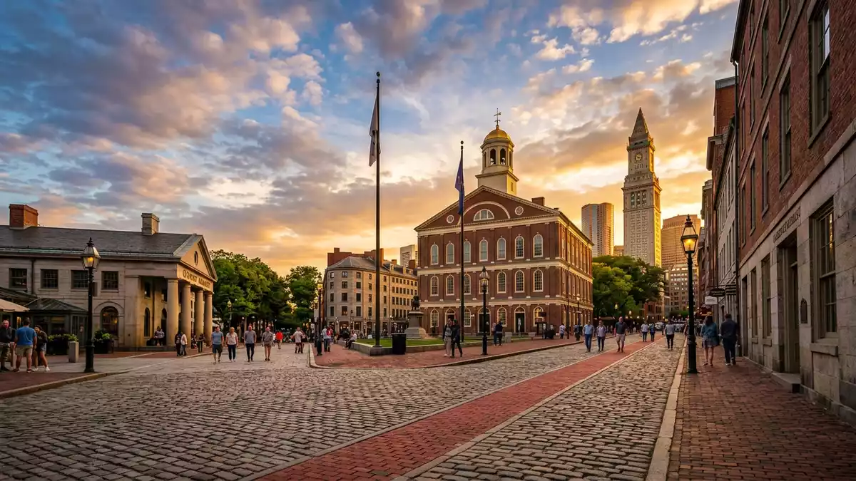
Freedom Trail is Boston’s red-marked walking route through a chain of historic sites. The trail links Boston Common, Charlestown, and places associated with the city’s Revolutionary-era landscape.
A red line through Boston’s historic core
The trail measures 2.5 miles (4 km) and connects 16 official historic sites. Its route crosses downtown Boston, the North End, and Charlestown, with the red line guiding the eye from one stop to the next.2.5 mile-Freedom Trail
Boston Common sits at one end of the route, and the trail reaches Bunker Hill Monument and the USS Constitution area at the Charlestown end. That spread gives the walk a broad historical range, from civic greens to naval and military landmarks.stretches from Boston Common
How the trail was marked and extended
The Freedom Trail was first dedicated in 1951, and the red line appeared in 1958. The route later extended into Charlestown, bringing Bunker Hill Monument and the USS Constitution into the connected sequence.dedicated in 1951
That history matters because the route is more than a list of addresses. It is a designed civic path, with the line itself acting as a visible thread between sites from different parts of the city.demarcated red brick line
Sites along the route
The trail passes places such as the Massachusetts State House, Park Street Church, Granary Burying Ground, Old South Meeting House, Old North Church, Faneuil Hall and Paul Revere House. Several of these are closely associated with Boston’s Revolutionary history, while others show the city’s older civic and religious fabric.16 official Freedom Trail
The route also includes burial grounds, a meeting house, a church, a former statehouse and the naval landmark of the USS Constitution. That mix gives the walk its layered character, with architecture, memory and public space side by side.historic sites in Boston
Visiting Freedom Trail: what travellers from Western Europe should know
- The trail runs through Downtown Boston, the North End and Charlestown. It is reached on foot through the city streets and by local transit near the main sites.
- The route is a city walk rather than a sealed park path. Some sections use sidewalks, and the ground surface changes from place to place.
- Boston Common, Faneuil Hall, Old North Church and the Charlestown end of the route are the most recognisable points on the line.
- The path is marked by red bricks or a red line. That marking is the clearest guide from one historic stop to the next.
Searching for Freedom Trail on social platforms
These links open searches for Freedom Trail on each platform.
Frequently asked questions about Freedom Trail
Where is Freedom Trail?
Freedom Trail runs through Boston, Massachusetts, linking sites in Downtown Boston, the North End and Charlestown. It begins at Boston Common and reaches the Charlestown end of the route.
What does a visit involve?
The trail is a walking route through the city, with red-brick or red-painted marking where the path is visible. It passes churches, burying grounds, a meeting house, civic buildings and the USS Constitution.
What makes Freedom Trail distinctive?
The trail stands out as a single route connecting a wide group of historic places across Boston. Its red line gives the walk a clear physical identity.


