
Fish River Canyon’s layered desert gorge near Hobas
Published on 09/18/2026 at 11:07 | Editorial responsibility: Rafael Müller, Editor-in-Chief AD HOC NEWS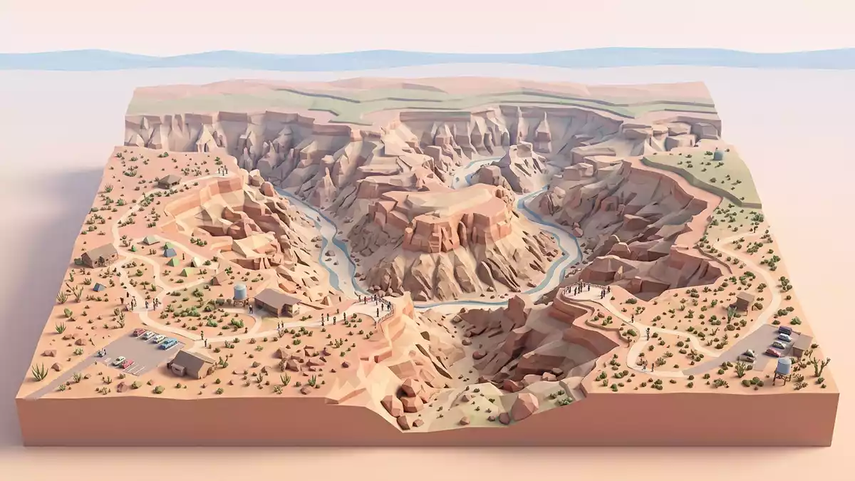
In southern Namibia near Hobas, Fish River Canyon presents a broad desert gorge where the Fish River has carved down through layered rock into a deep, stepped valley. The canyon lies within the /Ai-/Ais-Richtersveld Transfrontier Park, and its exposed strata trace more than a billion years of geological history in a single sweeping view.
A long canyon shaped by depth and length
Fish River Canyon stretches for about 160 km, with sections where the gorge reaches around 27 km in width and plunges to depths of roughly 550 m (1,804 ft). These dimensions place it among the largest canyons in Africa, with a pronounced inner gorge incised below a broader upper valley that visitors can see from the viewpoints near Hobas.160 km in length From the rim, the canyon walls read almost like a cross-section through the earth’s crust, revealing bands of contrasting rock and an abrupt change from flatter upper slopes to a narrower twisting trench far below.
The Fish River itself runs along the floor of this landscape, occupying a channel that winds through the deeper section of the canyon. During dry periods it can appear as a relatively modest river set against the scale of the surrounding cliffs, but its course has cut a gorge that reaches hundreds of metres in depth and spans many kilometres in length.300 to 700 metres deep The contrast between the slender river and the massive rock walls is one of the defining visual impressions from the Hobas viewpoints.
Layered rocks and visible contacts in the canyon walls
One of the most striking aspects of Fish River Canyon is the way its cliffs reveal different rock units stacked above one another. The upper canyon walls are formed largely by flat-lying sedimentary rocks of the Nama Group, including sandstones, shales and limestones that were laid down in shallow seas during the late Precambrian and early Cambrian periods.Nama Group sediments Beneath these layers lie older metamorphic basement rocks of the Namaqua Metamorphic Complex, such as gneiss, which formed more than a billion years ago at depth within the crust.Namaqua Metamorphic Complex
Along parts of the canyon the boundary between these units appears as a clear contact, where horizontally bedded sediments rest on tilted or more irregular metamorphic rocks below. Darker dolerite dykes cut through the older basement as linear bands, creating dark streaks against the lighter gneiss and adding another phase to the canyon’s visible history.dolerite dykes in basement rocks Seen from the Hobas viewpoints, these contrasting colours and textures give the canyon walls a layered, banded character that distinguishes sedimentary ledges from the more massive metamorphic slopes beneath.
Graben valleys, glaciers and the modern canyon form
The present shape of Fish River Canyon records several distinct episodes of landscape development. Geological work on the area indicates that a broad graben, or subsided trough, formed along north–south faults hundreds of millions of years ago, providing an early valley for the ancestral Fish River to follow.north–south graben valley Later, during the Dwyka or Karoo ice ages around 300 to 350 million years ago, southward-moving glaciers deepened parts of this valley and laid down glacial sediments belonging to the Karoo Supergroup.Dwyka ice age deposits
The modern canyon began to take on its current form after the breakup of Gondwana and uplift of the African continent, a process that increased the gradient of the Fish River and allowed it to cut more deeply into both sedimentary cover and underlying basement rocks.post-Gondwana incision As the river carved down, it created a wide upper canyon aligned with the ancient graben and a narrower lower canyon incised into older rocks, giving the gorge the two-level profile visible from Hobas: a broad stepped valley leading down to an inner trench where the river meanders between high walls.
Visiting Fish River Canyon: what travellers from Western Europe should know
- Fish River Canyon lies in southern Namibia near Hobas, within the /Ai-/Ais-Richtersveld Transfrontier Park. Hobas serves as a gate area for viewpoints overlooking the gorge, reached by road across a dry, rocky landscape.
- The viewpoints near Hobas stand above steep canyon walls, and the terrain around the rim includes rocky ground and abrupt drops, so visitors encounter uneven surfaces and exposed edges when walking between different lookout areas.
- The wider region around Fish River Canyon includes Ai-Ais at the southern end of the gorge and the Orange River to the south, giving the canyon a setting within a larger cross-border protected landscape.
- The official language is English and the currency is the Namibian dollar.
- Entry requirements depend on your nationality; UK travellers can check the FCDO travel advice at gov.uk/foreign-travel-advice, Irish travellers the Department of Foreign Affairs at ireland.ie.
Searching for Fish River Canyon on social platforms
These links open searches for Fish River Canyon on each platform.Frequently asked questions about Fish River Canyon
Where is Fish River Canyon in relation to Hobas and the wider region?
Fish River Canyon lies in southern Namibia near Hobas, within the /Ai-/Ais-Richtersveld Transfrontier Park, with the gorge extending between the Fish River and the Orange River basin.
What can visitors expect when they reach the viewpoints near Hobas?
Visitors encounter a dry, rocky rim with designated viewpoints looking over a deep, multi-level gorge where layered sedimentary and metamorphic rocks form high cliffs above the meandering Fish River.
What makes Fish River Canyon distinctive among desert landscapes in Namibia?
Its combination of a long, deep canyon, visible contacts between younger Nama sediments and older metamorphic basement, and dark dolerite dykes cutting the cliffs gives the area a particularly detailed geological cross-section.


