
Fish River Canyon’s desert gorge near Hobas
Published on 09/09/2026 at 09:35 | Editorial responsibility: Rafael Müller, Editor-in-Chief AD HOC NEWS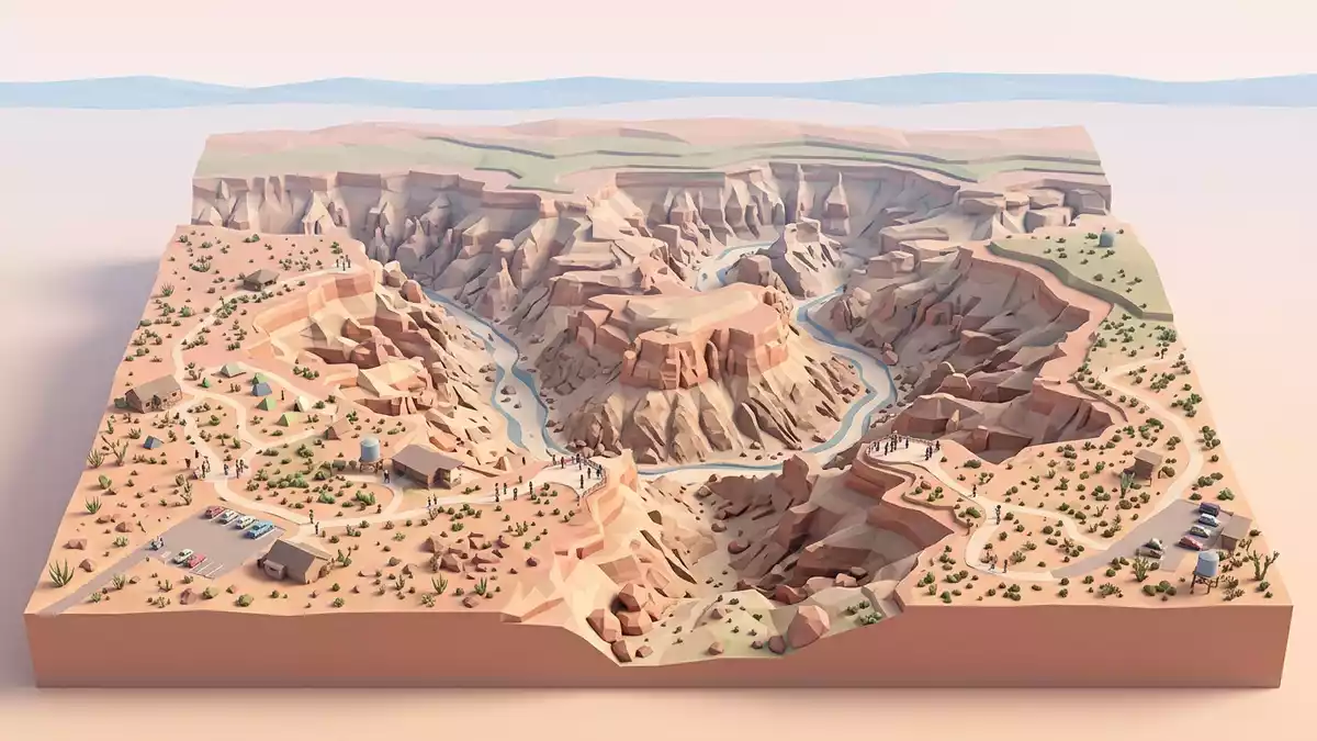
Fish River Canyon near Hobas in southern Namibia is a long desert gorge where the Fish River has cut down through layered rock, exposing a deep cross-section of the country’s southern plateau. Stretching across arid country within the Ai-Ais Richtersveld Transfrontier Park, it is known for its length of around 160 km (99 mi), a width reaching about 27 km (17 mi) and depths that approach 550 m (1,804 ft), giving visitors from the rim near Hobas a broad view into one of Africa’s largest canyon landscapes.length, width and depth
Desert canyon from the Hobas rim
Approaching Fish River Canyon from Hobas, the landscape is a dry plateau of bushes, stones and low hills that falls away suddenly into the gorge. The main viewpoints north of the canyon’s first waterfall offer a panoramic sight of the meandering river channel far below, with the canyon walls dropping in successive terraces to the floor.northern upper and southern lower canyon From these rim positions near Hobas, travellers look across a landscape carved in stages, where an upper, broader section steps down into a tighter inner trench.
Seen from the viewpoints, the Fish River itself lies in a wide bed where water forms pools for much of the year, filling more of the channel in wetter seasons. The walls around this channel show clear stratification, with darker bands marking intrusive rocks and paler layers forming shelves and ledges.dolorite dykes as dark streaks The Hobas sector is reached by a rim road that branches from the park entrance and follows the canyon edge to several viewpoints, where vehicles stop and visitors walk short distances to unfenced rock platforms above the void.
Ancient rocks and a long-cut river
The rock story at Fish River Canyon begins with very old shales, sandstones and lavas that now lie near the river at the canyon floor, deposited roughly 1,800 million years ago and later compressed and heated into a metamorphic complex.ancient shales, sandstones and lavas Granites intruded into these rocks, followed by dolorite dykes which appear as dark, linear features on the canyon walls. Subsequent erosion planed this complex into a surface that lay beneath a shallow sea over southern Namibia, where sediments of the Nama Group accumulated between about 650 and 500 million years ago.
A fracture in this crust around 500 million years ago created a broad valley aligned roughly north–south, setting the line along which the Fish River would later flow.north–south fracture and valley Later movements and erosional phases cut secondary trenches within this broad valley, leaving a canyon of nested forms which the Fish River then incised further over tens of millions of years. The result is what can be seen from Hobas: a multi-layered gorge whose profile tells of shifting seas, uplift and a river responding to changing levels of the surrounding plateau.
Fish River Canyon within Ai-Ais Richtersveld
Fish River Canyon lies within the Ai-Ais Richtersveld Transfrontier Park, a cross-border conservation area shared by Namibia and South Africa and known for rugged desert mountains, dry river valleys and hot springs.Ai-Ais Richtersveld Transfrontier Park In this setting, the canyon forms one of the main features on the Namibian side, with Hobas serving as the northern access point and Ai-Ais at the southern end, where thermal springs emerge among granitic rocks.
From the first waterfall north of the Hobas viewpoints to a point opposite the Chudaub trigonometrical beacon, the canyon measures around 56 km (35 mi) along the river course.56 km measured along river course The broader system extends further, with the canyon generally described as about 161 km (100 mi) long from Seeheim downstream, and its lower reaches continuing into remote terrain where the river heads towards the Orange River. Within the transfrontier park, wildlife and vegetation are adapted to sparse rainfall, extreme heat and long dry periods, giving the canyon a stark character that contrasts with lusher river landscapes elsewhere.
Visiting Fish River Canyon: what travellers from Western Europe should know
- Fish River Canyon is in southern Namibia, with the Hobas area reached by road from the country’s central regions and serving as the usual access point for canyon viewpoints on the Namibian side.entrance near Hobas Restcamp
- At the viewpoints near Hobas, short walks over uneven rock lead to unfenced positions on the rim, with sheer drops into the canyon and no built barriers between visitors and the edge.Hobas viewpoints access
- Fish River Canyon lies in an arid region where summer brings very high temperatures on the canyon floor; conditions for long hikes are therefore regulated by park authorities for safety.seasonal canyon hike access
- The official language is English and the currency is the Namibian dollar.
- Entry requirements depend on your nationality; UK travellers can check the FCDO travel advice at gov.uk/foreign-travel-advice, Irish travellers the Department of Foreign Affairs at ireland.ie.
Searching for Fish River Canyon on social platforms
These links open searches for Fish River Canyon on each platform.
Frequently asked questions about Fish River Canyon
Where is Fish River Canyon in relation to Hobas?
Fish River Canyon lies in southern Namibia within the Ai-Ais Richtersveld Transfrontier Park, with the Hobas area serving as the main access point to its northern viewpoints.Hobas Restcamp entrance
What should visitors expect when viewing the canyon from the rim?
Visitors can expect wide views over a terraced desert gorge where canyon walls drop hundreds of metres to the Fish River channel, reached by short walks from rim parking areas near Hobas.Hobas viewpoints description
What makes Fish River Canyon distinctive among African landscapes?
Fish River Canyon is distinctive for its combination of great length, considerable depth, multi-layered desert geology and location within a transfrontier park, forming one of the continent’s largest canyon systems.scale and geology of the canyon


