
Fish River Canyon and the sculpted gorge of southern Namibia
Published on 08/21/2026 at 06:33 | Editorial responsibility: Rafael Müller, Editor-in-Chief AD HOC NEWS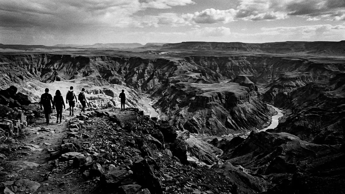
Fish River Canyon in southern Namibia presents an immense, stepped gorge carved into ancient rock, with Hobas on the northern rim acting as the main gateway for visitors. Within the /Ai-/Ais–Richtersveld Transfrontier Park, the canyon exposes geological layers laid down hundreds of millions of years ago, and the scale of the chasm is one of the defining landscapes of the country.
A canyon of monumental scale above the Fish River
The heart of Fish River Canyon is a long, meandering trench cut into the plateau where the Fish River loops and bends below the rim. Over a stretch described in geological studies as about 65 km, the river has incised the South African plateau by up to 550 m, revealing sub-horizontal strata stacked above older metamorphic rocksalong approximately 65 km. Broader descriptions of the system extend the canyon length to roughly 160 km, reflecting the longer reach from the upper Fish River down towards Ai-Aisabout 160 km long.
Along this course the gorge widens to around 27 km in places, giving the canyon an expansive, amphitheatre-like character when viewed from the rimup to 27 km wide. The /Ai-/Ais–Richtersveld Transfrontier Park, shared between Namibia and South Africa, encompasses the main canyon corridor, with the northern section near Hobas forming part of the protected area while further stretches downstream pass through privately managed landpart of the ?Ai-?Ais/Richtersveld Transfrontier Park. From the viewpoints near Hobas, the canyon’s layered rock walls, looping riverbed and broad terraces stand clearly in view.
Ancient rocks and layered geology on display
The rock sequence exposed in Fish River Canyon offers a cross-section through a long geological history of southern Namibia. At the base, close to the river, lie shales, sandstones and lavas that were originally deposited around 1,800 million years ago, long before the present canyon formedabout 1,800 million years ago. These rocks were later compressed and heated between roughly 1,300 and 1,000 million years ago, creating a metamorphic complex that includes granites and other altered formations.
Above this basement, erosion flattened the ancient surface before a shallow sea covered the region, laying down limestones, conglomerates and other sediments that now form the Nama Group visible high in the canyon wallsthe Nama Group of rocks. Geological work links major phases of canyon development to tectonic movements during the Cenozoic era, when deformation formed distinct grabens in the plateau and the Fish River deepened its course in responsea record of Cenozoic mantle dynamics. From the rim, these processes appear as sharp breaks in slope, stacked benches and contrasting colours between younger sediments and older metamorphic rock.
Hobas, viewpoints and the hiking route to Ai-Ais
For most travellers the entry point to Fish River Canyon is the Hobas area on the northern rim, which lies within the Namibian part of the /Ai-/Ais–Richtersveld Transfrontier Parknear the Hobas area. Hobas functions as a rest camp and administration point, with park offices and facilities set back from the canyon edgeHobas houses the Ministry offices. From this hub, a gravel rim road runs out towards the main viewpoints, where the plateau suddenly falls away into the gorge.
The multi-day Fish River Hiking Trail follows the canyon floor between the Hobas sector and the hot springs area of Ai-Ais to the south, covering a substantial stretch of the gorge in a single traversethe Fish River Hiking Trail. The descent route for this trail starts from a car park west of Hobas, dropping steeply from the rim down to the riverbedthe trail starts from the car park. While day visitors experience the gorge from a sequence of viewpoints near Hobas, trail hikers encounter river bends, gravel flats and bedrock pools along the canyon floor over successive days.
Visiting Fish River Canyon: what travellers from Western Europe should know
- Fish River Canyon lies in southern Namibia, with Hobas on the northern rim reached by road from other parts of the country and Ai-Ais further south along the canyon.
- The viewpoints near Hobas stand on a high, rocky plateau edge, with unfenced drops and uneven ground where sturdy footwear and care around the rim are important.
- The Fish River Hiking Trail runs along the canyon floor between the Hobas sector and Ai-Ais, with a steep initial descent that involves negotiating loose rock and a substantial height difference.
- The canyon area forms part of the /Ai-/Ais–Richtersveld Transfrontier Park, managed jointly by Namibian and South African conservation authorities as a cross-border protected landscape.
- The official language is English and the currency is the Namibian dollar.
Searching for Fish River Canyon on social platforms
These links open searches for Fish River Canyon on each platform.
Frequently asked questions about Fish River Canyon
Where is Fish River Canyon?
Fish River Canyon lies in southern Namibia within the /Ai-/Ais–Richtersveld Transfrontier Park, with the main visitor access near Hobas on the northern rim.
What should visitors expect when they arrive?
Visitors encounter a high, arid plateau that falls away into a deep gorge, with viewpoints near Hobas overlooking looping bends of the Fish River far below.
What makes Fish River Canyon distinctive among desert landscapes?
The combination of great depth, broad width and clearly exposed rock layers, together with the long course of the Fish River through the chasm, gives the canyon its distinctive character.


