
Farangi Samarias, Kreta’s limestone passage from mountains to sea
Published on 08/31/2026 at 10:51 | Editorial responsibility: Rafael Müller, Editor-in-Chief AD HOC NEWS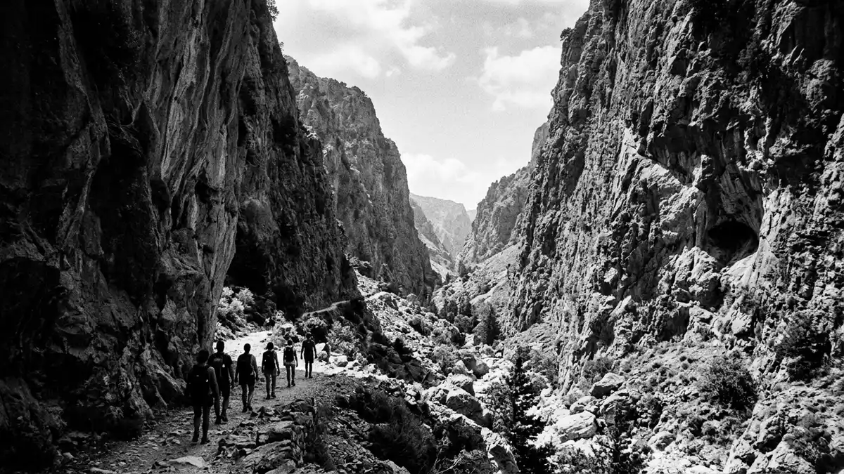
Farangi Samarias, better known in English as the Samaria Gorge, is a long limestone ravine slicing through the White Mountains of Kreta in Greece. It runs from the upland plateau of Omalos down to the Libyan Sea at the coastal hamlet of Agia Roumeli, turning a day’s walk into a continuous descent from mountain landscape to open shore.
Limestone, length and the White Mountains
Farangi Samarias lies in the south-west of Kreta in the regional unit of Chania, cutting through the Lefka Ori, or White Mountains, in a landscape of pale rock and steep flanks. The protected area around the gorge forms the National Park of Samaria, proclaimed in 1962 as Greece’s first mountain national park on the island and later recognised as a biosphere reserve under UNESCO’s Man and the Biosphere Programme.National Park of Samaria Within the park boundaries the walked route through the gorge itself extends for roughly 13 km, with the full approach from the trailhead at Xyloskalo on the Omalos plateau to the shoreline at Agia Roumeli bringing the total distance to about 16 km (10 mi).length along the pathway
The northern entrance stands at Xyloskalo at an altitude of around 1,200–1,250 m (3,940–4,100 ft), where the path begins by dropping sharply into the limestone valley. From there the route follows the streambed of the seasonal river between high cliffs and rock walls, gradually losing more than 1,200 m (3,940 ft) of elevation before reaching sea level at Agia Roumeli on the Libyan Sea.trail begins on the Omalos plateau The gorge occupies a mountainous limestone area that UNESCO lists as part of its World Network of Biosphere Reserves, reflecting both its rugged geology and the way wildlife habitats and human use share the same narrow corridor.mountainous limestone area
Walking from Xyloskalo to Agia Roumeli
The classic traverse of Farangi Samarias begins on the Omalos plateau at Xyloskalo, where the ground falls away and the maintained footpath starts to descend into the gorge. This entry point, reached by road from Chania on the north coast, marks the official northern gate of the National Park of Samaria and the start of the downhill walk to the Libyan Sea.stretches 16 kilometers through the White Mountains The route follows the line of the river, crossing the watercourse repeatedly on small bridges or stepping stones and passing through stands of pine and cypress that grow on the gorge floor and lower slopes.
Along the way walkers encounter abandoned hamlets and chapels that once served the remote communities of the White Mountains, as well as resting points and spring-fed fountains maintained for hikers inside the park. Midway through the gorge, the rock narrows to a particularly constricted section often referred to as the Iron Gates, where the cliffs close in and the path threads between the foot of the opposing walls. Beyond this pinch point, the valley begins to widen again before the maintained park path ends at the lower gate near Agia Roumeli, leaving a final stretch on level ground towards the sea.Iron Gates section
Nature, protection and wider landscapes
Farangi Samarias forms the core of a wider protected mountain landscape, sometimes described as the National Park of the White Mountains of Crete, whose boundaries cover several thousand hectares of limestone peaks, forests and high valleys.4,848 hectares Within this area the park authority safeguards natural habitats and the endemic species associated with them, including plants adapted to cliffs and scree slopes and wildlife that uses the remote side gullies off the main gorge.
The designation of Farangi Samarias as a national park in 1962 placed legal protection on both the gorge itself and the adjoining slopes, limiting development and formalising trail management, shelter maintenance and habitat conservation.acknowledged natural site and symbol of Crete Its later recognition within UNESCO’s network of biosphere reserves emphasised the combination of human access and ecological value, framing the gorge as a place where long-distance walking, traditional pastoral use of the surrounding mountains and the conservation of limestone gorge ecosystems meet in a single corridor.
Visiting Farangi Samarias: what travellers from Western Europe should know
- Farangi Samarias is in south-west Kreta in Greece, reached from the city of Chania on the north coast, with road access leading to the Omalos plateau and the Xyloskalo trailhead and boat connections serving Agia Roumeli on the Libyan Sea at the southern end of the walk.
- The traverse of the gorge involves a long downhill walk on uneven paths, with substantial altitude loss from Xyloskalo to Agia Roumeli, numerous short bridges and river crossings on stones, and stretches of rocky ground that demand sure footing over many hours.
- The gorge lies in a mountain area where weather and water levels can affect access; conditions in Farangi Samarias can change with the season and immediate situation.
- The official language is Greek and the currency is the euro.
Searching for Farangi Samarias on social platforms
These links open searches for Farangi Samarias on each platform.
Frequently asked questions about Farangi Samarias
Where is Farangi Samarias and how is it situated on Kreta?
Farangi Samarias is in south-west Kreta in Greece, in the regional unit of Chania, cutting through the White Mountains between the interior basin of Omalos and the coastal village of Agia Roumeli on the Libyan Sea.
What should visitors expect when walking through the gorge?
A walk through Farangi Samarias involves several hours on a maintained mountain path, a substantial continuous descent from the plateau to sea level, riverbed crossings and exposure to rugged limestone scenery in a formally protected national park.
What makes Farangi Samarias distinctive compared with other gorges?
Farangi Samarias stands out for its combination of length, its drop from over 1,200 m (3,940 ft) down to the Libyan Sea, its status as the core of the National Park of Samaria established in 1962, and its recognition as a biosphere reserve within UNESCO’s Man and the Biosphere network.


