
Farangi Samarias, Crete’s limestone gorge from mountains to sea
Published on 08/25/2026 at 22:03 | Editorial responsibility: Rafael Müller, Editor-in-Chief AD HOC NEWS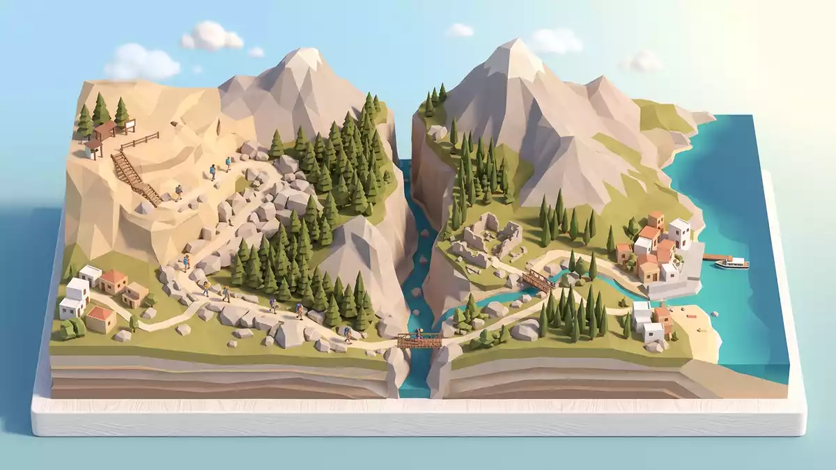
Farangi Samarias, better known in English as the Samaria Gorge, is a long limestone corridor running through the White Mountains of Kreta in Greece, dropping from the upland plateau of Omalos to the Libyan Sea at Agia Roumeli. Designated as a National Park of Greece in 1962, it forms the core of a protected mountain landscape that is also recognised as a biosphere reserve under UNESCO’s Man and the Biosphere ProgrammeNational Park of the White Mountains.
A limestone gorge through the White Mountains
Farangi Samarias lies in the south-west of Kreta, in the regional unit of Chania, cutting through the Lefka Ori, or White Mountains, between the interior basin of Omalos and the coastal hamlet of Agia Roumeli on the Libyan Seasouthwest Crete in the regional unit of Chania. The gorge itself extends for roughly 16 km (10 mi), with the maintained path continuing beyond the lower park exit towards the shore, forming a continuous downhill walk from mountain to seaextends for about 16 km. At its northern entrance the trailhead stands at an altitude of about 1,200 to 1,250 m (3,900 to 4,100 ft), while the route finishes close to sea level at Agia Roumelifrom the Omalos plateau at an altitude of 1,200 metres.
Geologically, Farangi Samarias is carved into limestone and forms part of a wider network of ravines within the White Mountains, a massif that rises steeply above the Cretan interiorSamaria Gorge within the White Mountains. The riverbed runs along the floor of the gorge, winding between rock walls that in places rise sharply on either side and narrow the passageway to a tight stone corridor. Sections of the path follow wooden walkways, bridges and stretches of stony trail, so that the continuous descent becomes a sequence of rock, gravel and short constructed sections rather than a single uniform surface.
From national park designation to biosphere reserve
Farangi Samarias forms the heart of the Samaria National Park, established in 1962 as a protected area within the White Mountains of western Creteproclaimed National Park of the White Mountains of Crete in 1962. The park covers a wider zone of peaks, upland plateaus and secondary ravines, with the “Big Gorge” acting as its most prominent feature and the best known through-route for visitorsthe reserve goes beyond the Big Gorge. Within this landscape the gorge provides access from the high interior to the Libyan Sea, linking alpine scenery with a remote south coast that has no road connection to the wider island.
The National Park of the White Mountains is part of the UNESCO World Network of Biosphere Reserves, underlining the combination of geological formations, endemic plants and mountain fauna present in the areaa Biosphere Reserve in the framework of the Man and Biosphere Programme. Within Farangi Samarias itself, traces of former habitation remain at the village of Samaria roughly midway along the gorge, where families once lived and combined small-scale agriculture with livestock and woodcuttingfamilies still lived in the village of Samaria. The designation as a national park has shifted the focus of the area towards conservation and controlled access, with the long gorge walk acting as a single continuous route through the protected terrain.
A long downhill traverse from plateau to Libyan Sea
The main trail through Farangi Samarias begins at Xyloskalo, on the edge of the Omalos plateau, and follows the gorge southwards towards Agia Roumeli on the Libyan Seathe trail begins on the Omalos plateau and ends at the Libyan Sea. Walkers follow a well-established path that descends steadily for much of its length, with sections of stepped track giving way to rougher ground along the streambed, and occasional bridges crossing from one side of the gorge to the other. The total walking distance, combining the gorge itself and the continuation to the coastal village, lies in the region of 16 to 18 km (10 to 11 mi), creating a full-day outing for many visitorsthe gorge stretches across a distance of 16 km while the entrance adds another 2 km.
One of the most recognisable sections of the route is the narrow lower part of the gorge, sometimes referred to as the “Big Gorge”, where the rock walls close in closely around the path and the riverbed flows through a confined stone passagethe Big Gorge as the faragas. From here the trail leads out towards the coastal plain and the beach at Agia Roumeli, where ferries connect the otherwise roadless village with other points on the south coast of Kretareturn journey from Agia Roumeli is by boat. For travellers from Western Europe, Farangi Samarias offers an accessible way to experience a long Mediterranean gorge walk that links a high plateau, a protected mountain interior and the Libyan Sea in a single day’s traverse.
Visiting Farangi Samarias: what travellers from Western Europe should know
- Farangi Samarias lies in south-western Kreta within the Chania regional unit, between the Omalos plateau in the White Mountains and the coastal village of Agia Roumeli on the Libyan Sea.
- The usual north–south traverse starts at the Xyloskalo trailhead on the rim of the Omalos plateau and finishes at Agia Roumeli, reached on foot through the gorge and onward along the coastal path.
- The route involves a sustained descent from over 1,200 m (about 3,900 ft) to sea level, with many steps, uneven stony sections and narrow passages along the riverbed that demand sure-footed walking.
- Agia Roumeli is connected only by sea to other settlements on the south coast of Kreta, so onward travel from the end of the gorge relies on coastal boat services rather than road access.
- The official language is Greek and the currency is the euro.
Searching for Farangi Samarias on social platforms
These links open searches for Farangi Samarias on each platform.
Frequently asked questions about Farangi Samarias
Where is Farangi Samarias located on Kreta?
Farangi Samarias is in south-western Kreta within the Chania regional unit, cutting through the White Mountains between the Omalos plateau and the coastal village of Agia Roumeli.
What should visitors expect when walking Farangi Samarias?
The gorge walk is a long downhill route of roughly 16 to 18 km (10 to 11 mi), combining stepped paths, stony riverbed sections and narrow rock corridors that demand steady footing.
What makes Farangi Samarias distinctive among Cretan landscapes?
Farangi Samarias combines a continuous limestone gorge, a designated national park created in 1962, and a full descent from a high plateau in the White Mountains to the shore of the Libyan Sea.


