
Emerald Bay, where Lake Tahoe narrows into cliffs and colour
Published on 09/18/2026 at 06:25 | Editorial responsibility: Rafael Müller, Editor-in-Chief AD HOC NEWS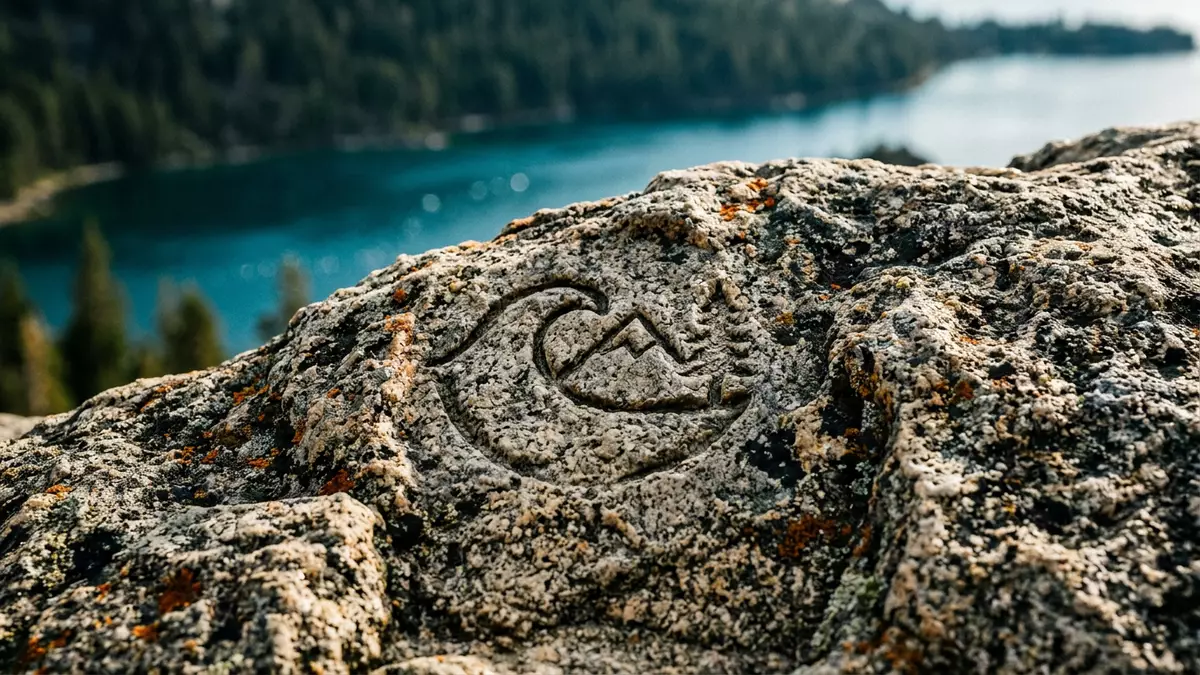
Emerald Bay on the Californian shore of Lake Tahoe is a narrow inlet where steep forested slopes drop to blue?green water and a sheltered basin concentrates much of the lake’s drama into a single view. It lies in Emerald Bay State Park in El Dorado County, with the bay, its surrounding cliffs and the small Fannette Island all protected as part of a landscape recognised as a National Natural Landmark in 1969.
An inlet carved into Lake Tahoe’s west shore
Seen from the roadside pull?outs above, Emerald Bay reads almost like a separate lake, a long inlet cut into the western side of Tahoe and framed by granite ridges and conifer forest. The bay forms a distinct indentation on the west shore, with water that takes on greener tones than the main body of Lake Tahoe because it is shallower and backed by pale rock and dense trees along the slopes.this somewhat shallower bay The park centred on the bay covers 1,533 acres of shore, hillsides and water, wrapping around this glacially carved basin and the granite terrain around it.spans 1,533 acres
The inlet holds the only island on Lake Tahoe, a rocky knoll known as Fannette Island that rises from the middle of the bay and gives the waterline a focal point.the only island in Lake Tahoe From the surrounding viewpoints, the combination of steep granite headwalls, the small island and the broad expanse of the main lake beyond sets up a layered landscape: close?in cliff and forest, middle?distance bay, and the wider bowl of Tahoe against higher mountains in the background.
Vikingsholm and Fannette Island: architecture on the shore and in the bay
At the head of Emerald Bay, close to where the inlet narrows and the surrounding slopes close in, stands Vikingsholm, a 38?room mansion whose profile and detailing draw on Scandinavian forms and building traditions.a 38-room mansion Completed in 1929 for Lora Josephine Knight, who had bought the property encompassing the head of the bay and Fannette Island the previous year, it is regarded as one of the finest examples of Scandinavian?inspired architecture in the United States.purchased the property in 1928 Stone walls, timber details and steep roofs echo elements of Nordic buildings, while the setting on the lakeshore leaves the house immediately connected to the water and the surrounding forest.
Fannette Island itself carries traces of Knight’s use of the bay, including a small stone “tea house” on its summit that visitors can see from boats on the water or from the viewpoints along the shore.tea house on Fannette Island The relationship between Vikingsholm on the beach and the island out in the bay gives this end of Emerald Bay a distinctive two?part character: architecture on land at the foot of the trail, and a smaller structure carried by the granite island, both sitting within the wider protected park.
Trails, beaches and underwater remains within Emerald Bay State Park
Emerald Bay State Park is not confined to the land around the inlet; since 1994, the waters of the bay have been formally included within the park, making this one of California’s early underwater park designations.included the surrounding water Beneath the surface lie submerged timbers, old boats and other relics from earlier use of the bay, now protected along with the natural features and giving context to the shoreline buildings and trails.
On land, paths and beaches gather much of the park’s activity into a compact area. A maintained trail descends from the parking area on Highway 89 to the shore near Vikingsholm, dropping several hundred feet in elevation and reaching a beach backed by trees and the stone walls of the mansion.steep one mile trail From this lakeside, the Rubicon Trail follows the shore past coves and headlands towards other parts of the park, linking Emerald Bay with neighbouring areas such as D.L. Bliss State Park and passing further beaches, boat?in camping areas and viewpoints on the way.Rubicon Hiking Trail
Visiting Emerald Bay: what travellers from Western Europe should know
- Emerald Bay lies north of the built?up area of South Lake Tahoe on the Californian side of Lake Tahoe and is reached by road along California State Route 89, which runs above the western side of the bay.
- The main trail from the roadside parking down to the lakeshore near Vikingsholm is steep and descends a significant elevation on a maintained path; the return walk involves a sustained climb back up to the road.
- The surrounding terrain combines granite outcrops, forested slopes and narrow roadside viewpoints, so walking footwear suitable for uneven surfaces is helpful on paths and for short walks to the overlooks.
- Emerald Bay State Park sits within the United States; the official language is English and the currency is the United States dollar.
- Entry requirements depend on your nationality; UK travellers can check the FCDO travel advice at gov.uk/foreign-travel-advice, Irish travellers the Department of Foreign Affairs at ireland.ie.
Searching for Emerald Bay on social platforms
These links open searches for Emerald Bay on each platform.
Frequently asked questions about Emerald Bay
Where is Emerald Bay in relation to South Lake Tahoe?
Emerald Bay lies north of South Lake Tahoe on the Californian shore of Lake Tahoe, in El Dorado County, and is reached along California State Route 89.
What should visitors expect on a first visit to Emerald Bay?
Visitors encounter a narrow inlet backed by granite cliffs and forest, with viewpoints above the water, a steep trail down to the lakeshore and the lakeside setting of Vikingsholm.
What makes Emerald Bay distinctive among Lake Tahoe’s landscapes?
Emerald Bay combines Lake Tahoe’s only island with a protected inlet, a designated underwater park and the Scandinavian?inspired mansion of Vikingsholm gathered into a single compact setting.


