
Dujiangyan and the river that built the Chengdu plain
Published on 09/17/2026 at 15:17 | Editorial responsibility: Rafael Müller, Editor-in-Chief AD HOC NEWS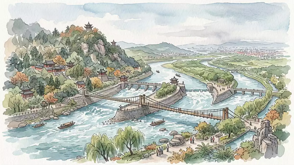
On the western edge of the Chengdu plain in China, Dujiangyan turns hydraulic engineering into a landscape, guiding the Min River into fields and terraces without a dam. Begun in the third century BC under Li Bing of the Qin dynasty, the system still regulates floodwater and irrigation for the Chengdu region and is inscribed as part of the Mount Qingcheng and Dujiangyan Irrigation System UNESCO World Heritage site.
An ancient river system written into stone
Dujiangyan lies where the Min River leaves the mountains and spreads onto the flatlands, at the junction of the Sichuan basin and the edge of the Qinghai–Tibet Plateau. The setting gives the system its character: channels, embankments and weirs sit between rocky riverbanks and cultivated ground, turning a natural transition into a controlled bifurcation of water.the western portion of the Chengdu flatlands The core works occupy the middle reaches of the Min River, close to Dujiangyan City in Sichuan Province, with Mount Qingcheng rising to the south as a wooded backdrop.
The irrigation system was initiated around 256 BC, during the Warring States period, when Li Bing served as governor of Shu Prefecture under the Qin kingdom.built by Li Bing in the Qin Dynasty Construction began in the third century BC and established a way of managing the Min River that avoided the use of a blocking dam, relying instead on cut channels and diversion dikes that harness the river’s gradient into gravity-fed distribution.begun in the 2nd century BCE
Weirs, dikes and the flow into the Chengdu plain
The heart of Dujiangyan is a set of named structures that divide, slow and guide the Min River into irrigation channels. Near the highest point of the Chengdu plain stand the Weir Works, with diversion dikes and spillways that mark the start of the irrigated area.the Weir Works and irrigated area From here, the river’s flow is split and controlled before entering the network of fields that spread across the plain.
Three elements are central to the visible engineering: Yuzui, a diversion dike sometimes described as a “fish mouth”; Feisha, a spillway weir; and Baopingkou, the main inlet into the canal system.Yuzui diversion dike, Feisha weir, Baopingkou inlet Around them run embankments and watercourses such as Baizhang Dike and the Erwang Temple Watercourse, forming a mesh that combines diversion, sediment discharge, flood management and irrigation in one continuous arrangement.Fish Mouth and Diamond Dike, Flying Sand Weir and Baopingkou Standing on the terraces above the river, the visitor sees water passing through cut channels and around stone dikes before disappearing into the grid of canals leading towards the farmland of the Chengdu plains.
A living World Heritage landscape
Dujiangyan is recognised internationally as a cultural landscape where engineering, agriculture and belief meet. Together with Mount Qingcheng, the irrigation system is listed as a cultural property under criteria (ii), (iv) and (vi) on the UNESCO World Heritage List, with inscription dating from 2000.Mount Qingcheng and the Dujiangyan Irrigation System Documentation for nomination 1001 describes Dujiangyan as a landmark in water management technology that still performs its original functions.criterion (ii) for water management
The system has also been recognised as a Heritage Irrigation Structure by the International Commission on Irrigation and Drainage, highlighting its continuing role in distributing river water to farmland.Heritage Irrigation Structure Canals fed by Baopingkou and its associated works carry water across numerous counties of Sichuan, and the pattern of fields on the Chengdu plain still reflects the layout set during the Han dynasty and later expansions.irrigated the Chengdu Plain For a visitor, that living function is visible in the contrast between the rocky river course near the city and the ordered agricultural landscape beyond.
Visiting Dujiangyan: what travellers from Western Europe should know
- Dujiangyan lies north-west of Chengdu in Sichuan Province and is reached by road and rail links that follow the Min River valley towards Dujiangyan City.
- Within the scenic area, paths and terraces run above the riverworks, with stairways and embankments that require walking on uneven stone surfaces.
- Mount Qingcheng rises nearby, and both the irrigation system and the forested slopes can be viewed in the same day from the river corridor.
- The official language is Chinese and the currency is the renminbi (yuan).
- Entry requirements depend on your nationality; UK travellers can check the FCDO travel advice at gov.uk/foreign-travel-advice, Irish travellers the Department of Foreign Affairs at ireland.ie.
Searching for Dujiangyan on social platforms
These links open searches for Dujiangyan on each platform.
Frequently asked questions about Dujiangyan
Where is Dujiangyan located?
Dujiangyan is in Sichuan Province in south-west China, close to Dujiangyan City north-west of Chengdu, on the middle reaches of the Min River.
What can visitors expect when exploring Dujiangyan?
Visitors encounter riverworks, diversion dikes, canals and embankments set in a valley landscape, with walking routes along terraces overlooking the water and the irrigated plain.
What makes Dujiangyan distinctive among irrigation sites?
Dujiangyan is a third-century BC hydraulic system that manages the Min River without a dam and still feeds canals across the Chengdu plain, recognised as part of a World Heritage cultural landscape.


