
Crater Lake National Park and its deep volcanic basin
Published on 09/15/2026 at 12:36 | Editorial responsibility: Rafael Müller, Editor-in-Chief AD HOC NEWS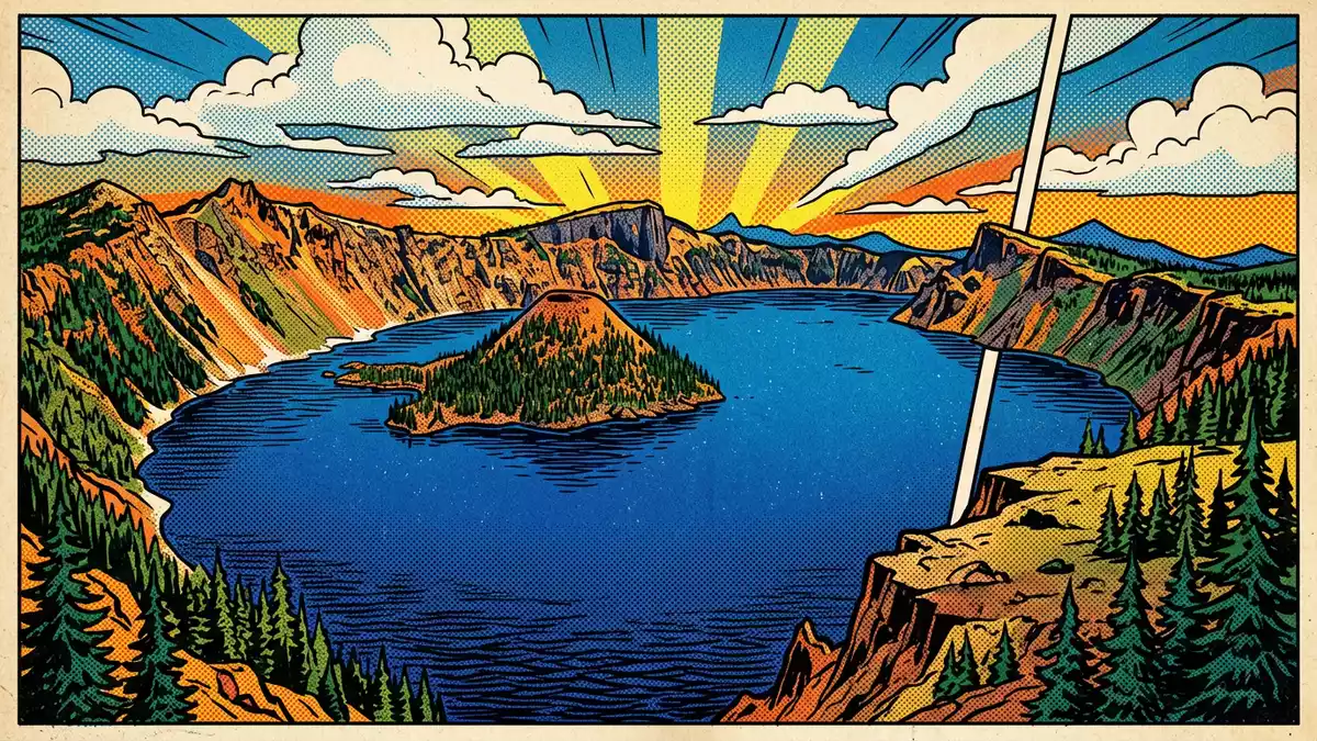
Crater Lake National Park in southern Oregon centres on Crater Lake, a deep volcanic basin filled with remarkably clear water and enclosed by steep cliffs of the Cascade Range. The lake occupies the collapsed summit of Mount Mazama, a stratovolcano whose destruction created one of the most striking calderas in the United States in the late Holocene.
A lake inside a collapsed volcano
Crater Lake lies within the caldera of Mount Mazama, a former volcano in the Cascade Range that underwent a climactic eruption about 7,700 years ago. The eruption emptied large volumes of magma from beneath the mountain, and the summit and upper flanks then collapsed, forming a basin roughly 8 to 10 km across and more than 1 km deep at its centre.Mount Mazama caldera Rain and snow gradually collected in this depression, creating Crater Lake, which has no major rivers flowing in or out and is sustained largely by precipitation and limited seepage.
The caldera rim rises in high cliffs above the water, with peaks such as Hillman Peak and Mount Scott forming prominent points along the skyline.Rim peaks around Crater Lake Within the lake, later eruptions built volcanic cones on the caldera floor, and one of these, Wizard Island, reaches above the surface as a forested island with a volcanic summit. Other cones remain submerged, contributing to the complex underwater topography that researchers have charted with repeated soundings.
Depth, clarity and scale of Crater Lake
Crater Lake is among the deepest lakes in the world, with measurements indicating a maximum depth close to 590 m and a substantial average depth across its basin.Maximum and average depth figures The caldera itself is about 1,200 m deep from rim to floor, and the lake’s surface lies far below the surrounding crest, emphasising the vertical scale of the collapsed volcano.Depth of the caldera The shoreline forms a roughly circular outline broken by lava flows, talus slopes and small promontories.
The water in Crater Lake is notably clear, with visibility measurements that reach several tens of metres down into the blue depths.Water clarity values This clarity reflects the absence of large inflowing rivers and the limited input of sediments, allowing the lake to act as a natural reservoir within the volcanic basin. The steep caldera walls rise several hundred metres above the water in many places, creating a continuous ring of cliffs that frame the lake and highlight the contrast between dark rock and bright surface.
From Mount Mazama to national park
Mount Mazama developed over hundreds of thousands of years as successive eruptions built a high stratovolcano of andesite, dacite and related volcanic rocks along the Cascade arc.Geology of Mount Mazama The climactic eruption around 7,700 years ago removed much of this edifice, and subsequent smaller eruptions within the caldera produced Wizard Island and other features that now sit within Crater Lake. The wider park landscape includes forested slopes, pumice deposits and outcrops that record different stages in the volcano’s growth and collapse.
Crater Lake National Park was established on 22 May 1902, becoming one of the earliest national parks in the United States.Act establishing the park in 1902 The park encompasses Crater Lake, the caldera rim and surrounding terrain, preserving both the volcanic landforms and the mixed conifer forests that grow on the ancient lava flows and ash layers.Park area and setting Trails, viewpoints and a rim road provide access to different perspectives on the lake and the high country of southern Oregon, while research programmes continue to study its geology, hydrology and ecosystems.
Visiting Crater Lake National Park: what travellers from Western Europe should know
- Crater Lake National Park lies in southern Oregon on the crest of the Cascade Range, reached by roads that climb from lower valleys to the caldera rim.
- The terrain around the lake involves high altitude, steep caldera walls and paths that can include sustained gradients and sections of rocky ground.
- Elsewhere in the park, forested slopes and volcanic outcrops provide walking routes with varying elevation gain and views across the caldera.
- The official language is English and the currency is the United States dollar.
- Entry requirements depend on your nationality; UK travellers can check the FCDO travel advice at gov.uk/foreign-travel-advice, Irish travellers the Department of Foreign Affairs at ireland.ie.
Searching for Crater Lake National Park on social platforms
These links open searches for Crater Lake National Park on each platform.
Frequently asked questions about Crater Lake National Park
Where is Crater Lake National Park located?
Crater Lake National Park is in southern Oregon in the United States, on the crest of the Cascade Mountain Range east of the Pacific coast.
What should visitors expect when exploring the park?
Visitors encounter Crater Lake within a high volcanic caldera, with steep cliffs, forested slopes, viewpoints along the rim and trails that cross varied volcanic terrain.
What makes Crater Lake National Park distinctive among national parks?
Crater Lake National Park is distinctive for its deep, clear lake occupying the collapsed summit of Mount Mazama, enclosed by a steep-walled caldera formed about 7,700 years ago.


