
Ciudad Encantada, a stone city in the highlands of Cuenca
Published on 09/12/2026 at 12:07 | Editorial responsibility: Rafael Müller, Editor-in-Chief AD HOC NEWS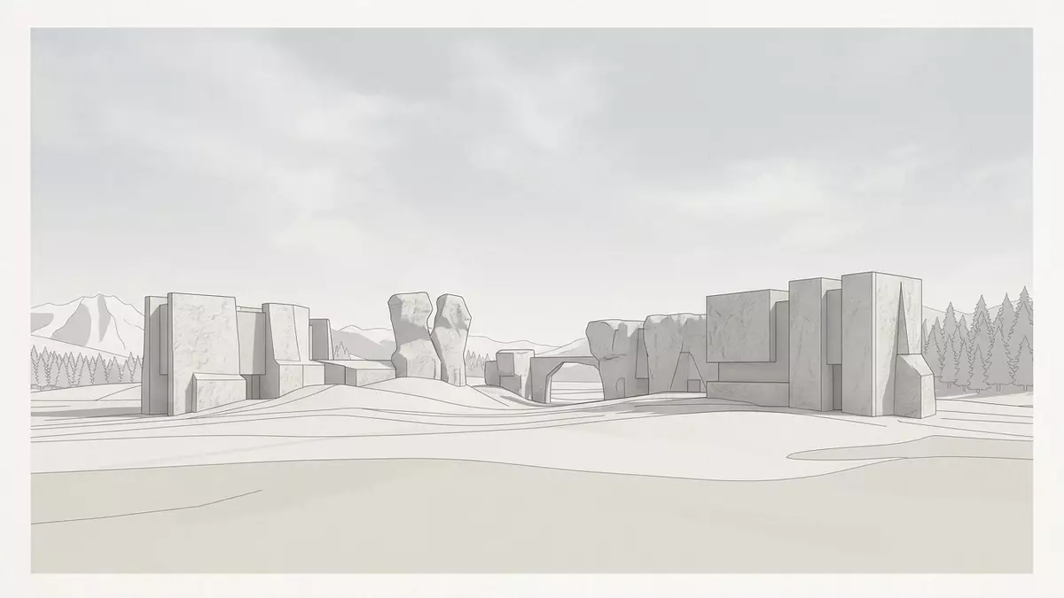
Ciudad Encantada, in the Serranía de Cuenca highlands north of Cuenca in Spain, is a limestone landscape where erosion has shaped the plateau into something that reads like a stone-built city laid out among pine woods. The area forms part of the Serranía de Cuenca Natural Park and has been recognised as a protected nature site since 1929, giving this cluster of rock forms a formal place in Spain’s catalogue of valued landscapes.
A karst plateau turned into a stone city
The heart of Ciudad Encantada is a bare karst plateau developed in horizontal limestone and dolomite beds of Cretaceous age, deposited when this part of Castilla-La Mancha lay beneath the Thetis sea around 90 million years ago.Thetis sea origin Subsequent uplift of the Iberian interior and the cutting of the nearby Júcar river exposed these rocks to rainwater, frost and seasonal temperature changes, progressively widening their fractures and dissolving the more vulnerable layers.
Geologists describe the result as a textbook karst landscape, with pavements, pedestal rocks and isolated blocks emerging from the plateau in a relatively compact area of around 100 ha (250 acres).area of about 100 ha Walking between the outcrops gives the impression of streets flanked by stone façades, while clearings open like small squares and narrower corridors slip between higher masses of rock. The pine forest surrounding the plateau sets a softer backdrop, but inside the core area the ground is largely rock underfoot, with patches of thin soil and scattered vegetation in hollows.
Named rock figures and protected status
Ciudad Encantada has long been known not only for its geological interest but also for the way its rocks resemble familiar figures when viewed from certain angles. Many formations carry names that reflect this resemblance, such as groupings described as a sea of stone or paired blocks compared to lovers meeting, and visitors trace a path that links these named points across the plateau.named rock formations The forms themselves are products of differential erosion: harder layers stand as pedestals or walls, while neighbouring bands have weathered away to leave passages and detached masses.
The Spanish state recognised the scenic and scientific value of Ciudad Encantada early in the twentieth century, declaring it a Sitio Natural de Interés Nacional on 11 June 1929.declaration in 1929 This status anchors the plateau within national conservation policy and has since been complemented by its inclusion in the wider Serranía de Cuenca Natural Park. Within that park, Ciudad Encantada stands as a compact ruiniform karst area, meaning a landscape where rock forms resemble the remains of built structures, and it has become a reference point for the geology of the region.ruiniform karst plateau
Landscape setting and walking through Ciudad Encantada
Ciudad Encantada lies within the municipality of Cuenca, close to the locality of Valdecabras, on high ground where extensive pine woods surround the karst core.near Valdecabras in Cuenca The site sits at an altitude of around 1,500 m (4,921 ft), which gives the plateau a distinct highland character and brings cooler air and a wide horizon over the Serranía de Cuenca. Approaching along the CM-2104 road, the forest thickens before the rocky interior appears as a more open area cut by paths and flanked by taller stone masses.
The route through Ciudad Encantada follows prepared paths that loop through the plateau, connecting viewpoints, named rock figures and more enclosed passages between blocks.path network through the rocks Underfoot, the terrain alternates between relatively even rock surfaces, rougher broken ground and earth paths where soil has accumulated. The rocks themselves rise to varying heights, some forming low walls and others standing as taller towers of limestone that frame the sky above the clearings. The mixture of stone and forest, and the way the route threads between them, makes the walk as much about the wider landscape as about the individual formations.
Visiting Ciudad Encantada: what travellers from Western Europe should know
- Ciudad Encantada lies north of Cuenca in east-central Spain, within the Serranía de Cuenca highlands, and is reached by road along the CM-2104 towards Valdecabras.
- The terrain inside the site includes rock surfaces, uneven ground and sections of path with steps or short slopes, so walking requires secure footwear and attention on the limestone underfoot.
- The plateau stands at around 1,500 m (4,921 ft) above sea level, and weather conditions can vary with altitude, especially in colder months.
- The surrounding area includes other viewpoints over the Júcar river gorge and pine-covered hillsides, making Ciudad Encantada part of a wider highland landscape.
- The official language is Spanish and the currency is the euro.
Searching for Ciudad Encantada on social platforms
These links open searches for Ciudad Encantada on each platform.
Frequently asked questions about Ciudad Encantada
Where is Ciudad Encantada located?
Ciudad Encantada is in the Serranía de Cuenca highlands north of the city of Cuenca in Castilla-La Mancha, within the municipality of Cuenca and near Valdecabras.
What can visitors expect when walking through Ciudad Encantada?
Visitors follow prepared paths across a karst plateau of limestone and dolomite, moving between rock formations, clearings and passages that resemble streets and squares of a stone city.
What makes Ciudad Encantada distinctive among Spanish landscapes?
Ciudad Encantada combines a compact ruiniform karst landscape, recognised as a protected nature site since 1929, with a highland setting of pine woods and an altitude of around 1,500 m (4,921 ft).


