
Ciudad Encantada, a stone city in the highlands of Cuenca
Published on 09/01/2026 at 20:11 | Editorial responsibility: Rafael Müller, Editor-in-Chief AD HOC NEWS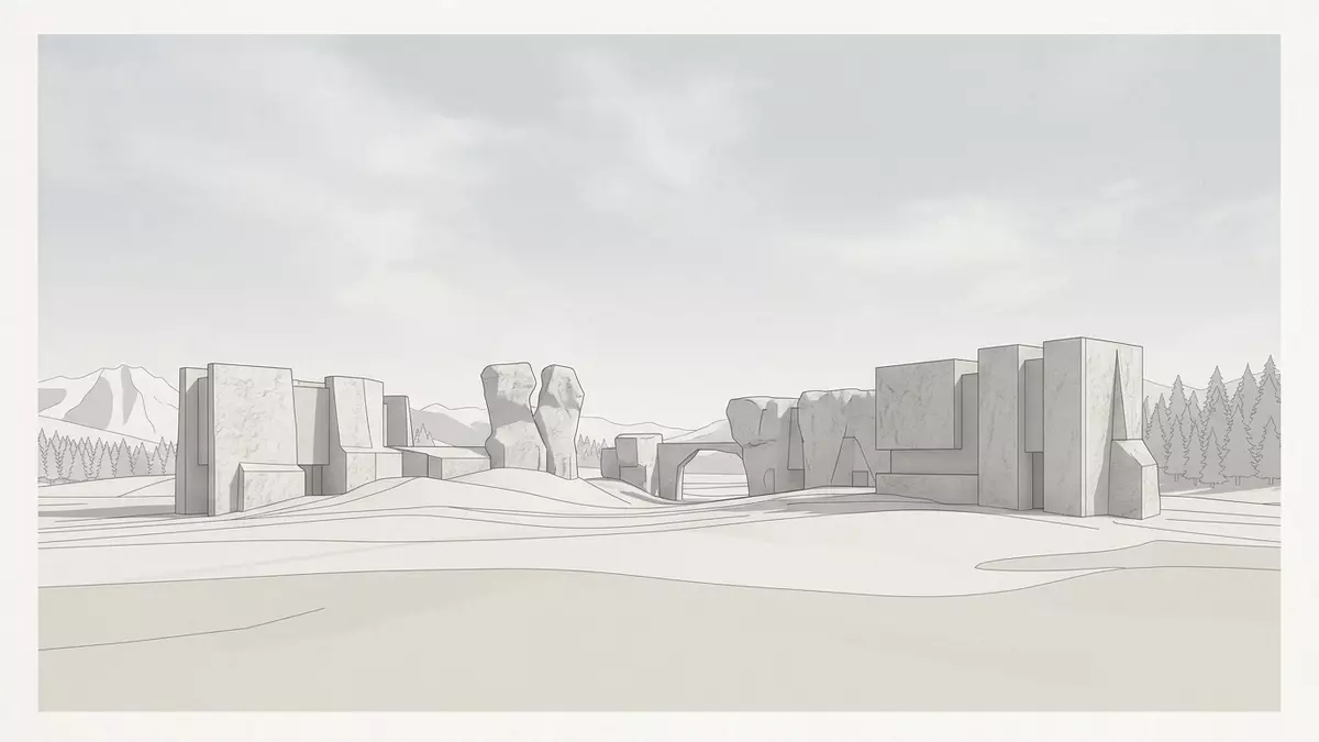
On a high plateau in the Serranía de Cuenca, Ciudad Encantada feels like a city laid out in stone, with limestone pillars, blocks and arches standing among pine trees in the thin mountain air. This karst landscape north of Cuenca in Spain formed in the Cretaceous period, when dolomitic and limestone beds were laid down and later exposed to erosion over many millions of years. The terrain sits within the Serranía de Cuenca Natural Park and brings together geology and landscape in a way that visitors can read in the ground beneath their feet and in the shapes of the rocks around them.
A karst plateau carved into streets and towers
Ciudad Encantada lies in the highlands near Valdecabras, in the southern part of the Serranía de Cuenca, where a limestone and dolomite plateau has been cut into an intricate relief by water, wind and temperature changes. Over geological time the dissolution of the rock and the widening of fractures have produced a bare karst surface, with pavements, blocks, pillars and ledges that resemble the plan of a city set on a plateau.a limestone landscape where erosion has created something that reads like a stone-built city laid out on a plateau Between the rock groups narrow passages thread across the uneven ground, with flat slabs, steps and thresholds forming something close to streets and squares.
The underlying rocks at Ciudad Encantada belong to a dolomite unit described in specialist geology as the Ciudad-Encantada-Dolomit, a sequence of calcitic and dolomitic beds deposited in the late Cretaceous, around 90 million years ago.Geologically gehört Ciudad Encantada zu einer Dolomit-Einheit, die in der Fachliteratur als Ciudad-Encantada-Dolomit beschrieben ist These flat-lying strata were later uplifted and dissected, leaving remnants that now stand as mushroom-like pedestal rocks and residual plateaus, while the softer material around them has been removed. The result is a ruiniform landscape where erosion has drawn out edges, overhangs and freestanding towers in pale rock.
Named formations: mushrooms, bridges and a sea of stone
Walking through Ciudad Encantada, many of the formations carry names that pick out the figures they resemble and help visitors navigate the site. The best known is El Tormo Alto, a high monolith that rises from the plateau like a balancing column, widely cited as a representative emblem of the Enchanted City.El Tormo Alto: A 20 meter monolith that looks like a balancing game Nearby, blocks have eroded into pedestal and mushroom forms, with wide caps resting on narrower bases and pine trees standing between them. Elsewhere on the plateau, arches and isolated spans of rock recall bridges and gateways, and gullies and alleys open between walls.
Many of these shapes have acquired descriptive names: the Dog, the Bears, the Seal, the Turtle, the Roman Bridge, the Mushrooms, the Convent, the Theatre, the Ships and the Sea of Stone.Visitors will soon recognise these: Boats, the Dog, the Sea of Stone, Roman Bridge, the Seal, the Bears, the Slide, the Lovers of Teruel, the Mushrooms, the Convent, the Turtle Signposted routes on the plateau lead past these named rocks, including narrow corridors such as the Slide, where a rocky alley forms a long passage with changes of level, and open spaces like the Sea of Stone, a broad rocky surface where erosion has sculpted patterns that echo waves and swells.The Sea of Stone: An extensive flat rocky surface where erosion has created shapes that imitate waves Together the names create a vocabulary for the landscape, making the rock forms readable as a kind of silent population of animals, objects and structures.
Geology, pine forest and the wider Serranía de Cuenca
Beyond the individual formations, Ciudad Encantada forms part of a wider karst landscape in the Serranía de Cuenca Natural Park, where mesozoic carbonate rocks are strongly folded and fractured and interspersed with forested slopes. The plateau of the Enchanted City stands at an elevation given in Spanish sources as around 1,500 m (4,921 ft), with pine woodland encircling the bare rock and the Júcar river cutting through the highlands nearby.Se localiza cerca de Valdecabras, en el término municipal de Cuenca (España), en una amplia zona de pinares [...] y a una altitud de 1500 metros The contrast between the pale limestone blocks and the darker forested slopes around them is part of what makes the plateau distinctive within the regional landscape.La Ciudad Encantada de Cuenca es uno de los paisajes kársticos nacionales por excelencia
In geological terms Ciudad Encantada is a textbook example of bare karst, with limestone pavements, karren fields, pedestal rocks and natural bridges all visible within a relatively compact area.Ciudad Encantada (Enchanted City) is a bare karst area with strange rock formations The erosive action of water flowing through fractures, combined with freeze–thaw cycles and the varying resistance of limestone and dolomite, has produced forms that serve as field examples for geomorphology. For travellers with an interest in geology or landscape, the site offers a rare chance to see so many classic karst features gathered on one accessible plateau.
Visiting Ciudad Encantada: what travellers from Western Europe should know
- Ciudad Encantada is situated in the Serranía de Cuenca north of the city of Cuenca, in east-central Spain, and is reached by road on the CM-2104 towards Valdecabras.
- The terrain is a high plateau of limestone and dolomite with uneven rock pavements, steps and narrow passages between blocks, so walking involves changes of level on hard ground.
- The surrounding area forms part of the Serranía de Cuenca Natural Park, with pine woodland around the bare rocks and views over the highlands from different points on the plateau.
- Spanish is the official language and the currency is the euro.
Searching for Ciudad Encantada on social platforms
These links open searches for Ciudad Encantada on each platform.
Frequently asked questions about Ciudad Encantada
Where is Ciudad Encantada and what kind of place is it?
Ciudad Encantada is a high limestone and dolomite plateau north of Cuenca in east-central Spain, forming a bare karst landscape within the Serranía de Cuenca Natural Park.
What should visitors expect on a visit to Ciudad Encantada?
Visitors walk among rock formations that resemble mushrooms, arches, walls and towers, following paths over uneven pavements and through narrow passages, with named figures such as El Tormo Alto and the Sea of Stone signposted on the plateau.
What makes Ciudad Encantada distinctive among Spanish landscapes?
Ciudad Encantada combines a late Cretaceous dolomite unit with intensive erosion to produce an unusually dense concentration of classic karst features, giving the plateau the appearance of a stone-built city surrounded by pine forest and highland views.


