
Ciudad Amurallada de Cartagena and its Caribbean walls
Published on 09/24/2026 at 02:23 | Editorial responsibility: Rafael Müller, Editor-in-Chief AD HOC NEWS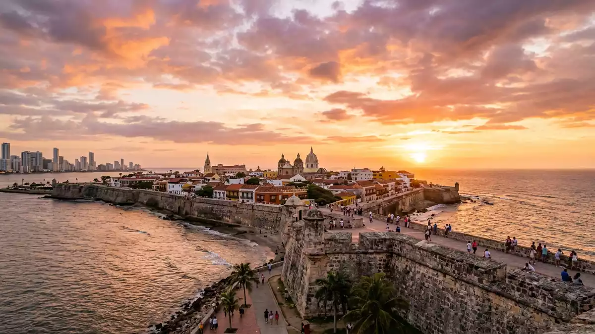
Ciudad Amurallada de Cartagena is a historic district enclosed by a continuous belt of stone fortifications beside the Caribbean Sea. Within the walls, colonial streets connect churches, palaces, balconies, courtyards and public squares, while bastions open towards Cartagena’s bay.
The fortification gives the district its defining form. Construction began in the Spanish colonial period and the walls were completed in 1796, creating a long defensive circuit around the historic centre. Their masonry, bastions and sea-facing platforms remain part of the city’s built landscape.
Cartagena’s walls and the making of a fortified city
Cartagena de Indias was founded on 1 June 1533 by Pedro de Heredia. It became a major Spanish port on the Caribbean coast, and military architecture developed around the harbour and the settlement.
The first major wall construction began in 1614. Carlos de Roda Antonelli supervised an early phase, followed by Cristóbal de Roda and other engineers. The work extended across the seventeenth and eighteenth centuries, with bastions and connecting walls forming a larger defensive system.
The completed circuit is about 11 km long. Its stone surfaces, parapets, ramps and sentry positions create a broad architectural edge between the streets of the old city and the water beyond. The preserved walls are completed in 1796.
Three districts within the historic centre
Ciudad Amurallada de Cartagena contains the districts of San Pedro and San Diego, while Getsemaní lies directly beside the walled centre. Each area has a distinct architectural character within Cartagena’s colonial urban fabric.
San Pedro centres on the cathedral and palaces with Andalusian influences. San Diego contains former merchants’ residences and narrow streets. Getsemaní is associated with the city’s popular quarter and extends the historic setting beyond the main defensive enclosure.
Colourful façades, wooden balconies, heavy doors and internal courtyards appear along the streets. Churches and civic buildings add larger stone and plaster forms to the dense urban pattern. The district’s colonial architecture is described in the UNESCO historic description.
The walls make these details legible as parts of a single fortified town. Streets meet gateways, bastions and open sections of rampart, producing repeated views between domestic buildings, military masonry and the Caribbean horizon.
Stone ramparts beside the Caribbean
The wall belt is both a defensive structure and a raised public route through the historic district. Its parapets frame views across the bay, towards the harbour and across Cartagena’s later urban areas.
Bastions project from the main line of masonry. Their angled faces, platforms and embrasures reveal the geometry of early modern military architecture without separating it from the surrounding streets.
Cartagena’s fortified ensemble forms part of the World Heritage property Port, Fortresses and Group of Monuments, Cartagena, inscribed in 1984. The designation includes the port, fortifications and historic monuments, not only the wall itself.
The city’s architectural periods remain visible in close proximity. Spanish colonial churches stand near residential façades, while the fortifications retain their military scale. The Cartagena fortification ensemble is situated beside a bay in the Caribbean Sea.
San Felipe de Barajas, outside the central wall circuit, belongs to the wider defensive landscape of Cartagena. Within Ciudad Amurallada de Cartagena, the wall itself remains the clearest physical expression of the district’s historical identity.
Visiting Ciudad Amurallada de Cartagena: what travellers from Western Europe should know
- The historic centre lies in Cartagena beside the Caribbean coast. Rafael Núñez International Airport is the named airport serving the city, and the walls stand within the central walled district.
- The wall route includes ramps, uneven masonry and changes of level. Streets inside the district are narrow, with pavements and cobbled sections around historic buildings.
- The fortified circuit is about 11 km long. Its bastions and parapets include open sections beside the city’s historic streets and harbour views.
- The official language is Spanish and the currency is the Colombian peso.
- Entry requirements depend on your nationality; UK travellers can check the FCDO travel advice at gov.uk/foreign-travel-advice, Irish travellers the Department of Foreign Affairs at ireland.ie.
Searching for Ciudad Amurallada de Cartagena on social platforms
These links open searches for Ciudad Amurallada de Cartagena on each platform.
Frequently asked questions about Ciudad Amurallada de Cartagena
Where is Ciudad Amurallada de Cartagena?
It is the historic walled district of Cartagena de Indias on Colombia’s Caribbean coast. The fortifications surround the central colonial streets and stand beside the harbour.
What can visitors expect inside the walls?
The district contains churches, plazas, colonial houses, balconies, courtyards, narrow streets and military masonry. The wall route includes bastions, parapets and views towards the Caribbean.
What makes the district distinctive?
Its defining feature is the long stone fortification belt completed in 1796. The walls connect Cartagena’s colonial urban fabric with its port and Caribbean setting.


