
Carthage between sea and history on the Gulf of Tunis
Published on 09/10/2026 at 14:32 | Editorial responsibility: Rafael Müller, Editor-in-Chief AD HOC NEWS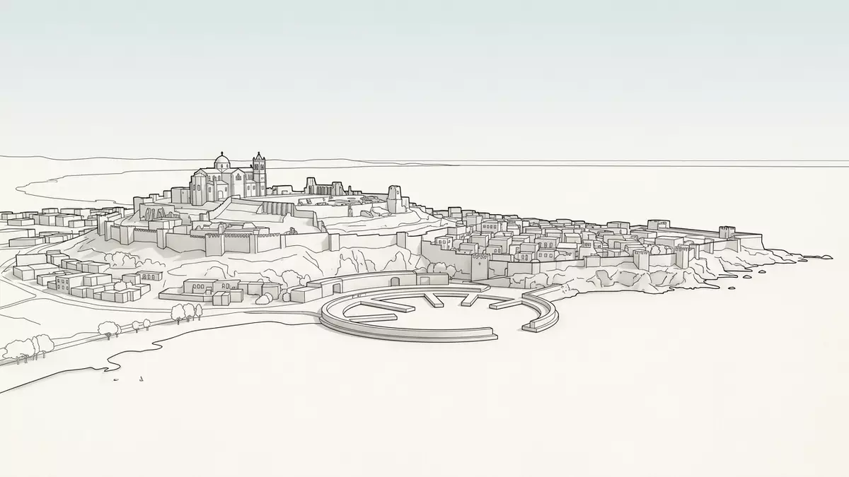
Carthage in Tunisia is both an ancient name from Phoenician history and a modern coastal municipality north-east of Tunis, where archaeological remains sit among villas and gardens on hills above the Gulf of Tunis.residential suburb of Tunis The site carries traces of a city founded by Phoenician settlers in the first millennium BC and destroyed by Rome in 146 BC, later rebuilt as Roman Carthage and recognised as a World Heritage property.
From Phoenician foundation to Roman reconstruction
Carthage was founded as a Phoenician city on the Gulf of Tunis, its name Qart Hadasht meaning “New City” in the Punic language.founded in the 9th century B.C. The traditional foundation date is 814 BC, linked to settlers from Tyre on a promontory facing the Mediterranean sea.traditional date 814 BCE Over centuries it developed into the centre of the Carthaginian maritime empire, controlling trade routes and ports across the western Mediterranean.
The Punic city fell after the Third Punic War, when Roman forces destroyed Carthage in 146 BC and levelled much of its fabric.destroyed in 146 BC On the ruins, Julius Caesar initiated a Roman colony called Colonia Iulia Concordia Carthago, realised under Augustus around 29 BC, which became the capital of Africa Proconsularis and a major Christian centre.Roman colony on the ruins This layering of Punic and Roman phases gives Carthage its distinctive historical profile, where different eras are legible in stone and street layout.
The archaeological site scattered through a modern suburb
Today the archaeological site of Carthage is dispersed through the contemporary municipality, with groups of ruins occupying hills, fields and shorelines within a largely residential district.site dispersed in the current city The core landmark is the Byrsa hill, the former Punic citadel and Roman acropolis, which rises above the Gulf of Tunis and the surrounding plain.hill dominating the Gulf Around it lie sectors of Roman houses, Punic quarter remains, basilicas and bath complexes embedded in an urban fabric of streets, gardens and diplomatic residences.municipality with residences and embassies
UNESCO inscribed the Archaeological Site of Carthage on the World Heritage List in 1979, recognising both the scale of the ancient remains and their role in Mediterranean history.added to World Heritage List in 1979 The protected property covers multiple parcels, including the area of the hills, Punic residential quarters and basilica sites mapped in detail by the World Heritage Centre.mapped sectors of Carthage For visitors, this means that Carthage is not a single enclosed park but a sequence of archaeological zones threaded through streets and coastal viewpoints.
Ruins that trace Punic, Roman and Christian Carthage
The visible ruins at Carthage illustrate successive phases of North African urban history, from Punic foundations to Roman engineering and early Christian architecture.Phoenician city-state and later ruins On Byrsa hill, excavations uncovered Punic houses with regular plots, stone-built walls and narrow lanes that give a sense of the pre-Roman town plan.Punic city centre on Byrsa Nearby, the remains of Roman streets follow a grid pattern, with foundations of townhouses, cisterns and public buildings laid out in orthogonal alignment across terraces overlooking the sea.regular grid plan with Roman houses
Further downhill, massive masonry from bath complexes and basilicas reflects the scale of Roman and late antique investment in the rebuilt city.views of bath and basilica remains Carthage became a centre of Latin-speaking Christianity, associated with figures such as Tertullian and Cyprian, and basilica ruins on headlands and slopes mark that phase of its life.major Christian centre with basilicas Later episodes, including Vandals, Byzantines and the Arab conquest under Hassan ibn al-Nu'man in 698, left fewer standing structures but shape the long historical arc visitors encounter through on-site interpretation.capture and destruction in 698 CE
Visiting Carthage: what travellers from Western Europe should know
- Carthage lies north-east of central Tunis on the Gulf of Tunis, reached overland from Tunis by suburban rail and local roads leading towards the coastal hills.
- The archaeological areas are spread across slopes and shorelines, with uneven ground, stone steps and paths between excavation zones that demand steady footing.
- In summer, daytime temperatures in Tunis and Carthage can rise well above 30 °C, and exposed terraces on Byrsa hill and at the coastal ruins offer little natural shade.
- Within view of many excavation sectors are diplomatic residences and modern villas, underlining that Carthage functions both as a monument landscape and as a contemporary residential district.
- The official language is Arabic and the currency is the Tunisian dinar; entry requirements depend on your nationality; UK travellers can check the FCDO travel advice at gov.uk/foreign-travel-advice, Irish travellers the Department of Foreign Affairs at ireland.ie.
Searching for Carthage on social platforms
These links open searches for Carthage on each platform.Frequently asked questions about Carthage
Where is Carthage in relation to Tunis?
Carthage is a coastal municipality north-east of central Tunis, on hills and shorelines along the Gulf of Tunis that form part of the wider urban area.
What should visitors expect when exploring Carthage?
Visitors encounter separate archaeological zones rather than a single enclosed site, with Punic remains, Roman urban structures and basilica ruins interspersed among streets, gardens and diplomatic residences.
What makes Carthage distinctive among Mediterranean historic cities?
Carthage combines a Phoenician foundation, destruction in 146 BC and Roman reconstruction as Africa Proconsularis’ capital, leaving layered Punic, Roman and Christian ruins recognised as a UNESCO World Heritage property.


