
Cape of Good Hope, where the Atlantic cliffs frame Africa’s turning point
Published on 08/28/2026 at 21:34 | Editorial responsibility: Rafael Müller, Editor-in-Chief AD HOC NEWS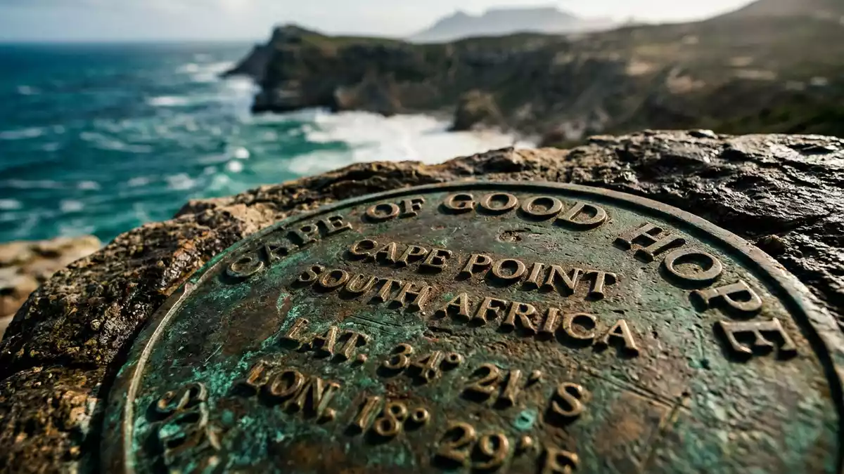
On the southern end of the Cape Peninsula south of Kapstadt, the Cape of Good Hope forms a rocky headland where ocean, cliff and low shrubland come together in a compact landscape. Part of Table Mountain National Park, it is entwined with fifteenth-century Portuguese navigation and with the wider story of South Africa’s Atlantic coast.
Where the peninsula falls into the Atlantic
The Cape of Good Hope lies near the tip of the Cape Peninsula, a mountainous spur of land that extends from Table Mountain towards the Atlantic, with Cape Point projecting slightly further south-east beyond it. The cape itself sits a little west and north of Cape Point on the peninsula’s south-western margin, forming a conspicuous promontory jutting into the ocean.rocky headland on the Atlantic coast The wider peninsula reaches southwards from the city for tens of kilometres, ending in a chain of cliffs and slopes rather than a single needle of land.
Geologically, the coastline around Cape of Good Hope exposes strata from the Table Mountain Group, an Ordovician sedimentary sequence whose resistant sandstones form many of the Cape Peninsula’s ridges and cliff faces.Table Mountain Group sedimentary unit Waves strike slabs and ledges of this rock, with narrow inlets and boulder-strewn shores shaped over long periods by Atlantic swells. Inland from the shore, slopes rise towards higher ground that carries the same underlying geology but supports different vegetation.
Ocean currents, weather and plant life
Offshore, Cape of Good Hope occupies a zone where warmer water associated with the Mozambique–Agulhas system moving down the Indian Ocean side of southern Africa encounters cooler Benguela waters pushing up from Antarctic latitudes along the Atlantic margin.convergence of warm and cool currents This interaction contributes to unsettled seas and to the long-standing reputation of the cape among sailors for stormy conditions and strong swells.
On land, the headland’s vegetation belongs to the Cape Floral Region, a globally significant centre of plant diversity recognised as a World Heritage Site.part of the Cape Floral Region Low shrubs, grasses and proteas form a dense cover on many of the slopes, adapting to thin soils and exposure to wind. This fynbos landscape differs markedly from the built-up districts of Kapstadt further north, giving the peninsula’s end a distinctly wild character even though the city lies within reach.
Cape of Good Hope in maritime history
The Cape of Good Hope entered European charts in the fifteenth century, when the Portuguese navigator Bartolomeu Dias sailed south along Africa’s Atlantic coast and rounded the cape in 1488, demonstrating that ships could pass the continent’s southern limit by sea.Bartolomeu Dias rounding the southern tip of Africa Accounts describe Dias initially calling the headland Cabo das Tormentas, “Cape of Storms”, after the difficult weather he encountered offshore.
The name Cape of Good Hope is associated with King John II of Portugal, whose optimism about a sea route to India linked the promontory with the prospect of eastward trade.renaming from Cape of Storms to Cape of Good Hope Vasco da Gama followed Dias’s path in the 1490s, sailing from Portugal around the cape and onwards to India, confirming that the Atlantic and Indian Oceans were connected by navigable sea lanes. Over subsequent centuries, the cape served as a waypoint for ships linking Europe with Asian ports, and its name extended to a wider colonial entity, the Cape Colony, which became part of South Africa in 1910.Cape Colony lasting until 1910
Protected headland within Table Mountain National Park
Conservation measures for the southern tip of the peninsula began with the creation of the Cape of Good Hope Nature Reserve in 1939, enclosing the headland and adjacent slopes within a defined area.Cape of Good Hope Nature Reserve established in 1939 In the late twentieth century this reserve was amalgamated into the Cape Peninsula National Park, which in turn was renamed Table Mountain National Park, extending protection over a larger stretch of mountain, coastline and marine environment.
The Cape of Good Hope section of the park occupies the peninsula’s southern reach. Roads approach it along both coasts, one route following the Atlantic side through places such as Kommetjie and another tracing False Bay past Simon’s Town before turning towards the reserve’s interior.approach from Kommetjie or Simon’s Town Within its boundaries, cliffs drop to rocky shorelines, inland valleys carry streams and patches of denser vegetation, and vantage points look across both the Atlantic swells and the more enclosed waters of False Bay.
Visiting Cape of Good Hope: what travellers from Western Europe should know
- Cape of Good Hope lies south of Kapstadt at the tip of the Cape Peninsula, within Table Mountain National Park, and is reached by road on routes signposted to the park.
- The terrain around the headland includes uneven coastal paths, rocky outcrops and slopes exposed to Atlantic wind, so access between viewpoints and shorelines involves walking over natural surfaces.
- On clear days the elevated ground above the cape offers views along the peninsula towards Table Mountain and across the entrance to False Bay, with ocean horizons extending into the South Atlantic.
- The official language of the wider region is English alongside other national languages, and the currency is the South African rand.
- Entry requirements depend on your nationality; UK travellers can check the FCDO travel advice at gov.uk/foreign-travel-advice, Irish travellers the Department of Foreign Affairs at ireland.ie.
Searching for Cape of Good Hope on social platforms
These links open searches for Cape of Good Hope on each platform.Frequently asked questions about Cape of Good Hope
Where is Cape of Good Hope in relation to Kapstadt?
Cape of Good Hope stands at the southern end of the Cape Peninsula, south of Kapstadt, within the protected area of Table Mountain National Park.
What should visitors expect when they reach the headland?
Visitors encounter Atlantic-facing cliffs, rocky shorelines, fynbos-covered slopes and viewpoints where the peninsula and surrounding ocean can be seen in multiple directions.
What makes Cape of Good Hope distinctive among African capes?
The cape combines a rugged Atlantic promontory with documented roles in fifteenth-century Portuguese navigation and later long-distance sea routes between Europe and Asia.


