
Cape of Good Hope, where ocean swells meet African cliffs
Published on 09/15/2026 at 08:22 | Editorial responsibility: Rafael Müller, Editor-in-Chief AD HOC NEWS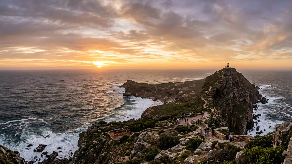
Cape of Good Hope is the rocky headland that marks the southern end of the Cape Peninsula in South Africa, projecting into the Atlantic southwest of Kapstadt. Its position at the tip of the peninsula, combined with steep cliffs and open ocean swells, makes it a natural focal point where sea, rock and maritime history converge in one compact landscape.
A headland at the end of the Cape Peninsula
The Cape of Good Hope forms part of the mountainous Cape Peninsula, a spur of land that extends from Table Mountain towards the south-western extremity of the African continent.mountainous Cape Peninsula The headland itself lies near the end of this spur, on the Atlantic side, with the open South Atlantic stretching away from its cliffs.rocky promontory at the southern end
The cape’s cliffs rise above the shoreline, with a land height that reaches around 256 m (840 ft) above sea level on the headland.altitude of 256 metres Low, hardy shrubs and grasses cling to the slopes, part of the wider fynbos vegetation that characterises this stretch of coast.grass and low shrub vegetation Standing on the paths above the rocks, the view runs along the peninsula to nearby Cape Point and, on clear days, back towards the skyline of Kapstadt.
Currents, oceans and a reputation for heavy seas
The waters off Cape of Good Hope have long been associated with strong winds and energetic swells, a reputation that grew from the conditions early navigators encountered off the headland.Cape of Storms reputation Offshore, warm water carried southward in the Mozambique–Agulhas current brushes against cooler Benguela waters that move northwards from Antarctic latitudes along the Atlantic margin.convergence of warm and cool currents
This interaction between currents contributes to choppy seas and changing surface patterns around the cape, even though the formal dividing line between the Atlantic and Indian Oceans lies further east at Cape Agulhas.ocean boundary at Cape Agulhas From the viewpoints above the rocks, the line of surf under the cliffs, the colour shifts offshore and the broad sweep of the ocean give a sense of how exposed this point is to long-distance swells.
Bartolomeu Dias, the “Cape of Storms” and a changed name
In 1488 the Portuguese navigator Bartolomeu Dias became the first recorded European to round the southern end of Africa, sailing past the headland that is now known as Cape of Good Hope on his voyage between Portugal and the Indian Ocean.Bartolomeu Dias in 1488 Accounts from the fifteenth century describe him naming the promontory Cabo das Tormentas, “Cape of Storms”, in reference to the difficult weather and sea state encountered off its shores.Cabo das Tormentas
King John II of Portugal later adopted the more optimistic name Cabo da Boa Esperança, “Cape of Good Hope”, linking the headland with the prospect of an all-water route between Europe and Asia.renaming to Cape of Good Hope Over the following centuries, the sea route that rounded this cape became a major corridor for trade and exploration, and the place itself entered European maps and narratives as a waymarker on voyages that connected the Atlantic and Indian Ocean worlds.sea route that bypasses Suez
Visiting Cape of Good Hope: what travellers from Western Europe should know
- Cape of Good Hope lies south of Kapstadt on the Cape Peninsula in South Africa, and is reached along the peninsula roads that lead towards the headland.
- The terrain around the cape includes paved paths, natural rocky ground and short, steep sections, with viewpoints reached by walking routes over uneven surfaces.
- The headland forms part of Table Mountain National Park, so natural vegetation and wildlife are present around the paths and parking areas.
- The coastline near the cape is exposed to Atlantic swells, and access points to the shoreline involve steps and paths close to rocky edges.
- The official language is Afrikaans and English is widely used; the currency is the South African rand.
Searching for Cape of Good Hope on social platforms
These links open searches for Cape of Good Hope on each platform.Frequently asked questions about Cape of Good Hope
Where is Cape of Good Hope located in South Africa?
Cape of Good Hope is on the Atlantic coast at the southern end of the Cape Peninsula, south of Kapstadt in the Western Cape province.
What should visitors expect on a visit to Cape of Good Hope?
Visitors encounter a rocky headland with high cliffs, Atlantic swells, coastal vegetation and walking paths that link viewpoints and access points to the shoreline.
What makes Cape of Good Hope distinctive among capes?
The cape combines a prominent peninsula headland, converging ocean currents and its role in Bartolomeu Dias’s fifteenth-century sea route between Europe and Asia.


