
Cap de Formentor: limestone cliffs at Mallorca’s northern edge
Published on 09/24/2026 at 01:31 | Editorial responsibility: Rafael Müller, Editor-in-Chief AD HOC NEWS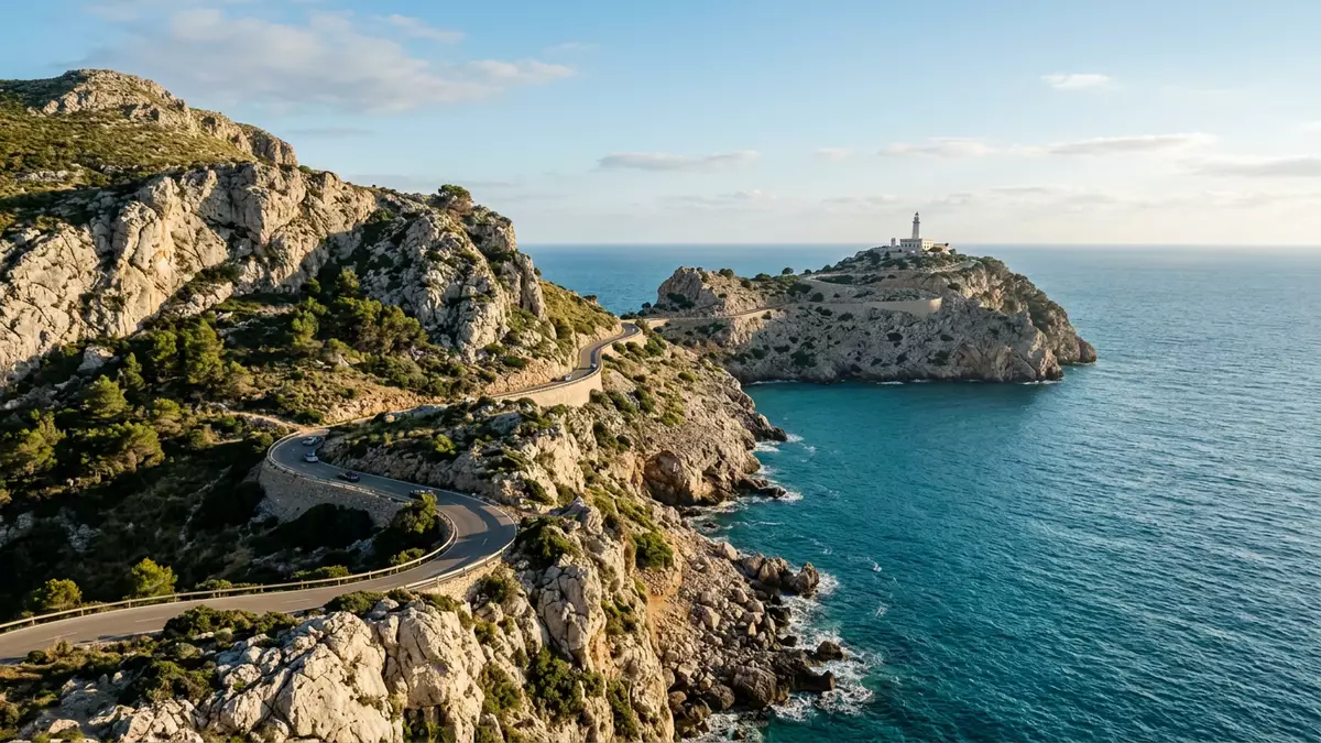
Cap de Formentor is Mallorca’s northernmost headland, where the Serra de Tramuntana reaches the Mediterranean in cliffs of pale limestone. The cape is the outer end of a long peninsula, with the Formentor lighthouse standing on a rocky promontory above the sea.
Cap de Formentor at the end of the Tramuntana
The headland lies in the municipality of Pollença, north-east of Port de Pollença. Its peninsula extends into the sea from Mallorca’s northern coast, while the Bay of Pollença opens to the south.
The cape forms the northern limit of the Serra de Tramuntana. Mountain ridges run along the peninsula, with steep coastal faces descending towards coves and open water. the Formentor peninsula is associated with a narrow landform extending from the island into the Mediterranean.
Jurassic limestone shaped into cliffs
The cliffs of Cap de Formentor consist of massive limestone from the Lower Jurassic, a geological period that began more than 200 million years ago. The rock belongs to the same broad mountain landscape as the Serra de Tramuntana.
During the Miocene, tectonic movement folded and stacked these rock formations. The result is visible in the cape’s ridges, abrupt slopes and broken coastal profiles. Jurassic cliffs of Cap de Formentor form a geological landscape rather than a single isolated rock.
The lighthouse above the northern sea
The Formentor lighthouse was built in the nineteenth century and became a fixed landmark at the peninsula’s outer end. Its white tower rises above a rocky promontory, with the sea visible around the headland.
Construction of the lighthouse began in 1857, and the building was completed in 1863. The tower remains connected with Mallorca’s maritime landscape, where cliffs, narrow channels and open Mediterranean water meet. the lighthouse’s 1863 history places the structure within the island’s nineteenth-century coastal infrastructure.
The lighthouse is not the only feature at the cape. Rocky viewpoints, mountain slopes and sea-facing bends belong to the same continuous landscape. At the waterline, coves cut into the peninsula, while birds inhabit the cliffs and scrub.
Visiting Cap de Formentor: what travellers from Western Europe should know
- Cap de Formentor lies in the municipality of Pollença, at Mallorca’s northern tip. The Ma-2210 road runs from Port de Pollença along the peninsula towards the lighthouse.
- The approach follows a mountainous coastal road with bends, steep slopes and exposed limestone scenery. The lighthouse stands above the sea on a rocky promontory.
- Fumat is the highest point of the Formentor peninsula, reaching 384 m (1,260 ft) above sea level. The terrain includes ridges, cliffs and small coves.
- The official language is Spanish and the currency is the euro.
Searching for Cap de Formentor on social platforms
These links open searches for Cap de Formentor on each platform.
Frequently asked questions about Cap de Formentor
Where is Cap de Formentor?
Cap de Formentor is at the northernmost tip of Mallorca, in the municipality of Pollença. The headland forms the outer end of the Formentor peninsula.
What can visitors expect at the cape?
The landscape includes a winding mountain road, limestone cliffs, rocky viewpoints, coves and the Formentor lighthouse. The terrain is steep and exposed in places.
What makes Cap de Formentor distinctive?
Cap de Formentor combines Lower Jurassic limestone, Serra de Tramuntana ridges and a nineteenth-century lighthouse above the Mediterranean. The cape brings geology, mountain terrain and maritime history together in one headland.


