
Canyon de Chelly and its sheer sandstone stories near Chinle
Published on 08/22/2026 at 18:21 | Editorial responsibility: Rafael Müller, Editor-in-Chief AD HOC NEWS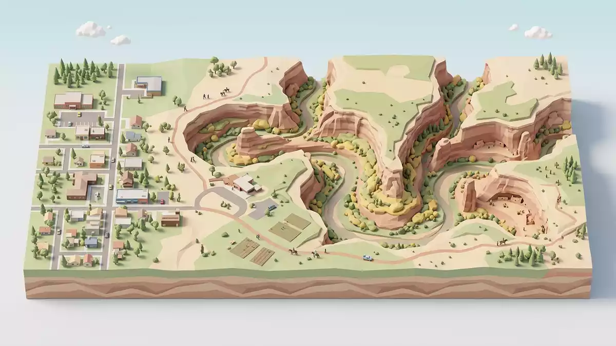
Canyon de Chelly in northeastern Arizona is a broad network of sandstone gorges that meets the town of Chinle at the edge of the Navajo Nation, where vertical cliffs frame a living farming landscape on the canyon floor.Canyon de Chelly National Monument was established in 1931 in Apache County as part of the United States National Park system, protecting both the landforms and the archaeological remains that trace more than four millennia of human presence.The canyon lands lie entirely on Navajo Tribal Trust Land, making it a rare national monument where families still live and farm within the protected area.
Sandstone walls and a canyon carved over millions of years
Canyon de Chelly’s defining impression is geological, with sheer sandstone walls that rise from a cultivated valley and trace a series of branching canyon corridors through northeastern Arizona.Land uplifts and stream cutting over millions of years shaped the colourful cliffs, leaving surfaces streaked in reds, oranges and creams where rock faces drop in near-vertical planes to the canyon floor. The monument covers tens of thousands of acres and includes several main canyons, whose rims are reached by roads from Chinle and from the highlands to the east, giving views across cliff edges to the patchwork of fields and rock outcrops below.North and South Rim Drives follow the edges of the principal gorges and provide overlooks where the contrast between flat surrounding uplands and sudden canyon voids is clear.
One of the most striking formations visible from the South Rim is Spider Rock, a tall sandstone pinnacle rising from the canyon floor beside the main channels.Spider Rock stands about 800 ft (244 m) above the valley, a slender tower of pale sandstone isolated from the surrounding cliff faces and catching light differently through the day. Around it, the canyon walls show deep alcoves and ledges cut into the sandstone, where gravity, water and wind have shaped hollows that later became sites for human settlement. Above the cliffs, the surrounding plateau carries scrub desert vegetation, while the canyon floor supports trees, shrubs and cultivated fields that mark the presence of long-term farming.
A landscape lived in for thousands of years
Canyon de Chelly is not only a geological feature but also one of the oldest continuously inhabited regions in North America, where layers of human settlement appear in alcoves, on ledges and in the valley floor below the cliffs.Evidence of habitation dates from around AD 300, and archaeological remains span more than 4,000 years of occupation on this part of the Colorado Plateau.Ancient Puebloan communities built pit houses and later more complex dwellings in the canyon, often placing masonry structures within natural alcoves in the cliff face where rock overhangs offered shelter. Later, Hopi people cultivated fields in the canyon, raising corn and peaches on the valley floor, while the Navajo, or Diné, established homesteads and fields that linked farming with herding.
The stone and adobe dwellings visible on the cliff walls today stand as direct traces of these cultures, with multi-storey masonry rooms tucked beneath overhangs and facing the valley.Well-known sites such as White House Ruin sit on ledges partway up the canyon wall, stacked in tiers that follow the natural alcove and looking out across fields and cottonwood trees below. The monument preserves these structures in situ rather than as isolated artefacts, so the relationship between homes, cliff, and farmland remains legible: stone-built rooms in the rock, cultivated plots on the floor, and paths and tracks threading between them. Families continue to live and farm within the canyon under Navajo trust arrangements, maintaining a continuity between the ancient settlements and present-day use of the land.
A Navajo trust landscape within a national monument
Unlike many protected sites in the United States, Canyon de Chelly National Monument lies entirely on Navajo Tribal Trust Land, making it both a federal unit and a homeland in active use.The geodiversity atlas notes that the monument’s boundaries sit on the outskirts of Chinle in northeastern Arizona, with ranches, fields and homesteads on the valley floor. Within this arrangement, the United States National Park Service manages the archaeological resources and the interpretive facilities, while Navajo families continue to reside and work inside the canyon landscape. This shared framework gives Canyon de Chelly a dual character: it is both a place of monumental sandstone architecture and a lived-in rural environment.
The designation as a national monument came in 1931, when President Herbert Hoover signed the act authorising its creation and then issued a proclamation for the new protected area.The 1931 authorisation aimed to safeguard archaeological sites that range from early pit houses to later masonry settlements, as well as the broader canyon setting. For travellers, this means that cliff dwellings, rock formations and present-day Navajo farms form one continuous landscape rather than separate attractions. The town of Chinle serves as the modern gateway to the monument, with the main welcome centre reached from Highway 191 and local routes that lead towards the canyon rim and entrance roads.Directions to the park emphasise paved approaches across Navajo Nation land, reinforcing the close ties between the monument and the surrounding community.
Visiting Canyon de Chelly: what travellers from Western Europe should know
- Canyon de Chelly National Monument lies in Apache County in northeastern Arizona, with Chinle as the nearest town and Highway 191 providing the principal road access from the wider region.
- The terrain within the monument consists of sandstone canyon walls with cultivated valley floors; viewpoints on the rim are reached by paved roads, while the interior involves dirt tracks and uneven ground.
- The official language is English and the currency is the United States dollar.
- Entry requirements depend on your nationality; UK travellers can check the FCDO travel advice at gov.uk/foreign-travel-advice, Irish travellers the Department of Foreign Affairs at ireland.ie.
Searching for Canyon de Chelly on social platforms
These links open searches for Canyon de Chelly on each platform.
Frequently asked questions about Canyon de Chelly
Where is Canyon de Chelly and what kind of place is it?
Canyon de Chelly National Monument is in Apache County in northeastern Arizona, near Chinle, and consists of sandstone canyons within Navajo Tribal Trust Land.
What should travellers expect when visiting Canyon de Chelly?
Travellers encounter high sandstone cliffs, rim overlooks reached by paved roads, archaeological sites on canyon walls and an actively farmed valley floor with Navajo homesteads.
What makes Canyon de Chelly distinctive among canyon landscapes?
It combines deep sandstone gorges, prominent formations such as Spider Rock, long-term habitation spanning thousands of years and a status as a national monument entirely on Navajo trust land.


