
Canal Grande: Venice’s great water boulevard
Published on 08/21/2026 at 07:45 | Editorial responsibility: Rafael Müller, Editor-in-Chief AD HOC NEWS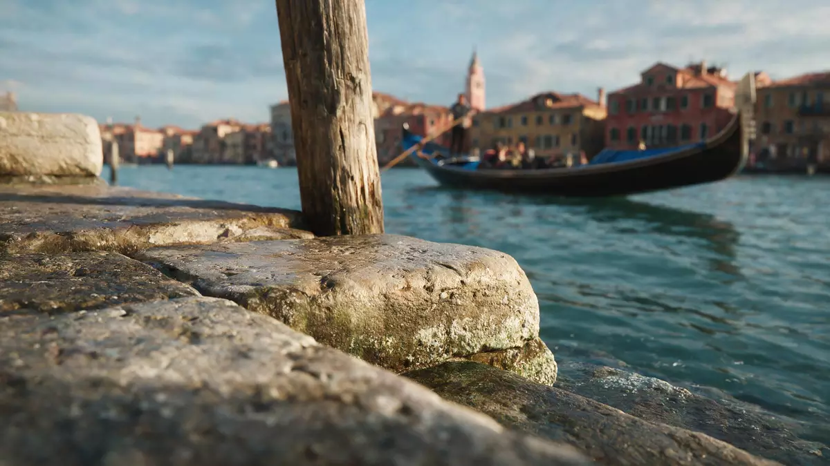
Canal Grande in Venedig is the great curved waterway that cuts through the historic centre of Venice, dividing the city into two parts while linking the lagoon with the basin of Saint Mark. Tracing an inverted S across the map, it runs for about 3.8 km (2.4 miles) between the area near the Santa Lucia railway station and the open water off Piazza San Marco, with a width between roughly 30 and 90 m (98 and 295 ft) and an average depth of around 5 m (16 ft), making it the largest channel in Venice and its main water-traffic corridor.the largest channel in Venice
A sweeping S?shaped waterway through the historic city
The form of Canal Grande is immediately striking on any map of Venice: the watercourse bends through the city in a broad reverse-S, separating the historic centre into two halves while gathering in smaller canals that flow in from the surrounding districts.knapp vier Kilometer lange Hauptwasserstraße One end lies near the railway and road access at Ponte della Libertà and Piazzale Roma, where travellers from the mainland first meet the lagoon, while the other opens into the wide basin in front of San Marco, with its view towards the island of San Giorgio Maggiore.from Ponte della Libertà to the Saint Mark’s Basin
Along its length, Canal Grande passes through or beside several of Venice’s historic sestieri, including Cannaregio, San Polo, Santa Croce, Dorsoduro and San Marco, and receives the outflow of dozens of narrower canals that branch deep into the city’s neighbourhoods.dzieli je na dwie cz??ci, ka?da po 3 dzielnice The waterway’s dimensions give it the presence of a broad boulevard translated into water, with room for ferries, private boats and working craft to move between the railway area, the Rialto district and the monumental heart of Venice near San Marco.
Palaces, churches and bridges along Canal Grande
What gives Canal Grande its distinctive character is the dense line of palaces, churches and civic buildings that stand directly on its banks, their entrance doors and decorative facades opening onto the water rather than onto conventional streets.overlook the most beautiful palaces, churches and buildings Many of these frontages display Venetian Gothic tracery, Renaissance symmetry or Baroque massing in stone and brick, and together they form a continuous architectural display that is best read from a boat passing along the canal.
Several bridges cross Canal Grande, linking the two sides of the historic centre. The Rialto Bridge in the San Polo district is the most widely recognised, a solid stone structure with arcades that replaced earlier wooden crossings and became a focus for commerce and movement between the markets and the rest of the city.the most famous bridge over the canal is the Ponte di Rialto Further upstream and downstream, additional bridges and ferry points provide access between neighbourhoods, but the long stretches without crossings leave sequences of palaces undisturbed along the water’s edge.
Canal Grande as Venice’s main transport artery
Beyond its architectural frontage, Canal Grande functions as a central transport artery for Venice. Public waterbuses, known as vaporetti, run the length of the canal on regular routes, giving residents and visitors a straightforward way to move between the railway station area, the Rialto district and San Marco without using the dense network of side canals or narrow streets.lines 1 and 2 of the Vaporetti travel along Smaller craft, including traditional gondolas, private boats and commercial vessels, share the waterway, making it both a transport corridor and a place where the working life of the lagoon city can be observed at close quarters.
The canal links key points of arrival and exchange, connecting the railway station and road terminus at one end with the historic trading centre around Rialto and the ceremonial spaces of San Marco at the other.main waterway of Venice following a reverse-S course Over centuries it has served as a route for goods and people moving between the lagoon and the city’s commercial heart, and its present role as the primary water route maintains that connection in a form shaped by modern ferry services and private navigation rules.
Visiting Canal Grande: what travellers from Western Europe should know
- Canal Grande runs through the centre of Venice in north-eastern Italy, connecting the area near the Santa Lucia railway station and Piazzale Roma with the basin off Piazza San Marco, so it is encountered naturally when arriving by train or road and moving towards the historic core.
- The canal itself is a wide waterway without pavements along most stretches, so moving beside it often involves walking along narrow fondamenta on one side or crossing bridges to reach specific viewpoints.
- Several bridges span Canal Grande, including the Rialto Bridge near the traditional market district, and these crossings often involve stone steps that can feel steep for travellers with limited mobility.
- Venice lies in Italy, where the official language is Italian and the currency is the euro.
Searching for Canal Grande on social platforms
These links open searches for Canal Grande on each platform.
Frequently asked questions about Canal Grande
Where is Canal Grande located within Venice?
Canal Grande runs through the historic centre of Venice in north-eastern Italy, linking the railway and road approaches near Ponte della Libertà with the basin off Piazza San Marco.
What can visitors expect when travelling along Canal Grande?
A journey along Canal Grande reveals a broad waterway lined with palaces, churches and civic buildings whose main facades face the water, with public ferries and smaller boats sharing the route.
What makes Canal Grande distinctive among Venice’s waterways?
Canal Grande stands out for its sweeping reverse-S course, its considerable length and width compared with other canals, and the concentration of historic architecture directly fronting onto its banks.


