
Canal de Panama: watching oceans rise and fall beside Panama-Stadt
Published on 08/29/2026 at 10:05 | Editorial responsibility: Rafael Müller, Editor-in-Chief AD HOC NEWS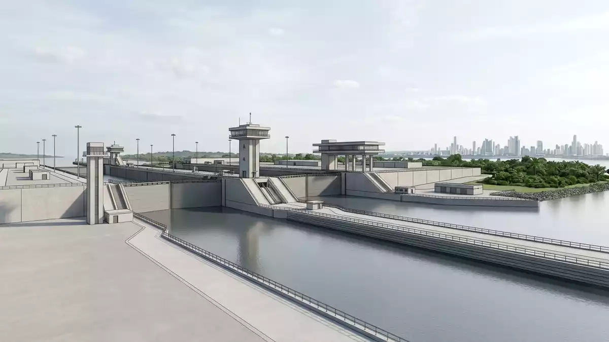
The Canal de Panama, the Panama Canal, is an artificial waterway across the Isthmus of Panama that links the Atlantic and Pacific oceans and runs close to Panama-Stadt. Completed in 1914 after a decade of United States construction following an earlier French attempt, it turns the narrow spine of Central America into a passage where ocean-going ships are lifted up above sea level, carried across Gatun Lake and lowered back again. This combination of locks, lakes and channels has made Panama a key crossroads of global shipping for more than a century.
Locks, lakes and the route across the isthmus
The Canal de Panama cuts across one of the narrowest parts of the Isthmus of Panama, connecting deep water in the Caribbean Sea on the Atlantic side with the Gulf of Panama on the Pacific side over a distance of about 80 km (50 mi) from ocean entrance to ocean entrance.connects the Atlantic and Pacific oceans From the northern entrance near Colón, ships pass through Limón Bay and reach the Gatun Locks, a flight of chambers that lifts vessels to the level of Gatun Lake, roughly 26 m (85 ft) above sea level.Gatun Lake 26 metres above sea level
Gatun Lake, formed by Gatun Dam on the Chagres River, carries ships across the interior of Panama along a broad summit-level channel before they enter the narrower Culebra (Gaillard) Cut through the continental divide.Gatun Lake formed by Gatun Dam On the Pacific side the Pedro Miguel Locks lower ships to Miraflores Lake and the Miraflores Locks bring them back down to sea level, after which a dredged channel leads out under the Bridge of the Americas towards the open Pacific near Balboa and Panama-Stadt.Bridge of the Americas and Pacific entrance
Engineering achievement and historical anchors
The idea of crossing the isthmus by water dates back to the sixteenth century, but it was in the late nineteenth century that work on a canal began in earnest under the French diplomat Ferdinand de Lesseps, famous for the Suez Canal.French construction attempts led by de Lesseps Severe engineering difficulties and disease forced the French company to abandon the project in 1889. In 1904 the United States took over the partly excavated route, following the Hay–Bunau-Varilla Treaty with the newly independent Republic of Panama, and reorganised the work under the Isthmian Canal Commission.
Chief engineers including John Frank Stevens and George Washington Goethals oversaw the building of massive earthworks, dams, locks and supporting railways, turning a jungle corridor and river valley into a controlled staircase of water.US construction under Goethals The canal opened to shipping on 15 August 1914 with the transit of the cargo ship SS Ancon, and remained under United States administration until the end of 1999, when the Panama Canal Authority, a Panamanian government entity, assumed full control under the Torrijos–Carter Treaties.transfer of control in 1999
Canal de Panama as a place to watch ships and water
For travellers based in Panama-Stadt the most accessible section of the Canal de Panama lies on the Pacific side near the Miraflores and Pedro Miguel locks, where terraces and viewing areas overlook the chambers and the artificial Miraflores Lake. From here it is possible to see oceangoing ships approach along the channel, enter the lock chambers and rise or fall as freshwater from Gatun Lake moves through the system. The locks on both sides share broadly similar dimensions, with original chambers about 300 m (1,000 ft) long and 33 m (110 ft) wide, large enough for the Panamax class of vessels.lock chamber dimensions
A major expansion project, completed in 2016, added a third lane of larger locks at Agua Clara on the Atlantic side and Cocolí near the Pacific, allowing Neopanamax ships of greater beam and draft to cross Central America.third set of locks opened in 2016 These new complexes sit beside the original lock flights rather than replacing them, so visitors can see both the century-old concrete lock walls and the more recent structures in use. The contrast between lake water at summit level, narrow rock cut through the continental divide and tidal ocean approaches makes the canal landscape varied despite its industrial focus.
Visiting Canal de Panama: what travellers from Western Europe should know
- The Canal de Panama runs between the Caribbean Sea near Colón and the Pacific near Balboa, with Panama-Stadt close to the Pacific entrance and linked by road to the Miraflores and Cocolí lock areas.
- The terrain along the canal includes engineered embankments, concrete lock structures and elevated viewing platforms; approach routes to lock viewpoints involve stairs and walkways over uneven ground.
- On the Atlantic side, the canal corridor passes through low hills and lakes towards the Caribbean; on the Pacific side, the waterway curves past bridges and port installations within sight of Panama-Stadt’s urban skyline.
- The official language is Spanish and the currency is the Panamanian balboa, which is pegged to and circulates alongside the US dollar.
- Entry requirements depend on your nationality; UK travellers can check the FCDO travel advice at gov.uk/foreign-travel-advice, Irish travellers the Department of Foreign Affairs at ireland.ie.
Searching for Canal de Panama on social platforms
These links open searches for Canal de Panama on each platform.
Frequently asked questions about Canal de Panama
Where is Canal de Panama in relation to Panama-Stadt?
The Canal de Panama runs across central Panama between Colón on the Caribbean and Balboa on the Pacific, with Panama-Stadt situated close to the Pacific entrance and canal-side port areas.
What can visitors expect when they visit Canal de Panama?
Visitors encounter a working ship canal with concrete locks, artificial lakes, channels and nearby bridges, and can view large vessels being raised and lowered as they transit between oceans.
What makes Canal de Panama distinctive among major waterways?
Canal de Panama combines a lock staircase, summit-level freshwater lakes and a route through the continental divide, creating a short interoceanic passage that has reshaped global shipping since 1914.


