
Caminito del Rey: a cliffside path through the Gaitanes gorge
Published on 08/30/2026 at 14:13 | Editorial responsibility: Rafael Müller, Editor-in-Chief AD HOC NEWS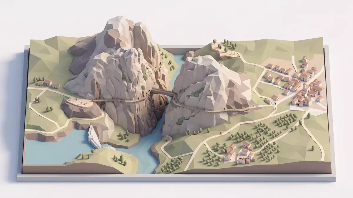
Caminito del Rey above Ardales in southern Spain is a narrow pedestrian walkway fastened to the cliffs of the Gaitanes gorge, following the river far below. Built in the early twentieth century beside a hydroelectric canal and renewed in the twenty-first century, it turns an industrial access path into a spectacular traverse of vertical limestone walls.
A path pinned to the gorge
The core of Caminito del Rey is a concrete and steel boardwalk attached to the rock of the Desfiladero de los Gaitanes, a deep canyon carved by the Guadalhorce river between Ardales and Álora in the province of Málaga.Desfiladero de los Gaitanes The structure runs high above the water, with sections where the walkway hangs around 100 m (328 ft) over the river on almost sheer walls.hangs around 100 m
The route combines these cliffside sections with stretches on mountain paths and bridges, forming a linear trail from the northern side near Ardales to the southern exit by El Chorro.linear trail from the northern side Walkers move across exposed spans where the river cuts through narrow defiles and then into a wider valley section, always with the walkway closely following the canyon walls.
From hydroelectric access to royal path
Caminito del Rey began as an industrial structure linked to hydroelectric power projects in the early twentieth century, rather than as a leisure trail.industrial structure linked to hydroelectric power Construction of the maintenance path started in 1901 for the company Sociedad Hidroeléctrica del Chorro, which operated plants at Gaitanejo and El Chorro, and work on the walkway concluded in 1905.concluded in 1905
The name “Caminito del Rey”, “the King’s little path”, dates from 1921, when King Alfonso XIII crossed the route during an official visit linked to the nearby dam works.King Alfonso XIII crossed the route Photographs from that visit and the association with the monarch fixed the royal title, which has remained attached to the walkway ever since, even as its role shifted from a working access for plant staff to a managed hiking route.
Renewed walkway for contemporary hikers
The original early twentieth-century path was built as a narrow concrete track with basic supports, and over decades its condition deteriorated, leaving broken sections and missing handrails along the gorge.concrete track with basic supports In the twenty-first century a complete renovation installed a new system of steel supports, wooden decking and protective railings, closely following the historic line while meeting modern safety standards.
The present route is organised as a one-way trail descending from north to south, beginning in the municipality of Ardales and ending in Álora.one-way trail descending from north to south Over roughly 7.7 km (4.8 miles), including approach paths, it combines steep-walled canyon sections with more open stretches near reservoirs and valley slopes, but always returns to the dramatic boardwalks attached to the gorge.
Visiting Caminito del Rey: what travellers from Western Europe should know
- Caminito del Rey lies in the province of Málaga in southern Spain, with the northern access near Ardales and the southern exit close to El Chorro station.
- The terrain includes narrow boardwalks attached high on limestone cliffs, suspension bridges and mountain paths, and requires walking along exposed sections above the river.
- The official language is Spanish and the currency is the euro.
- Entry requirements depend on your nationality; UK travellers can check the FCDO travel advice at gov.uk/foreign-travel-advice, Irish travellers the Department of Foreign Affairs at ireland.ie.
Searching for Caminito del Rey on social platforms
These links open searches for Caminito del Rey on each platform.
Frequently asked questions about Caminito del Rey
Where is Caminito del Rey located?
Caminito del Rey is in the province of Málaga in southern Spain, running through the Gaitanes gorge between the municipalities of Ardales and Álora.
What should visitors expect on the route?
Visitors walk along cliffside boardwalks, suspension bridges and mountain paths above the Guadalhorce river, with extended sections on narrow, elevated walkways fixed to the rock.
What makes Caminito del Rey distinctive?
Its distinctive character comes from the combination of an early twentieth-century hydroelectric access route and a modern hiking path that follows high limestone walls through a deep canyon.


