
Calzada de Amador: Panama-Stadt’s Pacific causeway of canal rock
Published on 09/21/2026 at 20:03 | Editorial responsibility: Rafael Müller, Editor-in-Chief AD HOC NEWS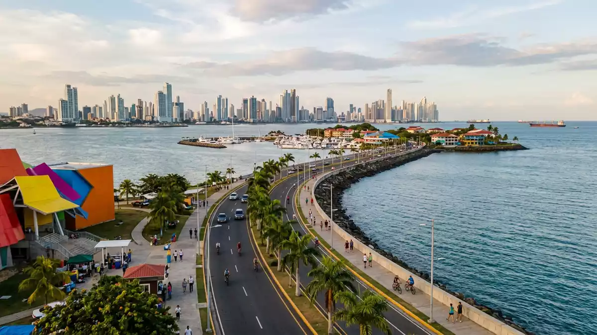
Calzada de Amador in Panama-Stadt is a long waterfront causeway built in 1913 from rock excavated during construction of the Panama Canal, reaching out into the Pacific to link the mainland with small islands and open views of ships and skyline alike.Built in 1913 it remains one of the clearest places where the engineering of the canal and the daily life of Panama City share the same strip of land.
A road built from canal stone
The core identity of Calzada de Amador lies in its origin as a breakwater and road created from spoil removed from the Culebra Cut during the canal project between 1904 and 1914.Rock excavated from the Culebra Cut was piled out into the Pacific to form a solid spine, then paved to carry traffic and military installations.
The causeway extends for about 6 km (3.7 miles) from the mainland towards the ocean, connecting Panama-Stadt with the islands of Naos, Perico and Flamenco, and in some descriptions also Culebra.A road extending 6 kilometres creates an elongated promenade where land, sea and shipping lanes meet in a single linear landscape.
From fortifications to waterfront promenade
When Calzada de Amador was first completed in the early twentieth century it formed part of a defensive system at the Pacific entrance to the canal, with fortifications such as Fort Grant and Fort Amador established along its length to guard the southern approach.Fort Amador military use left structures whose remnants are still visible beside the modern road.
Over the decades the military character gave way to civilian waterfront uses and Calzada de Amador became a seafront boulevard lined with marinas, restaurants and leisure facilities, while keeping its basic form as a causeway of stone and asphalt reaching out into the ocean.A historic causeway transformed into a leisure zone Today the same strip carries joggers, cyclists and families along the water, with views back towards Panama City and out towards the shipping lanes.
Islands, views and everyday activity
The islands connected by Calzada de Amador each give the road a different character: Naos holds research facilities and the Punta Culebra Nature Center, Perico and Flamenco provide marinas, boat services and ferry terminals, and between them the road runs as a spine with the Pacific on one side and the canal entrance on the other.Connecting Naos, Perico, Culebra and Flamenco gives the causeway a sequence of waterfront scenes rather than a single viewpoint.
Along the length of Calzada de Amador a dedicated path for walking and cycling runs beside the carriageway, turning the breakwater into a linear public space where ships waiting for the canal, the Bridge of the Americas and the skyline of Panama-Stadt can be seen along one continuous route.A 6 km road and walkway makes the relationship between city and canal concrete, with the Pacific surf on the rocks below and large vessels passing within sight.
Visiting Calzada de Amador: what travellers from Western Europe should know
- Calzada de Amador runs from the Pacific shore of Panama-Stadt towards the islands of Naos, Perico, Culebra and Flamenco; it is reached by road from central districts and by local bus routes serving the causeway.
- The terrain is gently built: a paved carriageway with an adjacent walking and cycling path, low kerbs and stretches of reclaimed rock edging the water rather than steep natural cliffs.
- For visitors arriving by public transport, Albrook station on Metro Line 1 serves as a hub, with bus services such as route C850 continuing towards the causeway from the nearby bus terminal.
- The climate brings strong sun along the exposed seafront, and the length of the causeway means that a visit often involves time outdoors on an unshaded promenade.
- The official language is Spanish and the currency is the Panamanian balboa, which circulates alongside the United States dollar.
Searching for Calzada de Amador on social platforms
These links open searches for Calzada de Amador on each platform.
Frequently asked questions about Calzada de Amador
Where is Calzada de Amador located?
Calzada de Amador lies at the Pacific entrance to the Panama Canal, extending from Panama-Stadt towards the islands of Naos, Perico, Culebra and Flamenco.
What can visitors expect on a visit?
Visitors encounter a long waterfront road with a separate walking and cycling path, marinas, research centres and leisure areas, with sustained views of the canal entrance and the city skyline.
What makes Calzada de Amador distinctive?
It is distinctive as a 6 km causeway built from canal excavation rock, once lined with fortifications such as Fort Amador and now functioning as a public promenade linking the city to Pacific islands.


