Calzada de Amador: Panama City’s Pacific promenade
Published on 09/07/2026 at 21:26 | Editorial responsibility: Rafael Müller, Editor-in-Chief AD HOC NEWS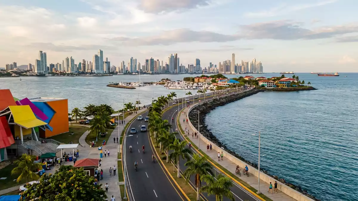
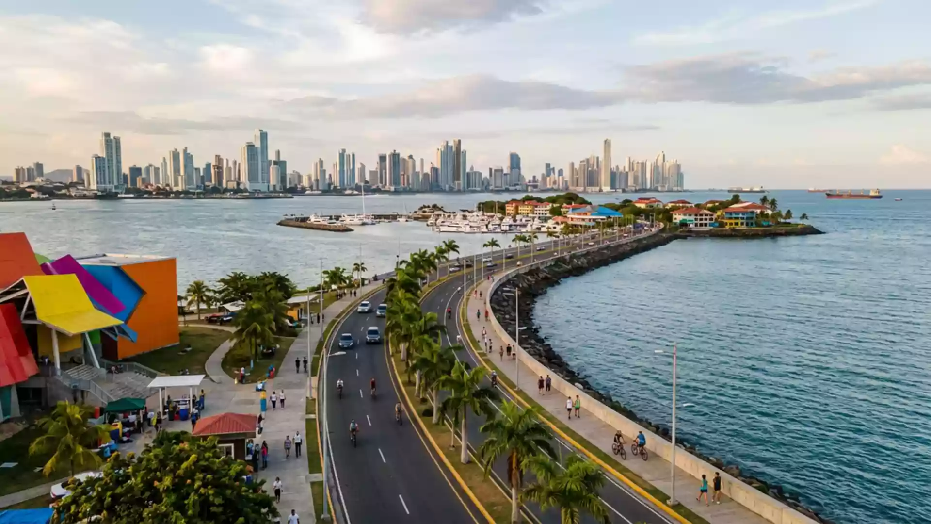
Calzada de Amador in Panama-Stadt is a waterfront road and promenade that reaches out from the mainland towards small Pacific islands at the entrance to the Panama Canal. Built in the early twentieth century using rock excavated during canal construction, it has shifted from military breakwater to leisure strip without losing its close relationship to the water and shipping lanes.
A causeway built from the Panama Canal
Calzada de Amador was constructed in 1913 by the United States administration of the Canal Zone, using rock and soil taken from the Culebra Cut during the building of the Panama Canal. The original structure functioned as a breakwater protecting the Pacific entrance to the canal and formed part of Fort Amador, a military installation guarding the approaches to this strategic route.Built in 1913 with rock from the canal The road runs from the city shoreline in Ancón district out over the water, so that traffic passes between open sea on one side and the shipping channel on the other.
The causeway links Panama City’s mainland to a small archipelago of islands in the Pacific. Naos, Perico, Culebra and Flamenco are now tied to the city by the continuous strip of reclaimed ground and roadway, which extends for close to 6 km (around 3.7 miles) between shore and outer island.A scenic road connecting four small islands Along its length the view opens towards the Bridge of the Americas, the canal entrance and, on clear days, the outline of Taboga Island further out in the Gulf of Panama.
From Fort Amador to waterfront promenade
For much of the twentieth century the islands tied together by Calzada de Amador formed part of Fort Amador, a United States military complex established to protect the canal’s Pacific side. Defensive positions and service buildings were concealed among tropical vegetation on Naos, Perico, Culebra and Flamenco, and the roadway itself served primarily as access route and breakwater rather than public promenade.Fort Amador as a US military installation After the Torrijos–Carter Treaties of 1977 and the gradual handover of Canal Zone lands, this stretch of shore shifted away from military use and opened to civilian development.
In the early twenty-first century bunkers and former service structures along Calzada de Amador were adapted into restaurants, shops and educational facilities, while the roadway and edges of the islands were reshaped to accommodate multiple traffic lanes, parking, marinas and recreation areas.Transformation into a leisure and tourism area Walking along the causeway today, traces of past fortifications stand beside contemporary waterfront venues, and the strip reads as a continuous promenade with views back to Panama City’s skyline and out towards the Pacific.
Islands, views and everyday use
Each of the islands linked by Calzada de Amador carries a slightly different character within the shared coastal setting. Naos, closest to the mainland, hosts research facilities including a Smithsonian Tropical Research Institute outpost and the Punta Culebra Nature Center, where exhibits and outdoor paths focus on marine and coastal ecosystems.Naos and Punta Culebra Nature Center Further out, Culebra and Perico combine residential areas with marinas and boat services, while Flamenco at the far end concentrates a large marina, shopping areas and a ferry terminal.
Along most of Calzada de Amador a paved waterfront path runs beside the vehicle lanes, reserved for walking, jogging and cycling. Local residents and visitors use this path for relaxed outings by the sea, sometimes renting bicycles at the mainland end and following the gentle curve out towards the islands.Dedicated bike path along the causeway Benches, planting strips and occasional sculptures punctuate the route, and several stretches open directly onto the water with small quays and viewpoints.
Visiting Calzada de Amador: what travellers from Western Europe should know
- Calzada de Amador extends south-west from central Panama-Stadt towards the Pacific entrance to the Panama Canal, reached by road from the city’s downtown districts without crossing the canal locks themselves.
- The terrain along the causeway is generally level, with long paved paths suitable for walking and cycling; some sections involve exposed stretches beside the roadway and open seafront.
- Naos, Perico, Culebra and Flamenco are all accessible along the same strip of reclaimed ground, with marinas and ferry services concentrated around Flamenco at the outer end.
- The official language is Spanish and the currency is the Panamanian balboa, which circulates alongside the United States dollar.
- Entry requirements depend on your nationality; UK travellers can check the FCDO travel advice at gov.uk/foreign-travel-advice, Irish travellers the Department of Foreign Affairs at ireland.ie.
Searching for Calzada de Amador on social platforms
These links open searches for Calzada de Amador on each platform.
Frequently asked questions about Calzada de Amador
Where is Calzada de Amador located?
Calzada de Amador runs from the mainland shore of Panama-Stadt in the Ancón area towards islands in the Pacific at the southern entrance to the Panama Canal.
What can visitors expect on a visit?
Visitors encounter a long waterfront road with paved paths for walking and cycling, marinas, restaurants and viewpoints over both the city skyline and canal shipping lanes.
What makes Calzada de Amador distinctive?
Its distinctive character lies in the combination of early twentieth-century breakwater built from canal excavation rock and its modern role as a continuous seaside promenade linking several small islands.