
Calzada de Amador links Panama-Stadt with four Pacific islands
Published on 09/24/2026 at 06:18 | Editorial responsibility: Rafael Müller, Editor-in-Chief AD HOC NEWS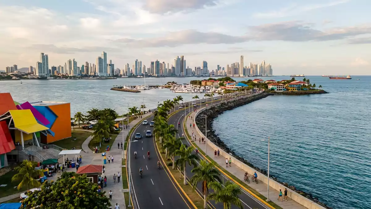
Calzada de Amador extends from Panama-Stadt into Panama Bay as a broad route over reclaimed ground. Its visible character comes from the connection between the mainland and four Pacific islands, while its foundation belongs to the construction era of the Panama Canal.
Calzada de Amador and the rock of the Panama Canal
Construction began in 1913, using rock excavated from the Culebra Cut during work on the Panama Canal. The route reaches towards Naos, Perico, Culebra and Flamenco islands, forming a long link between the city and the Pacific entrance.
The material gives the causeway a direct physical connection with one of the great engineering projects of the twentieth century. The canal authority’s description identifies the 1913 construction date, the Culebra Cut rock and the four connected islands.
Four islands across Panama Bay
Calzada de Amador is not a single waterfront building or isolated viewpoint. It is a linear landscape of roadway, shorelines and island connections, with the Pacific on both sides of the route.
Naos, Perico, Culebra and Flamenco give the causeway its distinctive geography. The mainland end lies within Panama-Stadt, while the outer route reaches towards the channel entrance and the open waters of Panama Bay.
The route measures about 6 km (3.7 miles) towards the Pacific. The route’s recorded length places the causeway within the scale of a substantial urban waterfront, rather than a short pier.
From Fort Amador to a public waterfront
The islands and causeway formed part of Fort Amador, a United States military complex associated with protection of the Panama Canal’s Pacific entrance. Military remains can be found among the island landscapes, adding concrete structures and historic traces to the route.
The Torrijos-Carter Treaties established the framework for the transfer of the Canal Zone to Panama. The handover of the canal and associated areas reached its decisive stage in 1999, after which Calzada de Amador became part of Panama-Stadt’s public waterfront.
Its present form brings together several layers of use. The route serves as a road and promenade, while the connected islands contain marinas, museums, research facilities, restaurants and open spaces. The causeway’s city connection is described as a 6 km route from the capital towards the Pacific islands.
Visiting Calzada de Amador: what travellers from Western Europe should know
- Calzada de Amador begins in the south-western waterfront of Panama-Stadt and runs towards Naos, Perico, Culebra and Flamenco. Road transport, taxis and cycling routes connect the mainland with the causeway.
- The route is exposed waterfront terrain, with long paved sections and open views across Panama Bay. Its length makes the setting different from a compact city square.
- Punta Culebra lies on Naos Island and contains facilities associated with the Smithsonian Tropical Research Institute, including marine displays and trails through tropical vegetation.
- The official language is Spanish and the currency is the Panamanian balboa.
- Entry requirements depend on your nationality; UK travellers can check the FCDO travel advice at gov.uk/foreign-travel-advice, Irish travellers the Department of Foreign Affairs at ireland.ie.
Searching for Calzada de Amador on social platforms
These links open searches for Calzada de Amador on each platform.
Frequently asked questions about Calzada de Amador
Where is Calzada de Amador?
It begins in Panama-Stadt and extends into Panama Bay towards Naos, Perico, Culebra and Flamenco islands.
What can travellers expect on a visit?
Travellers find a long waterfront route with paved surfaces, Pacific views, island scenery, canal landmarks and historic military remains.
What makes Calzada de Amador distinctive?
Its ground was formed with rock excavated from the Culebra Cut, linking the Panama Canal’s construction history with four Pacific islands.


