
Cabo da Roca, where the Sintra mountains meet the Atlantic
Published on 09/16/2026 at 20:37 | Editorial responsibility: Rafael Müller, Editor-in-Chief AD HOC NEWS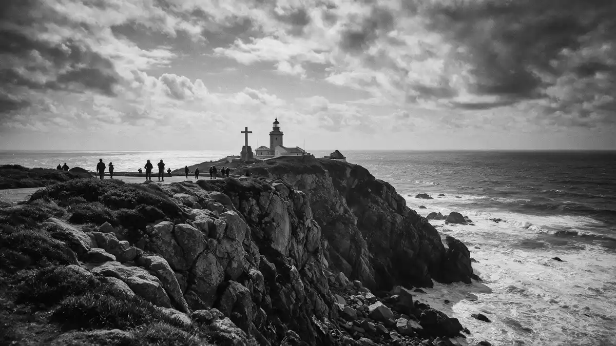
On the Atlantic coast west of Sintra, Cabo da Roca is the granite headland where the Sintra Mountains end abruptly in cliffs above the ocean, marking the westernmost point of mainland Europe and continental Portugal in the Lisboa district.westernmost point of mainland Europe The cape lies within the Sintra-Cascais Natural Park, with a lighthouse and traces of fortifications overlooking the Atlantic swells from an elevation of around 140 m (459 ft).
A granite cape at Europe’s western edge
Cabo da Roca forms the western end of the Sintra Mountain Range, a narrow granite promontory that drops in steep cliffs to the Atlantic Ocean.granite promontory forming the western end The cape stands roughly 40 km west of Lisbon, in the municipality of Sintra, between the coastal towns of Sintra and Cascais in the Lisboa region.40 km west of Lisbon The cliffs rise to about 140 m (459 ft) above sea level, giving wide views along the Serra de Sintra and the Atlantic coast on clear days.around 140 metres above the sea
The cape’s location has been recorded in geographical coordinates as 38°46?51?N, 9°30?02?W, a reference that has long mattered for navigation along Portugal’s Atlantic approaches.38°46?51?N, 9°30?02?W The designation as the westernmost point of continental Europe sets Cabo da Roca apart from other Atlantic viewpoints on the Iberian Peninsula, giving the site a clear geographical identity that is reinforced by simple markers on the headland.
Lighthouse and coastal defences above the Atlantic
High on the cape stands the Cabo da Roca Lighthouse, a beacon established in 1772 that continues to serve as a navigation aid on this exposed stretch of coast.lighthouse established in 1772 The lighthouse complex occupies a platform above the cliffs, at an elevation given as about 165 m (541 ft) above the Atlantic, making it visible from far offshore.165 metres above the Atlantic Ocean Its masonry tower and auxiliary buildings stand alongside radio masts and coastal signalling infrastructure associated with Portugal’s maritime routes.
Historical records indicate that a fort functioned at Cabo da Roca in the seventeenth century as part of a defensive line guarding the entrance to Lisbon’s harbour during periods such as the Peninsular Wars.fort in the seventeenth century Today only traces of this military presence remain, but the combination of fort remnants, lighthouse and modern navigation equipment underlines the cape’s long role as a working Atlantic headland rather than only a scenic viewpoint.
Landscape, natural park and coastal setting
Cabo da Roca lies within the Sintra-Cascais Natural Park, where the western slopes of the Serra de Sintra descend towards the ocean in a mix of cliffs, coastal vegetation and inland hills.within the Sintra-Cascais Natural Park The headland itself is described as a small triangle of land projecting into the Atlantic, formed by resistant granite of the Sintra mountains and bounded by vertical rock faces above the waves.triangle of land formed by granite rocks Coastal paths in the park connect Cabo da Roca with other viewpoints along the cliffs, and marked walking routes include sections that approach the cape from Sintra and Cascais.
The sea below the cape is part of the open Atlantic, with surf and swells meeting the cliff base rather than sheltered beaches. Inland, the terrain rises towards the forested and rocky heights of the Serra de Sintra, where castles, palaces and hilltop viewpoints stand above valleys. This combination of exposed ocean edge, upland granite and protected natural park makes Cabo da Roca a landscape site as much as a geographical marker, tying the cape into the wider coastal corridor between Sintra and Cascais.headland between Sintra and Cascais
Visiting Cabo da Roca: what travellers from Western Europe should know
- Cabo da Roca lies west of Sintra and north of Cascais, on the Atlantic coast of Portugal within the Sintra-Cascais Natural Park, and is reached by road from Sintra or Cascais along signed routes through Colares and Azóia.
- The headland consists of granite cliffs with exposed sections near the edge; paved paths and open ground lead from the road to the viewpoints above the Atlantic.
- Cabo da Roca is in Portugal, where the official language is Portuguese and the currency is the euro.
- Entry requirements depend on your nationality; UK travellers can check the FCDO travel advice at gov.uk/foreign-travel-advice, Irish travellers the Department of Foreign Affairs at ireland.ie.
Searching for Cabo da Roca on social platforms
These links open searches for Cabo da Roca on each platform.Frequently asked questions about Cabo da Roca
Where is Cabo da Roca located?
Cabo da Roca is on the Atlantic coast of Portugal in the municipality of Sintra, within the Lisboa district, west of Sintra and roughly 40 km west of Lisbon.
What can visitors expect when they reach the cape?
Visitors encounter a granite headland with cliffs above the Atlantic, signed viewpoints, simple markers indicating the westernmost point of mainland Europe and the lighthouse complex on higher ground.
What makes Cabo da Roca distinctive among European coastal sites?
Cabo da Roca combines the formal status of being mainland Europe’s westernmost point with the elevated cliffs of the Sintra-Cascais Natural Park and a lighthouse dating from 1772.


