
Cabo da Roca, where Europe drops into the Atlantic
Published on 09/18/2026 at 16:04 | Editorial responsibility: Rafael Müller, Editor-in-Chief AD HOC NEWS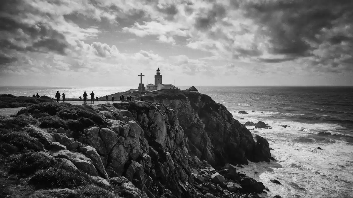
Cabo da Roca on Portugal’s Atlantic coast is the point where the Sintra Mountains come to an abrupt stop above the ocean, marking the western edge of mainland Europe. The headland lies within the Sintra-Cascais Natural Park and carries a lighthouse that began operating in 1772, making navigation history part of the landscape.
Granite cliffs at Europe’s western edge
Cabo da Roca is a granite promontory on the Atlantic coast of Portugal, forming the westernmost point of mainland Portugal and continental Europe within the Sintra Mountains. The cape stands around 140 m (460 ft) above the Atlantic, its rocky slopes dropping towards the breakers that strike the base of the cliffs.promontory in Portugal The headland lies within the Sintra-Cascais Natural Park, a protected coastal and mountain area to the west of Lisbon.within the Sintra-Cascais Natural Park
The cliffs at Cabo da Roca rise above the Atlantic in a series of rough granite surfaces with patches of vegetation adapted to salt spray and wind. The cape forms the western end of the Sintra Mountain Range, so the land behind the headland is shaped by hills rather than flat coastal plain.westernmost point of the Sintra Mountain Range On clear days the view reaches along the coastline in both directions, with other headlands and beaches visible beyond the immediate cliffs.
The Cabo da Roca Lighthouse and maritime signals
Set slightly back from the cliff edge stands the Cabo da Roca Lighthouse, a white tower with a red lantern attached to a group of service buildings arranged around a courtyard. The lighthouse began operating in 1772 and is one of the older purpose-built navigational beacons on the Portuguese coast, its light plane standing about 165 m (541 ft) above sea level.lighthouse located 165 metres above the Atlantic Ocean The tower itself is around 22 m tall, taking the focal point of the light to that height above the ocean.tower stands 22 metres tall
The lighthouse complex forms a low profile against the sky, with its compact buildings contrasting with the sharp drop towards the Atlantic just beyond their perimeter. It is included among six lighthouses ordered in the eighteenth century under a charter associated with Sebastião José de Carvalho e Melo, the Marquis of Pombal.list of six lighthouses ordered to be built The lighthouse has remained in operation since the eighteenth century, making Cabo da Roca an established reference point for ships navigating the entrance to Lisbon’s harbour.
Poetry, coordinates and the edge of the continent
Near the lighthouse, a stone monument marks Cabo da Roca as the westernmost point of mainland Portugal, continental Europe and the Eurasian landmass, combining geographical data with cultural references. The marker carries the coordinates of the cape, around latitude 38°47? north and longitude 9°30? west, making the headland a clear reference point on maps as well as on the ground.latitude 38º 47´north and longitude 9º 30´west The granite cliff, with its height around 140 m above sea level, represents the western end of the Sintra Mountains where the land stops abruptly at the ocean.western end of the Sintra Mountains
The headland is linked with a line attributed to the sixteenth-century poet Luís de Camões, “Aqui onde a terra se acaba e o mar começa”, appearing on the stone stele and tying the cape’s geography to literature.stone monument bearing a cross and a plaque with Luís de Camões' verse Historical records indicate that a fort stood at Cabo da Roca in the seventeenth century, guarding the maritime approach to Lisbon alongside other coastal defences, although only traces of that structure remain beside the lighthouse today.fort on Cabo da Roca in the 17th century
Visiting Cabo da Roca: what travellers from Western Europe should know
- Cabo da Roca lies in the municipality of Sintra, west of Lisbon, and can be reached by road from Sintra or Cascais using coastal and mountain routes.
- The headland is exposed above the Atlantic on high cliffs; paths around the monument and lighthouse area involve gradients and sections close to steep drops.
- The terrain combines paved surfaces near the buildings with rougher ground towards the cliff tops, so footwear suited to uneven paths is important for walking beyond the immediate monument area.
- The official language is Portuguese and the currency is the euro.
Searching for Cabo da Roca on social platforms
These links open searches for Cabo da Roca on each platform.
Frequently asked questions about Cabo da Roca
Where is Cabo da Roca located?
Cabo da Roca is a headland on the Atlantic coast in the municipality of Sintra in Portugal, within the Sintra-Cascais Natural Park.
What can visitors expect at the site?
Visitors encounter high granite cliffs above the Atlantic, the eighteenth-century lighthouse complex and a stone monument marking the cape’s coordinates and continental position.
What makes Cabo da Roca distinctive?
The cape is distinctive as the westernmost point of mainland Europe, combining dramatic Atlantic cliffs, an eighteenth-century lighthouse and literary references on its monument.


