
Bwindi Impenetrable National Park and its forested ridges
Published on 08/30/2026 at 13:38 | Editorial responsibility: Rafael Müller, Editor-in-Chief AD HOC NEWS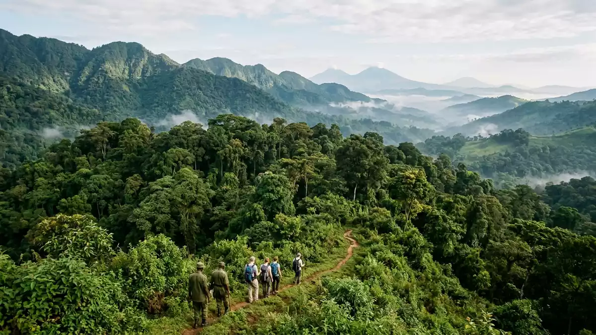
Bwindi Impenetrable National Park in southwestern Uganda is a forested mountain landscape near Kabale, recognised as a World Heritage site since 1994World Heritage site. Its slopes, ridges and dense tree cover give the park a strongly layered profile that changes with altitude.
Forest slopes and ridge country
The park lies at the junction of plain and mountain forests, on the eastern edge of the Albertine Rifteastern edge. Its setting is a patchwork of steep ground, valleys and high forest, rather than a single uniform woodland.
That variety is visible in the vegetation itself. Bwindi is known for Afromontane forest, and the park has more than 160 tree species and over 100 fern speciestree species.
A protected forest with deep ecological range
World Heritage inscription in 1994 places Bwindi among Uganda’s formally recognised natural sitesinscription in 1994. The park’s designation reflects the scale of its forest cover and the breadth of life it supports.
Sources describe it as a place of exceptional biodiversity, with birds, butterflies and many threatened species present alongside the forest itselfexceptional biodiversity. The mountain gorilla remains the species most closely linked with the park’s name in travel writing and conservation reporting.
Bwindi’s place in Uganda’s south-west
Bwindi sits in the Kigezi highlands, close to the border zone with the Democratic Republic of CongoKigezi highlands. Kabale is the nearest major town named in the available descriptions, which makes the park part of a wider south-western corridor of high ground and forest.
Its altitude runs from lower forest zones to higher montane slopes, so the landscape changes visibly as the ground risesaltitude runs. That variation helps explain why the park carries both lowland and montane forest character in the same protected area.
Visiting Bwindi Impenetrable National Park: what travellers from Western Europe should know
- The park is in south-western Uganda, near Kabale and close to the wider Albertine Rift zone. Road access is the usual approach from the region’s towns and valley routes.
- The terrain is steep in places and the forest sits across a wide altitude range. Walking in the park means dealing with ridges, slopes and uneven ground.
- English-language travellers will find Uganda’s official language context simple to recognise in practical terms. The national currency is the Ugandan shilling.
- The park’s landscape is a forest mosaic rather than a single block of canopy. Tree cover, fern growth and mountain forest features are part of the same setting.
Searching for Bwindi Impenetrable National Park on social platforms
These links open searches for Bwindi Impenetrable National Park on each platform.
Frequently asked questions about Bwindi Impenetrable National Park
Where is Bwindi Impenetrable National Park?
It lies in southwestern Uganda near Kabale, in the Kigezi highlands and along the edge of the Albertine Rift. The park extends across forested high ground rather than a flat basin.
What does a visit involve?
Expect steep slopes, forest paths and a landscape that changes with altitude. The park is shaped by ridges, dense vegetation and uneven terrain.
What makes it distinctive?
Its World Heritage status, forest structure and biodiversity define it. The park combines montane forest, fern-rich vegetation and the mountain gorilla story in one protected landscape.


