
Bryce Canyon National Park and its hoodoo amphitheatres
Published on 08/30/2026 at 11:06 | Editorial responsibility: Rafael Müller, Editor-in-Chief AD HOC NEWS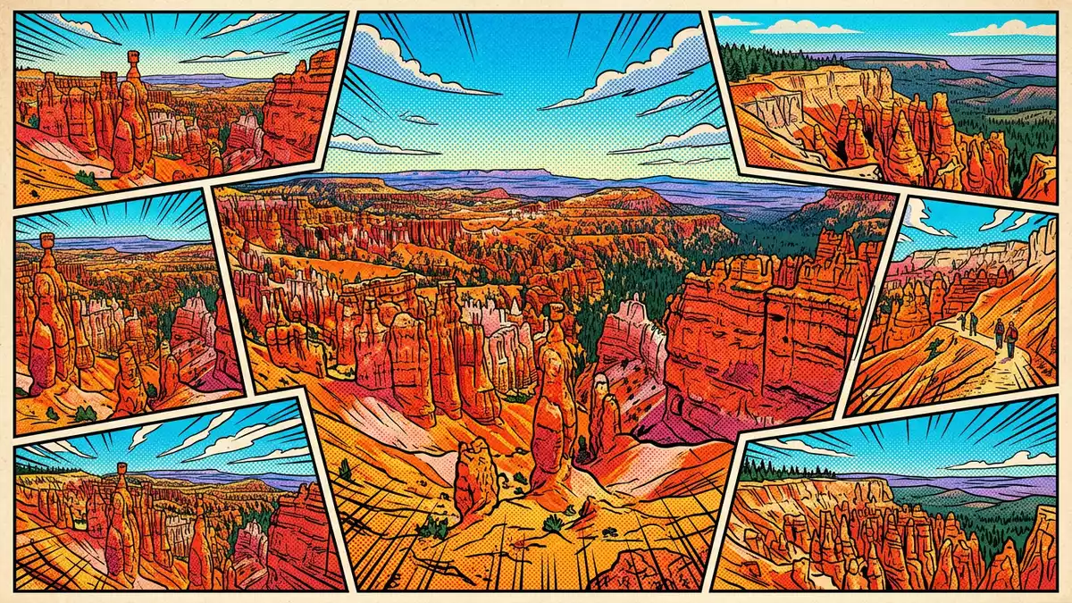
Bryce Canyon National Park is a high plateau landscape in southern Utah, where orange limestone cliffs break into amphitheatres filled with hoodoos. The park was established in 1928 and sits on the Paunsaugunt Plateau.
Orange cliffs and carved spires
The strongest visual signature is the hoodoo field, a dense scatter of spires, fins and windows cut into the Claron Formation. The park is linked with the name of Ebenezer Bryce, and its formal history reaches back to a national monument established in 1923.
Those rock forms rise in layered bands of red, cream and pale orange. The park’s southern end reaches 2,774 m (9,100 ft), while the visitor centre stands lower on the rim.
From national monument to national park
The park’s recorded history places it within the wider story of federal conservation in the American West. It began as Bryce Canyon National Monument in June 1923 and became Bryce Canyon National Park in February 1928.
February 1928 marks the name change, while the later park establishment followed in September 1928. The surrounding country is a plateau edge, and the geology exposes long bands of sedimentary rock rather than a single cliff line.
The plateau edge and its elevations
Bryce Canyon National Park lies in south-central Utah, within Garfield and Kane counties. Its elevations range from low country in the east to high ground near Rainbow Point, creating a wide vertical span across a compact area.
The park is part of the Colorado Plateau region, and the park address sits on UT-63 near Bryce. The landform is open enough for long views, yet the amphitheatres gather the rock into tight, steep-sided bowls.
Visiting Bryce Canyon National Park: what travellers from Western Europe should know
- The park lies on UT-63 near Bryce in southern Utah. The road access from the valley brings travellers onto the high rim rather than into a town centre.
- The main viewpoints sit high above the surrounding country. Paths into the amphitheatres involve steep ground and exposed descents in places.
- Shuttle, road and trail movement follow the rim-and-amphitheatre layout. The park’s geography makes the distances between overlooks and lower rock formations part of the visit.
- The official language is English and the currency is the US dollar.
- Entry requirements depend on your nationality; UK travellers can check the FCDO travel advice at gov.uk/foreign-travel-advice, Irish travellers the Department of Foreign Affairs at ireland.ie.
Searching for Bryce Canyon National Park on social platforms
These links open searches for Bryce Canyon National Park on each platform.
Frequently asked questions about Bryce Canyon National Park
Where is Bryce Canyon National Park?
It is in southern Utah, in the United States, within Garfield and Kane counties. The park sits on the Paunsaugunt Plateau near the town of Bryce.
What can travellers expect on a visit?
Expect rim viewpoints, steep amphitheatres and trails that descend among hoodoos and layered limestone. The park combines long views from above with close views of carved rock below.
What makes Bryce Canyon National Park distinctive?
Its hoodoos are the defining feature, rising from the Claron Formation in dense clusters across the amphitheatres. The contrast between rim, basin and spire gives the park its unusual appearance.


