
Bonneville Salt Flats and the vast white basin of western Utah
Published on 09/18/2026 at 16:02 | Editorial responsibility: Rafael Müller, Editor-in-Chief AD HOC NEWS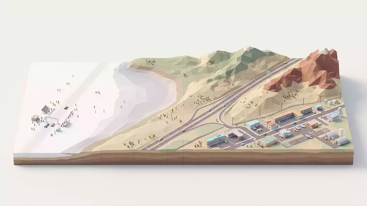
In the desert west of Wendover on the Utah–Nevada line, Bonneville Salt Flats spreads out as a hard, white salt pan bordered by low mountains and the interstate highway. This broad basin lies in Tooele County in north?western Utah and forms part of the Great Salt Lake Desert, where the flat, pale crust and distant ridges create an almost abstract landscape under the sky.Tooele County in north?western Utah
A salt pan born from Lake Bonneville
Bonneville Salt Flats occupies the western edge of the Bonneville basin, a remnant of Pleistocene Lake Bonneville that once filled much of northern Utah.remnant of Pleistocene Lake Bonneville As that lake drained and dried over roughly the last 20,000 years, lake sediments were left behind and then reworked by wind and water, shaping the present?day playa. The basin’s closed hydrology means that dissolved minerals carried in by groundwater and surface water remain behind as water evaporates, concentrating salts at the surface.
Geological studies describe the salt crust as a lens?shaped deposit of interbedded halite and gypsum above laminated carbonate muds and oolitic sands.lens?shaped deposit of evaporite minerals The elevation is around 1,285 m (4,215 ft) above sea level, making the flats a high desert basin ringed by ranges such as the Silver Island Mountains to the north?west.elevation around 4,215 ft Seasonal flooding spreads a thin layer of water over parts of the flats, which then dry to leave a crust patterned with polygonal cracks and crystalline surfaces.
Racing, research and the white expanse
Along the northern side of Bonneville Salt Flats, near the access road known as Bonneville Speedway, a long, straight section of crust has been used for land speed racing courses for much of the twentieth century.Bonneville Speedway access road The ground’s hardness and breadth allow marked tracks to run across the salt pan when conditions permit, turning the otherwise bare surface into a measured course with timing equipment and support vehicles. Away from the racing corridor, other areas of the northern flats serve as viewpoints and photography spots, where vehicles and people appear small against the pale ground.
Much of Bonneville Salt Flats is managed by the U.S. Bureau of Land Management, which oversees recreational use, racing events and commercial operations on different parts of the basin.managed by the U.S. Bureau of Land Management Scientific work continues alongside recreation: hydrology and geomorphology studies monitor flooding cycles, crust thickness and mineral zones across the playa, mapping how the surface responds to climate and human use.hydrology and geomorphology studies For visitors, the most immediate impression is visual: a white sheet of salt crust stretching toward grey and brown ranges, with the flatness making distant objects appear closer than they are.
Form, texture and desert surroundings
The salt crust at Bonneville displays several recognisable textures. In some seasons it forms a smooth, hard surface marked by shallow tyre tracks and survey stakes; in others, polygonal patterns outline the edges of salt plates. These forms arise from evaporation and crystallisation processes within the saline groundwater and surface films. Beneath the crust, lake?derived sediments grade from carbonate muds to sands, while zones of gypsum and halite dominate nearer the centre of the flats.carbonate, sulfate and chloride zones
Geographically, Bonneville Salt Flats lies west of Great Salt Lake and spans both sides of Interstate 80 near the Utah–Nevada border.spans both sides of Interstate 80 To the north?west, the Silver Island Mountains rise above the playa, while to the south a broader lacustrine plain carries other evaporite deposits.bordered by the Silver Island Mountains The combination of flat white ground, highway, railway and desert peaks gives the area a layered spatial character, with transport routes skimming the edge of the salt pan and small settlements such as Wendover clustering on firmer ground beside the basin.
Visiting Bonneville Salt Flats: what travellers from Western Europe should know
- Bonneville Salt Flats lies in north?western Utah, near Wendover at the Utah–Nevada border, and is reached along Interstate 80, which crosses the flats.
- The basin surface is a salt crust that can be hard and smooth or wet and soft, and travellers walk or drive on open, level ground without shade.
- The surrounding desert sits at over 1,200 m (3,900 ft), and the combination of altitude, reflective ground and exposure to sun creates demanding conditions for extended time outdoors.
- Wendover provides the nearest services on firmer ground beside the flats, and Interstate 80 rest areas offer viewpoints directly beside the salt pan.
- The official language is English and the currency is the United States dollar. Entry requirements depend on your nationality; UK travellers can check the FCDO travel advice at gov.uk/foreign-travel-advice, Irish travellers the Department of Foreign Affairs at ireland.ie.
Searching for Bonneville Salt Flats on social platforms
These links open searches for Bonneville Salt Flats on each platform.Frequently asked questions about Bonneville Salt Flats
Where is Bonneville Salt Flats located?
Bonneville Salt Flats lies in Tooele County in north?western Utah, in the western part of the Great Salt Lake Desert near the Utah–Nevada border and Wendover.
What should travellers expect on a visit?
Travellers encounter a broad, white salt crust stretching across a desert basin, with open, level ground, minimal shade and distant views of surrounding mountain ranges.
What makes Bonneville Salt Flats distinctive?
The combination of lens?shaped evaporite crust linked to ancient Lake Bonneville, high desert elevation and use as a land speed racing site gives the flats a particular character among salt pans.


