
Bonneville Salt Flats and the mirror-white desert of Wendover
Published on 09/07/2026 at 15:06 | Editorial responsibility: Rafael Müller, Editor-in-Chief AD HOC NEWS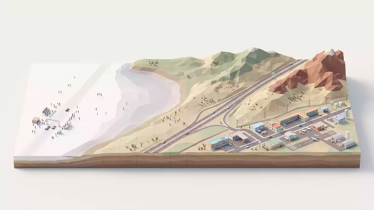
West of Wendover in the USA, Bonneville Salt Flats stretches as a broad, pale sheet of salt between the Silver Island Mountains and Interstate 80, forming one of North America’s most distinctive desert landscapes.Bonneville Salt Flats The flats lie in the western part of the Great Salt Lake Desert, on the edge of the ancient Bonneville Basin, and are managed largely as public land by the U.S. Bureau of Land Management.western part of the Great Salt Lake Desert
A hard white crust shaped by an ancient lake
Bonneville Salt Flats occupies the western margin of the Bonneville Basin, where the floor of the basin dips gently towards the Utah–Nevada border and forms a broad playa, or dry lake bed.occupies the west edge of a large flat playa The flats cover roughly 30,000 acres of ground on the desert floor, a lens-shaped crust whose thickness increases towards the centre and remains feather-thin at the margins where mud and gypsum begin to appear.30,000 acre expanse Beneath this crust lies brine saturated with sodium chloride, collected in a basin where evaporation is the primary way water leaves.
The salt crust itself is made up largely of halite, the mineral form of common salt, with zones of gypsum and carbonate minerals around it that reflect the chemistry of the basin’s water and sediment.evaporite minerals on the Salt Flats Geologists now trace the story of the flats back to the drying of Lake Bonneville, an Ice Age lake that once filled much of the Great Basin; after the lake shrank, several metres of its sediment were stripped by wind before gypsum sand and then salt began to accumulate several thousand years ago.after Lake Bonneville dried up approximately 13,000 years ago Standing on the flats today, the result is a ground surface that appears almost level to the horizon, broken only by low rises of mud at the edges and the distant outline of mountain ridges.
A natural speedway on a salt pan
Bonneville Salt Flats is best known internationally as a venue for land speed racing, where the broad, hard pan has served as a natural speedway for specialised vehicles since the 1930s.primary venues for land speed record attempts The first recognised world land speed record on the flats was set by Sir Malcolm Campbell in 1935, driving his car Bluebird to a speed above 300 mph, and later decades saw a succession of record attempts that pushed past the 400, 500 and 600 mph marks.first world land-speed record on the Bonneville Salt Flats In 1970 Gary Gabelich’s rocket-powered Blue Flame recorded more than 1,000 km/h across the flats, an outright land speed record whose figure remains a reference point in discussions of extreme speed.
The racing area lies north of Interstate 80 at the Bonneville Speedway access, reached from Exit 4 near Wendover by a paved road that ends at a parking circle at the edge of the salt.Exit 4 (Bonneville Speedway) When conditions are suitable and the surface is dry, long marked courses are laid out across the flats, extending for several kilometres in straight lines within the wide open basin. On days without events the same open ground becomes a quiet expanse where tyre marks and shallow ponds of water are the main traces of use, and where the transition from solid salt to softer margins is visible underfoot.
Landscape, light and a visit from Western Europe
In geographical terms Bonneville Salt Flats sits about 110 miles west of Salt Lake City, near the Utah–Nevada border, with West Wendover to the west and the Silver Island Mountains rising immediately to the north.about 110 miles west of Salt Lake City The contrast between the white crust and the darker mountain slopes is one of the most striking features of the site, particularly when shallow water lies on the flats and reflects the sky and surrounding ranges. Rest areas along Interstate 80 offer panoramic views across the basin, while the access road towards the speedway brings visitors directly onto the salt surface where the fine texture of crystallised halite and the subtle undulations of the crust can be seen at close range.Rest areas at about mile marker 10
The flats form part of a larger hydrologic system in the Great Salt Lake Desert, sharing broad similarities with Pilot Valley playa to the north but occupying their own basin, fed by groundwater and occasional surface inflows that bring dissolved minerals to the salt pan.separate, though similar, hydrologic basins For a traveller, the sense of space is defined by clear sightlines to distant ranges and the low relief of the desert floor, with the motorway skirting the southern margin and the raceway extending across the northern sector. Photography, filming, running events and specialised motor sports share the same terrain at different times, all using the unusual combination of smooth natural ground and open desert frame.used for land speed racing, archery competitions, running races
Visiting Bonneville Salt Flats: what travellers from Western Europe should know
- Bonneville Salt Flats lies in north-western Utah near the Utah–Nevada border, reached from Wendover by Interstate 80 and the signed Bonneville Speedway exit leading towards the flats.
- The terrain on the flats is a broad, exposed salt crust with no shade and a ground surface that can range from hard to soft; walking requires attention to wet patches and areas where the crust thins.
- Rest areas along Interstate 80 west of Salt Lake City provide elevated views across the flats from the edge of the motorway, while the Leppy Pass Road and speedway access road bring vehicles directly to the salt surface.
- The official language is English and the currency is the United States dollar.
- Entry requirements depend on your nationality; UK travellers can check the FCDO travel advice at gov.uk/foreign-travel-advice, Irish travellers the Department of Foreign Affairs at ireland.ie.
Searching for Bonneville Salt Flats on social platforms
These links open searches for Bonneville Salt Flats on each platform.
Frequently asked questions about Bonneville Salt Flats
Where are Bonneville Salt Flats in relation to Wendover?
Bonneville Salt Flats lie just east of Wendover near the Utah–Nevada border, reached from Interstate 80 at the Bonneville Speedway exit that serves the raceway area.
What should a visitor expect when stepping onto the flats?
The flats present a wide, exposed salt crust with a largely level surface, distant views to surrounding mountains and ground conditions that vary between firm, dry areas and softer, wet patches.
What makes Bonneville Salt Flats distinctive among desert landscapes?
The combination of a thick halite crust, reflective shallow water at certain times and a long history of land speed racing on a natural salt pan gives the site a particular character within the Great Salt Lake Desert.


