
Bonneville Salt Flats, a vast white mirror near Wendover
Published on 09/17/2026 at 11:34 | Editorial responsibility: Rafael Müller, Editor-in-Chief AD HOC NEWS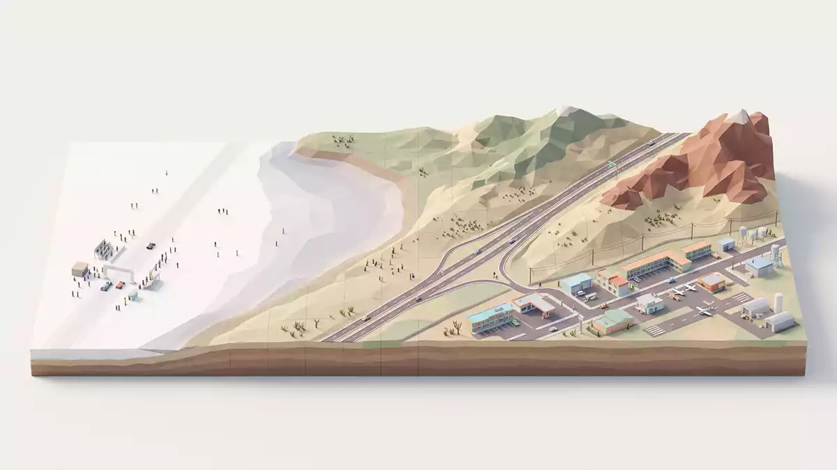
Bonneville Salt Flats stretches west of Wendover on the Utah–Nevada line, a hard white salt crust forming one of the flattest natural surfaces in the Great Salt Lake Desert. Its pale expanse, framed by dark mountains and bisected by Interstate 80, has become a landscape where geology, racing culture and sheer scale meet.
A salt pan shaped by an ancient lake
The salt flats occupy part of the western Great Salt Lake Desert in Tooele County, Utah, within the broader Bonneville basin that once held Lake Bonneville, a Pleistocene lake that covered much of north-western Utah.western Great Salt Lake Desert When Lake Bonneville stood near its highstand around 17,000 years ago, water lay more than 300 m (1,000 ft) deep over the future site of the flats, leaving terraces on nearby slopes as it receded.water exceeded 1,000 ft deep
After the lake dried, wind removed several metres of lake sediments before gypsum sand began to accumulate roughly 8,000 years ago, followed by saline waters that built up a distinctive crust of halite and gypsum layers.gypsum sand began to accumulate The modern salt flats form a perennial saline pan, with stratified layers several metres thick in the centre and thinning towards the margins, the product of repeated flooding, evaporation and mineral deposition over thousands of years.perennial saline pan
A white surface measured in thousands of hectares
Seen from the air or from the low rest areas on Interstate 80, Bonneville Salt Flats appears as a broad white sheet stretching towards the Silver Island Mountains, broken only by shallow drainage lines and the straight cut of the highway.broad, salt-covered lake bed The Bureau of Land Management records the flats as covering about 30,000 acres, or roughly 120 km² (46 square miles), an Area of Critical Environmental Concern and Special Recreation Management Area within the Great Salt Lake Basin.30,000 acres or 45 square miles
The crust itself is dominantly halite, with gypsum and carbonate-rich sediments forming underlying zones; near the centre it reaches thicknesses of around 1.5 m, tapering to only a few centimetres at the fringes.carbonate, sulfate and chloride zones Within this area, Interstate 80 divides the flats into northern and southern halves, the northern side used for motor-sport courses and sightseeing areas, the southern side hosting commercial potash operations that draw on the same saline groundwater system.Interstate 80 divides it into northern and southern halves
Racing on the salt and visiting from Wendover
Bonneville Salt Flats lies just east of Wendover, with the main motor-sport access reached from Exit 4 on Interstate 80, signposted for Bonneville Speedway, and then along Leppy Pass Road to a paved cul-de-sac at the edge of the crust.from Wendover, travel east on I-80 The flats have hosted land speed racing courses for much of the twentieth century, laid out on long straight lines across the salt when conditions permit; on other days visitors walk, photograph and explore the patterned surface close to the access road.land speed racing
The area is managed by the Bureau of Land Management, which treats it as a Special Recreation Management Area and issues permits for organised racing, filming and research projects alongside more informal sightseeing.Special Recreation Management Area Wendover itself, straddling the Utah–Nevada border, serves as the nearest town with services, sitting only a short drive west along Interstate 80, making the salt flats accessible as a distinct excursion from the desert edge.
Visiting Bonneville Salt Flats: what travellers from Western Europe should know
- Bonneville Salt Flats lies east of Wendover on the Utah–Nevada border, reached from Interstate 80 at Exit 4, following Leppy Pass Road towards the Bonneville Speedway access area.
- The terrain at the access point is flat but exposed, with a hard salt surface that can be thin near the margins; footwear that tolerates salt and occasional shallow surface water is advisable.
- Bonneville Salt Flats sits within the Great Salt Lake Desert of Utah in the United States; the official language is English and the currency is the US dollar.
- From Western Europe the nearest major international hub is Salt Lake City International Airport, with onward travel westwards across Utah by road towards Wendover and the salt flats.
Searching for Bonneville Salt Flats on social platforms
These links open searches for Bonneville Salt Flats on each platform.
Frequently asked questions about Bonneville Salt Flats
Where are Bonneville Salt Flats?
Bonneville Salt Flats are in Tooele County in north-western Utah, on the western edge of the Great Salt Lake Desert close to Wendover on the Utah–Nevada border.
What should visitors expect on a visit?
Visitors encounter a vast, pale salt surface with minimal vegetation, strong horizons and distant mountain backdrops, reached from Interstate 80 and open to walking and careful driving when conditions permit.
What makes Bonneville Salt Flats distinctive?
The combination of its large, flat salt crust area, its origin in the desiccation of Lake Bonneville and its long use as a land speed racing course gives the flats a character unlike other desert sites.


