
Bohinjsko jezero, a long glacial lake in Bohinj
Published on 08/28/2026 at 19:16 | Editorial responsibility: Rafael Müller, Editor-in-Chief AD HOC NEWS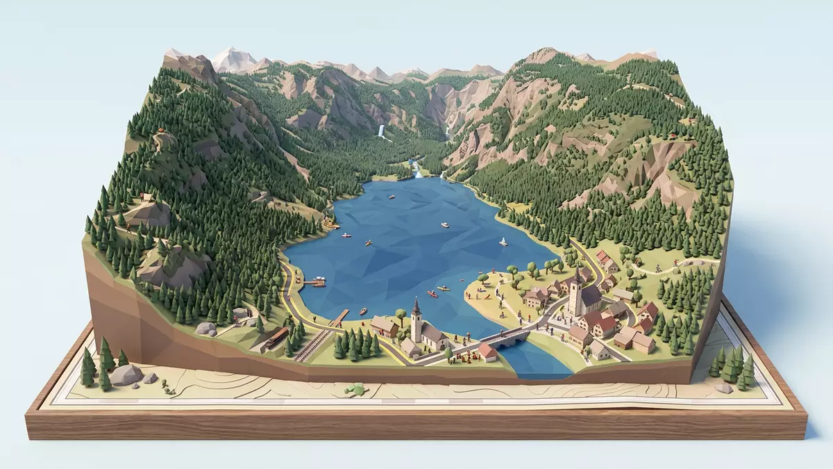
Bohinjsko jezero, known in English as Lake Bohinj, is a long glacial lake in the municipality of Bohinj in north?western Slovenia, enclosed by the Julian Alps and protected within Triglav National Park. Its basin forms the largest natural permanent lake in Slovenia, a clear stretch of alpine water set within the Bohinj valley in the Upper Carniola region.
Shape, scale and the glacial basin of Bohinjsko jezero
The defining impression of Bohinjsko jezero is its elongated form, a narrow lake basin aligned broadly east–west between steep alpine slopes. The lake occupies a glacially carved depression that was shaped by the Bohinj glacier, leaving a long trough whose surface covers about 318 ha and extends for just over 4 km from the village of Rib?ev Laz to the area around Ukanc.lake basin and dimensions Along much of its length Bohinjsko jezero remains relatively narrow, with a maximum width of around 1.2 km across the central part of the basin.surface area and width
The water surface lies at an elevation of roughly 525–526 m (about 1,720–1,725 ft) above sea level, giving Bohinjsko jezero the character of a sub?alpine lake set below higher summits of the Julian Alps.elevation and setting In the eastern bay the lake reaches a maximum depth of around 45 m (148 ft), with much of the basin dropping beyond 20 m, and the water volume has been measured at roughly 92.5 million cubic metres.depth and water volume Steep wooded slopes and rock faces rise directly above the shoreline in many places, reinforcing the impression of a long, enclosed valley lake.
Water, inflows and the protected landscape around the lake
Bohinjsko jezero lies within Triglav National Park, the main protected area of the Slovenian Alps, and is part of a wider landscape of mountains, forests and high pastures.location within Triglav National Park The surrounding watershed extends up to elevations of around 2,000 m and consists largely of carbonate rock, with slopes and ridges draining into the lake via streams and springs.watershed and geology This setting gives Bohinjsko jezero a distinctive frame: limestone and dolomite cliffs, densely forested hillsides and views towards higher peaks of the Julian Alps.
The lake is a flow?through system. At its western end cold water from the Savica waterfall and river enters the basin, supplemented by smaller mountain streams and karst springs emerging near the base of Mount Komar?a.main inflow from Savica At the eastern end the water drains out through the Sava Bohinjka river, which carries the outflow towards the Sava watershed. Measurements indicate that the entire water volume of the lake renews roughly three times a year, with an estimated residence time of about four months for an individual parcel of water.residence time and outflow The result is a clear body of water with relatively moderate nutrient input and visible stratification between surface and deeper layers.
Bohinjsko jezero in Bohinj: villages, access and lake shore
Administratively, Bohinjsko jezero lies in the Municipality of Bohinj in the north?western part of Slovenia, within the Upper Carniola region.municipality and region The lake sits along the Bohinj valley, which extends westwards from the direction of Bled, and the main settlements by the shore are Rib?ev Laz at the eastern end and Ukanc towards the western end. Roads follow parts of the northern and southern shore, with short stretches where the forest comes directly down to the water and the shoreline remains path?based.
The shore of Bohinjsko jezero runs for just over 11 km (about 7 mi), alternating between open lakeside meadows, small beaches and wooded sections.shore length Church architecture and small bridges provide landmarks near Rib?ev Laz, including the stone bridge across the Savica outflow and the church of St John the Baptist, whose tower is visible from many points along the eastern shore.bridge and church at Rib?ev Laz Around Ukanc the surroundings feel more enclosed by forest and steep slopes, and trailheads for routes into higher ground, including paths towards the Komna plateau and Mount Vogel, lie within reach of the lakeside.
Visiting Bohinjsko jezero: what travellers from Western Europe should know
- Bohinjsko jezero lies in the Bohinj valley in north?western Slovenia, and is reached by road from the direction of Bled and Ljubljana, with public buses serving the lakeside settlements.
- The terrain around much of the shore combines gentle lakeside meadows with sections of uneven forest paths and short slopes; some approaches to viewpoints and trailheads involve stony mountain paths.
- The wider setting is the Julian Alps in Slovenia, and Bohinjsko jezero forms part of Triglav National Park, where marked trails lead from the lake up towards higher summits.
- The official language is Slovene and the currency is the euro.
Searching for Bohinjsko jezero on social platforms
These links open searches for Bohinjsko jezero on each platform.Frequently asked questions about Bohinjsko jezero
Where is Bohinjsko jezero located?
Bohinjsko jezero is in the Municipality of Bohinj in north?western Slovenia, within the Upper Carniola region and inside Triglav National Park in the Julian Alps.
What should travellers expect on a visit?
A visit to Bohinjsko jezero centres on a long glacial lake with clear alpine water, forested shores, small villages and trailheads leading into the surrounding mountains.
What makes Bohinjsko jezero distinctive among Slovenian lakes?
Bohinjsko jezero is distinctive as Slovenia’s largest natural permanent lake, occupying a glacial basin with a pronounced east–west alignment and lying entirely within a national park.


