
Blue Nile Falls, where the Ethiopian Highlands plunge into mist
Published on 08/26/2026 at 13:05 | Editorial responsibility: Rafael Müller, Editor-in-Chief AD HOC NEWS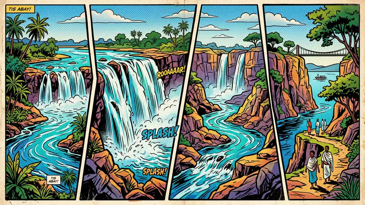
Blue Nile Falls in northern Ethiopia is where the Blue Nile river leaves the calm basin of Lake Tana and drops in a single dramatic leap into a rocky gorge, turning placid water into a curtain of spray and mist. Known in Amharic as Tis Issat or Tis Abay, “water that smokes”, the falls are a landmark of the Ethiopian Highlands and lie south-east of Bahir Dar in the Amhara Region, within easy reach of one of the country’s major lakeside cities.
The smoking water of the Blue Nile
Blue Nile Falls stands on the upper course of the Blue Nile, a major tributary of the Nile that rises from Lake Tana and flows towards Sudan and Khartoum.upper course of the river Here the river launches itself over a basalt escarpment into a deep gorge, dropping roughly 37 to 45 m (about 120 to 148 ft) in a single fall.between 37 and 45 metres high The drop is high enough that the river breaks into fragments of water and spray long before it reaches the base, creating a hanging cloud that gives the falls their “smoking” name in Amharic.
The falls are situated in South Gondar Zone of the Amhara Region, about 30 km (19 mi) downstream from Bahir Dar and the outlets of Lake Tana.about 30 kilometres downstream from the town of Bahir Dar In the rainy season, several parallel streams spill over the cliff and together can reach a width of hundreds of metres, while in the dry season individual channels of water carve their way down the basalt ledge.waterfall known locally as Tis Isat The surrounding landscape is composed of rolling highland farmland, small villages and patches of natural vegetation, with the river cutting a clear line through the plateau.
Basalt cliffs, rainbows and the Blue Nile gorge
The rock at Blue Nile Falls is basalt, part of the volcanic sequence that built much of the Ethiopian Highlands. The river drops over a resistant horizontal layer, forming a straight cliff edge and a plunge pool enclosed by dark rock. In high flow the water pours in a continuous sheet, while at lower discharge separated bands of water fall into the gorge and expose the underlying structure. On clear days sunlight catches spray rising from the base and throws rainbows across the gorge, adding colour to the dark rock and brown river.
Below the falls the Blue Nile is channelled into a narrower gorge, its flow confined between steep walls before the valley opens out downstream.before being channeled into a frothing gorge The contrast between the relatively gentle shores of Lake Tana and the abrupt break at Blue Nile Falls is one of the most striking geographical transitions in Ethiopia: within a short distance, calm lake water becomes a powerful river dropping over a cliff and carving its way towards Sudan.
Bridges, paths and village approaches
Access to Blue Nile Falls is through rural villages such as Tis Abay and Tissisat, which lie close to the east bank of the river south-east of Bahir Dar.road through the town of Tis Abay From these villages, footpaths lead towards the gorge, crossing cultivated fields and patches of scrub before reaching viewpoints above and below the falls. One of the notable structures near the site is a stone bridge dating from the seventeenth century, built by Portuguese influence and recognised as the first bridge to span the Blue Nile.seventeenth-century Portuguese bridge The bridge stands downstream of the falls and forms part of a walking circuit that links viewpoints and river crossings.
Approaches on foot include paths that descend towards the gorge, crossing the river on the historic bridge, and tracks that climb to vantage points above the falls.path above the falls Routes pass through farmland and village edges, so encounters with local residents and livestock are part of the setting. Some visitors reach viewpoints on the opposite bank by small boats that cross the river when conditions permit, linking paths and giving alternative angles on the waterfall and gorge.crossing the river by motorboat
Visiting Blue Nile Falls: what travellers from Western Europe should know
- Blue Nile Falls lies south-east of Bahir Dar in the Amhara Region of Ethiopia, on the Blue Nile river downstream from Lake Tana, and is approached via villages such as Tis Abay and Tissisat by road.
- Reaching viewpoints at the falls involves walking on uneven, rocky paths, including slopes and steps, and may include crossing a historic stone bridge or using simple river boats where available.
- The surrounding terrain is highland countryside at altitude, with cultivated fields, scattered trees and a river gorge; footwear suitable for rough ground is important.
- The official language is Amharic and the currency is the Ethiopian birr.
- Entry requirements depend on your nationality; UK travellers can check the FCDO travel advice at gov.uk/foreign-travel-advice, Irish travellers the Department of Foreign Affairs at ireland.ie.
Searching for Blue Nile Falls on social platforms
These links open searches for Blue Nile Falls on each platform.
Frequently asked questions about Blue Nile Falls
Where is Blue Nile Falls located?
Blue Nile Falls is on the Blue Nile river in the Amhara Region of Ethiopia, south-east of Bahir Dar and downstream from Lake Tana in the Ethiopian Highlands.
What should visitors expect on a visit to Blue Nile Falls?
Visitors encounter a high waterfall dropping over a basalt cliff into a gorge, with mist and spray, approached by rough footpaths through rural villages and highland countryside.
What makes Blue Nile Falls distinctive?
The combination of a significant single drop, basalt cliffs, the Amharic “smoking water” name and its position where the Blue Nile leaves Lake Tana gives the falls a distinctive character among African river landscapes.


