
Bay of Islands and the curve of Waitangi
Published on 09/10/2026 at 16:58 | Editorial responsibility: Rafael Müller, Editor-in-Chief AD HOC NEWS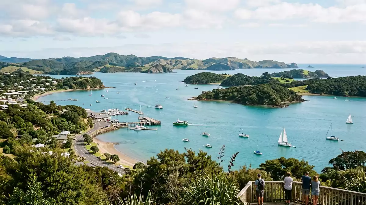
Bay of Islands near Paihia is a broad coastal landscape of water, islands and headlands in Northland, New Zealand. Its form is striking before any history enters the picture: the bay opens as an island-studded inlet rather than a simple sweep of shore.
The island-studded bay off Paihia
The bay is part of the northern North Island and lies on the South Pacific side of New Zealand. Britannica describes it as a bay and geographic region formed when the sea flooded an old river valley system.
Its shoreline runs for about 800 km (500 miles), and the water contains about 150 islands. Cape Brett and the Purerua Peninsula mark the outer shape of the bay, while Paihia sits on the southern side.
Waitangi on the bay shore
Waitangi Treaty Grounds stands in Paihia of the Bay of Islands, and its setting makes the link between place and history visible at once. The grounds occupy a shoreline site on Tau Henare Drive, with roads leading in from Paihia and across the bridge at the Waitangi River mouth.
The map page places the grounds 2 km from Paihia, and the same site is reached from the waterfront road and the one-lane bridge. The grounds are also seen from across the bay from Russell township, which gives the wider harbour a second vantage point.
Water, islands and the historic shoreline
The Bay of Islands is more than a name for a bay with many islands. It is a place where harbour water, settlement shorelines and historic landings meet in a compact maritime setting.
New Zealand’s tourism page lists Paihia, Russell, Opua and Kerikeri among the settlements around the bay. The same page notes the passage to Cape Brett and the Hole in the Rock, both part of the wider coastal scenery.
Visiting Bay of Islands: what travellers from Western Europe should know
- Bay of Islands is in Northland on New Zealand’s North Island, with Paihia on its southern shore. Waitangi Treaty Grounds is reached from Paihia by the waterfront road and a bridge over the Waitangi River mouth.
- The terrain around the grounds includes boardwalks, concrete paths, tracks, beaches and lawns. That mix means the ground changes from one section to another, and the site is spread across a broad coastal slope.
- Russell lies across the bay from the Waitangi shoreline. Cape Brett and the Purerua Peninsula frame the outer edges of the wider bay.
- The official language is English and the currency is the New Zealand dollar.
Searching for Bay of Islands on social platforms
These links open searches for Bay of Islands on each platform.
Frequently asked questions about Bay of Islands
Where is Bay of Islands?
It lies in Northland on New Zealand’s North Island, with Paihia on the southern shore and Russell across the water.
What does a visit there involve?
The area combines harbour scenery, island views and the Waitangi shoreline. Roads, bridge access and coastal paths connect the main points around Paihia and Waitangi.
What makes Bay of Islands distinctive?
The bay contains many islands within a broad inlet formed from an old river valley system. That geography gives the place its maritime character and its name.


