
Bay of Islands and Paihia, where history meets water
Published on 09/07/2026 at 09:45 | Editorial responsibility: Rafael Müller, Editor-in-Chief AD HOC NEWS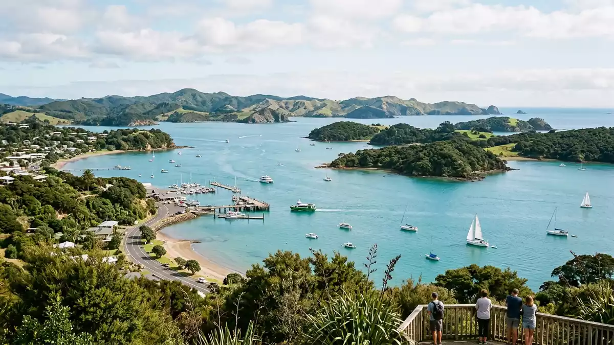
Bay of Islands is a wide harbour landscape in the north of New Zealand’s North Island, with Paihia among its main towns. Its water, islands and historic places give it a clear identity before any itinerary begins.
Island water and a long shoreline
The bay is a geographic region as well as a body of water, formed when the sea flooded an old river valley system. Britannica describes a shoreline of 500 miles and about 150 islands, while New Zealand’s national tourism site places 144 islands between Cape Brett and the Purerua Peninsula.a long shorelineabout 150 islands
The broad sweep of water includes inlets, sheltered passages and a chain of settled places around its edges. Paihia, Russell, Kerikeri, Opua and Waitangi belong to the cluster most visitors encounter first.
Cook, Marsden and the first European settlements
Captain James Cook entered the inlet in 1769 and gave the bay its English name. In 1814, the Reverend Samuel Marsden established the first permanent European settlement in New Zealand at Rangihoua, and the bay later became a centre for whalers in the 1830s.Captain James CookSamuel Marsden
The same bay later became one of the decisive places in New Zealand’s colonial story. The Treaty of Waitangi was signed here in 1840, and Waitangi remains the name most closely associated with that agreement.The Treaty of Waitangi
Paihia and the towns around the bay
Paihia sits on the eastern side of the bay and acts as a practical base for crossings, coastal walks and boat travel. Russell, Kerikeri and Opua add different layers of settlement, from harbour frontage to inland horticultural country and ferry access.
The bay’s towns are linked by water and road as much as by history. That combination makes the region read less like a single resort and more like a coastal network with a strong documentary past.
Visiting Bay of Islands: what travellers from Western Europe should know
- Bay of Islands lies in Northland, on the northern North Island of New Zealand. Paihia, Russell, Opua and Kerikeri are named towns in the area.
- The landscape centres on water, islands and harbour edges. Ferries run between Paihia and Russell, and a vehicle ferry links Opua and Russell.
- Waitangi Treaty Grounds, Rangihoua and the harbour settlements connect the place to early European contact and the Treaty of Waitangi.
- English is widely used in the area, and the currency is the New Zealand dollar.
- Conditions on the water and on coastal tracks vary with weather and tide, so harbours, ferries and walkways shape movement around the bay.
Searching for Bay of Islands on social platforms
These links open searches for Bay of Islands on each platform.
Frequently asked questions about Bay of Islands
Where is Bay of Islands?
Bay of Islands lies in Northland on the northern North Island of New Zealand. Paihia, Russell and Waitangi sit within the wider harbour area.
What does a visit involve?
The area combines ferry crossings, harbour views and places linked to early European settlement. The setting is made of water, islands, headlands and towns.
What makes Bay of Islands distinctive?
Its identity comes from the mix of a large island-studded bay and some of New Zealand’s earliest colonial history. Cook, Marsden and the Treaty of Waitangi all belong to the place’s story.


