Bay of Fundy tides and red cliffs at Saint John
Published on 09/09/2026 at 12:32 | Editorial responsibility: Rafael Müller, Editor-in-Chief AD HOC NEWS
On the Atlantic coast of Canada, the Bay of Fundy forms a deep inlet framed by red cliffs, mudflats and harbour towns, with Saint John as its largest urban centre on the water.
Bay of Fundy and the Atlantic edge of Canada
The Bay of Fundy lies between the provinces of New Brunswick to the north and west and Nova Scotia to the south and east, with a smaller outer reach touching the U.S. state of Maine.inlet of the Atlantic Ocean Its main axis runs north-east from the Gulf of Maine, gradually narrowing as it approaches the inner reaches known as Chignecto Bay and the Minas Basin.bay between New Brunswick and Nova Scotia Along this length, the coastline alternates between steep rock walls, sheltered coves and deeper natural harbours.
Saint John in New Brunswick developed as a major port city on the northern shore of the bay, at the point where the Saint John River meets the tidal waters.seaport city located on the Bay of Fundy The river cuts through the city and flows into the bay past rock ledges and channels shaped by the continual movement of water, giving the urban landscape a direct connection with the changing sea level.
The world’s highest tides and a moving shoreline
The Bay of Fundy is known for having one of the largest tidal ranges on Earth, with differences between low and high tide in the inner basin reaching well over 10 m (33 ft).largest tides on Earth In some parts of the upper bay, under typical conditions the water level at high tide can stand as much as 17 m (56 ft) above the level at low tide, a vertical difference high enough to cover tall rock formations and expose broad mudflats within hours.range sometimes exceeds 16 m
Water enters the bay from the Atlantic roughly every 12 hours and 25 minutes, producing two high tides and two low tides each lunar day and a continual cycle of flooding and ebbing along the shore.two high and two low tides each day The bay’s length and funnelled shape give its waters a natural rocking rhythm of a little over 13 hours, close to the period of the incoming tidal waves from the ocean, so large bodies of water slosh back and forth in step with the astronomical tide and amplify the height difference between high and low water.exceptionally high Fundy tides
Red sandstone cliffs, mudflats and rapids
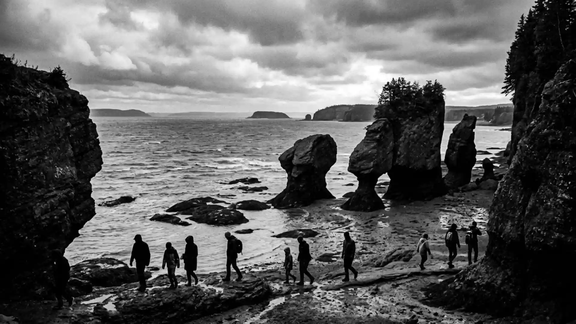
The shore around the Bay of Fundy is carved into cliffs, coves and sea stacks by energetic waves and rapid tidal currents, exposing layers of sedimentary rock and sculpted outcrops.steep bedrock cliffs and sea stacks Rivers draining into the bay from New Brunswick and Nova Scotia cut through soft Triassic sandstones coloured red and brown, releasing fine particles that remain suspended in the water and settle on the mudflats each time the tide recedes.soft red Triassic-era sandstone
In constricted channels and at river mouths, the incoming tide meets outflowing freshwater and forces its way upriver, creating areas of churning water and rapids whose direction can change with the tide.Reversing Rapids At low water the shore reveals broad areas of exposed sea floor with rippled sand, shallow pools and the bases of rock pillars, while high water covers these surfaces and lifts vessels to wharves that stand far above the mud at low tide.
Saint John’s harbour and Fundy towns
Along the shores of the Bay of Fundy, several communities have grown around natural harbours shaped by deep, sheltered inlets off the main bay, including Saint John and St. Andrews in New Brunswick and Digby and Hantsport in Nova Scotia.deepwater harbors These towns have histories tied to lumber exports, shipbuilding and maritime trade during the nineteenth and early twentieth centuries, when sailing ships and later steam vessels used the bay as a route into the interior and out to the wider Atlantic.
Saint John grew into a large settlement with port infrastructure on the inner harbour, where piers, quays and industrial buildings line the shore, and residential districts rise on hills above the water.largest population centre on the bay From the waterfront, views open towards the bay’s expanse, which at low tide shows exposed banks and at high tide becomes a broad sheet of water extending towards the head of the bay.
Visiting Bay of Fundy: what travellers from Western Europe should know
- The bay lies between New Brunswick and Nova Scotia on Canada’s Atlantic coast, with Saint John in southern New Brunswick providing a major harbour on its northern shore.
- Coastal terrain around the bay includes cliffs, rocky ledges and extensive intertidal mudflats, and access paths near the water can involve slopes, uneven ground and shorelines that change appearance with the tide.
- Saint John is connected to inland Canada and the United States by road and rail corridors, and ferries operate across parts of the bay between New Brunswick and Nova Scotia or nearby ports.
- The official languages of the surrounding provinces are English and French, and the national currency is the Canadian dollar.
- Entry requirements depend on your nationality; UK travellers can check the FCDO travel advice at gov.uk/foreign-travel-advice, Irish travellers the Department of Foreign Affairs at ireland.ie.
Searching for Bay of Fundy on social platforms
These links open searches for Bay of Fundy on each platform.
Frequently asked questions about Bay of Fundy
Where is the Bay of Fundy in relation to Saint John?
The bay extends inland between New Brunswick and Nova Scotia, with Saint John occupying a harbour on its northern shore at the mouth of the Saint John River.
What can visitors expect when exploring the shoreline?
Visitors encounter cliffs, rocky edges, mudflats and harbours where water levels rise and fall dramatically between low and high tide, revealing and covering large areas of sea floor.
What makes the Bay of Fundy distinctive among coastal landscapes?
The combination of very high tidal ranges, red sandstone cliffs, strong currents and towns like Saint John built directly on the changing waterline gives the bay a character shaped by moving seawater.