

Bay of Fundy’s colossal tides at Saint John
Published on 08/27/2026 at 09:31 | Editorial responsibility: Rafael Müller, Editor-in-Chief AD HOC NEWS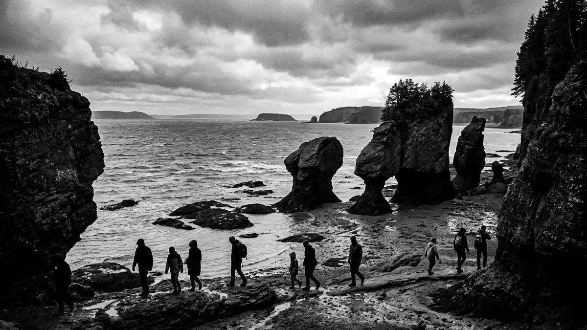
Along the Atlantic coast of eastern Canada, the Bay of Fundy forms a deep indentation between New Brunswick and Nova Scotia, and its waters meet the city of Saint John in a narrow rock gorge where tides reshape the shoreline several times each day. This bay is known for tidal ranges that reach about 16 m (52 ft) in its inner reaches, and those same tides drive the dramatic reversals of the Saint John River that define the waterfront of Canada’s oldest incorporated city.
A bay sculpted by extraordinary tides
The Bay of Fundy lies between the Canadian provinces of New Brunswick and Nova Scotia, opening southward into the North Atlantic Ocean. The bay is long and tapering, with smaller inlets such as Chignecto Bay and Minas Basin branching from its inner end, forming a kind of funnel that focuses the incoming Atlantic tide. In the upper bay, the tide rises and falls by about 16 m (52 ft), a range recognised as the highest in the world, with the water surface climbing and dropping twice during each lunar day.tidal range in the upper bay The timing of the tide is tied to the basin’s length and depth, so that the natural oscillation of the water mass matches the Atlantic tidal rhythm and repeatedly reinforces it.
On the New Brunswick shore near the head of the bay, Fundy National Park protects a stretch of coast where visitors can see the bare rock of the sea floor between tides. Along this coast, Parks Canada records tidal ranges of around 9 m (30 ft), with higher ranges further up the bay towards Chignecto Bay.tide heights near Alma in Fundy National Park The beating action of these tides has stripped away soil and softer sediments so that long stretches of shoreline expose tilted beds of ancient rock. The cliffs and platforms cut into these rocks continue around the bay, and on the Nova Scotia side a designated Cliffs of Fundy UNESCO Global Geopark showcases sites where the tides have carved out headlands and revealed a fault zone linked to the assembly and later breakup of the supercontinent Pangaea.Cliffs of Fundy UNESCO Global Geopark
Saint John and the Reversing Falls Rapids
Saint John stands on the north shore of the Bay of Fundy in New Brunswick, at the mouth of the Saint John River where it empties into the bay through a narrow rock gorge. In this confined channel, a series of submerged rock ledges breaks the river into churning rapids that have long been known as the Reversing Falls, now more precisely called the Reversing Rapids.Reversing Falls description The tides of the Bay of Fundy reach into this gorge, so that the direction of flow depends on the stage of the tide as much as on the volume of river water coming downstream.
At low tide in the bay, the Saint John River flows seaward over the ledges into the harbour, forming a train of standing waves and swirling eddies between the rock walls. As the tide rises, the level of the bay climbs until it matches and then exceeds the level of the river above the gorge, and the incoming seawater pushes upriver through the narrows. During this phase, the flow in the gorge reverses, with waves and whirlpools forming as the tidal current drives against the main river. Around the short slack-water period twice each tidal cycle, river and sea briefly balance and the rapids ease. Observation areas on the city side give a clear view into the gorge and across to the opposite cliffs, and the contrast between exposed rock at low tide and a fuller channel at high tide makes the relation between river and bay easy to see.
Rock, parks and long geological history
The coast around the Bay of Fundy exposes some of the oldest rocks in Atlantic Canada, and the tidal range makes these rocks unusually accessible along the shore. In Fundy National Park, the shoreline reveals bedrock of differing hardness, forming alternating headlands and coves; the repeated rise and fall of the tide has removed loose material and left a clean contact between rock, sand and water.Fundy National Park bedrock coastline Inland from the coast, the park’s forests and streams occupy a plateau cut by ravines that carry freshwater down to the bay, and the protected area was formally established in 1948, marking an early recognition of the region’s landscape and ecological value.Fundy National Park designation in 1948
On the Nova Scotia side, the Cliffs of Fundy UNESCO Global Geopark encompasses a chain of sites where waves, tidal currents and weathering have cut sheer faces into the coastal rock. These cliffs expose the Cobequid Fault, an ancient structure that records movements associated with the bringing together and later separation of continents within the supercontinent Pangaea.Cobequid Fault exposure Around Saint John itself, the gorge of the Reversing Rapids slices through Precambrian rock, and the collision of river and tide highlights the contrast between resistant bedrock walls and the constantly changing water level within them.
Visiting Bay of Fundy: what travellers from Western Europe should know
- The Bay of Fundy stretches between New Brunswick and Nova Scotia on Canada’s Atlantic coast, and Saint John lies on its northern shore at the mouth of the Saint John River.
- The Reversing Rapids gorge at Saint John is cut into solid rock, with viewpoints reached by roads and walkways that bring visitors close to the edge above churning water.
- Fundy National Park is situated near the village of Alma on the New Brunswick side of the bay, and it links coastal viewpoints with inland forest trails and streams.
- The official languages in this part of Canada are English and French, and the currency is the Canadian dollar.
- Entry requirements depend on your nationality; UK travellers can check the FCDO travel advice at gov.uk/foreign-travel-advice, Irish travellers the Department of Foreign Affairs at ireland.ie.
Searching for Bay of Fundy on social platforms
These links open searches for Bay of Fundy on each platform.
Frequently asked questions about Bay of Fundy
Where is the Bay of Fundy in relation to Saint John?
The Bay of Fundy lies between New Brunswick and Nova Scotia on Canada’s Atlantic coast, and Saint John stands on its northern shore where the Saint John River meets the bay.
What should visitors expect during a visit to the Bay of Fundy?
Visitors encounter dramatic tidal changes that expose sea-floor rock and mudflats at low tide and bring deep water against cliffs at high tide, especially near the inner bay and around Saint John’s Reversing Rapids.
What makes the Bay of Fundy distinctive among coastal landscapes?
The Bay of Fundy combines the world’s highest tidal range with a coastline that exposes ancient bedrock, leading to tidal phenomena such as the Reversing Rapids at Saint John and cliff sections recognised in a UNESCO Global Geopark.


