
Banaue Rice Terraces and the living mountains of Ifugao
Published on 09/12/2026 at 22:51 | Editorial responsibility: Rafael Müller, Editor-in-Chief AD HOC NEWS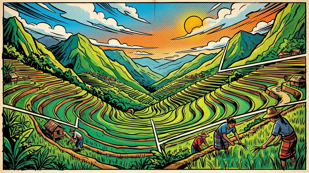
The Banaue Rice Terraces rise above the town of Banaue in the northern Philippines in a dense pattern of irrigated steps cut into the mountainsides, forming a cultivated landscape that turns steep slopes into layered fields. The terraces belong to the wider tradition of the Ifugao Rice Terraces in the Cordillera mountain range of Luzon, a system that has its roots in pre-colonial farming and is linked to a culture that has worked these highlands for many centuries.
Terraced mountains in the Cordillera heartland
The Banaue Rice Terraces lie within the municipality of Banaue in Ifugao province, part of the Cordillera Administrative Region on the island of Luzon in the Philippines. Here the Cordillera Central mountains form a spine of high ridges and narrow valleys, and the rice fields appear as horizontal bands cut into slopes that would otherwise be difficult to farm.Banaue lies in the Ifugao highlands The terraces occupy elevations of more than 1,000 m (3,281 ft), and the relief around them is marked enough that fields and villages cling to shelves of land between deep river cuttings and steep forested slopes.Topographic mapping of the Banaue area
From viewpoints above Banaue the terraces appear as a broad amphitheatre of stepped paddies following the natural contour of the hillside, with earth and stone retaining walls supporting narrow plots fed by small irrigation channels. This pattern is not confined to a single slope; fields extend along the sides of neighbouring valleys, where similar bands of cultivation link scattered hamlets. The landscape around the terraces includes forest on higher ridges, small rivers in the valley bottoms and roads that wind along the contours to connect farming communities.
Ifugao farming knowledge shaped into stone and soil
The Banaue Rice Terraces form part of the wider Ifugao Rice Terraces tradition, whose origins are dated by heritage bodies to ancient times; studies and commemorations of the terraces refer to construction that began long before Spanish colonial rule, with some references placing the beginning of large-scale terracing around the first century BC.Heritage records for the Ifugao Rice Terraces Across Ifugao there are many terrace clusters, including Batad, Bangaan, Hungduan, Mayoyao Central and Nagacadan, and together they form an extensive agricultural system that reworks the mountain slopes into usable farmland.Rice Terraces of the Philippine Cordilleras
The terraces at Banaue are irrigated fields held in place by walls of compacted earth and stone, built in narrow, repeated steps that follow the lie of the land. Water reaches the paddies through channels that tap streams and springs higher up the slopes, and the rice plots are edged by footpaths that link the fields to villages and roads. The terraces connect directly with settlements, where Ifugao houses and granaries stand close to the cultivated slopes, and the overall impression is of farmland and habitation interwoven rather than separated.
World Heritage context and the Banaue cluster
The wider Rice Terraces of the Philippine Cordilleras were inscribed on the UNESCO World Heritage List in 1995 as a cultural landscape, recognising a highland farming system that integrates social and ritual life with the shaping of the mountains over many generations.Rice Terraces of the Philippine Cordilleras inscription The World Heritage property covers five terrace clusters, including Batad and Bangaan in the municipality of Banaue, together with Hungduan, Mayoyao Central and Nagacadan.The town of Banaue and its terrace clusters
The terraces known specifically as the Banaue Rice Terraces are the fields closest to the town centre as seen from the established viewpoints, and they belong to the broader Ifugao Rice Terraces recognised in national heritage protection. In practice, travellers see a mosaic: the local Banaue cluster, the amphitheatre-like terraces of Batad with a village at their base, and the Bangaan terraces backing a traditional Ifugao village form neighbouring examples of similar techniques shaped by different valley forms. That proximity gives a clear sense of how terrace farming adapts to varied terrain while maintaining recognisable structural features.
Visiting Banaue Rice Terraces: what travellers from Western Europe should know
- The Banaue Rice Terraces lie in the municipality of Banaue in Ifugao province on Luzon; travellers usually reach the area by road from larger towns and cities in the Philippines.
- The terraces occupy steep mountain slopes, and paths between viewpoints, villages and fields can involve gradients, uneven stone steps and narrow sections close to cultivated paddies.
- Banaue stands within the Cordillera Central, and the approach roads follow valley lines and ridges, giving frequent views of terraced hillsides and river valleys as they climb into the highlands.
- The official language of the Philippines is Filipino, alongside English, and the national currency is the Philippine peso.
- Entry requirements depend on your nationality; UK travellers can check the FCDO travel advice at gov.uk/foreign-travel-advice, Irish travellers the Department of Foreign Affairs at ireland.ie.
Searching for Banaue Rice Terraces on social platforms
These links open searches for Banaue Rice Terraces on each platform.
Frequently asked questions about Banaue Rice Terraces
Where are Banaue Rice Terraces located?
Banaue Rice Terraces are in the municipality of Banaue in Ifugao province, part of the Cordillera Administrative Region on the island of Luzon in the northern Philippines.
What can travellers expect when visiting the terraces?
Travellers encounter steep terraced slopes, irrigated rice paddies, mountain views and paths linking viewpoints, villages and fields, all within a highland farming landscape shaped into steps.
What makes Banaue Rice Terraces distinctive among rice landscapes?
The terraces form part of a wider Ifugao system where stone and earth walls, contour-following paddies and close links between villages and fields turn rugged Cordillera mountains into a cultivated stepped terrain.


