
Archaia Agora in Athen, an open landscape of democracy
Published on 09/12/2026 at 20:27 | Editorial responsibility: Rafael Müller, Editor-in-Chief AD HOC NEWS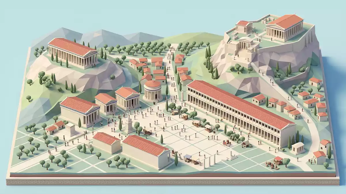
Archaia Agora in Athen, known in English as the Ancient Agora of Athens, spreads across a broad hollow north-west of the Acropolis where temples, stoas and civic buildings once formed the everyday stage of classical democracy. Set out as a public space in the sixth century BC, it became the principal meeting ground of Athenian citizens and the organised centre of political, judicial and commercial life in the city.
A civic landscape beneath the Acropolis
The Ancient Agora occupies a natural valley between the low hills of the Areopagus and Colonus Agoraeus, directly below the southern cliffs of the Acropolis and close to the course of the Panathenaic Way that crossed the square.The processional road for the Panathenaic festival ran through the area, linking the city to the Acropolis and shaping the open central zone that visitors see as a grassed expanse with scattered foundations.
Habitation and use in the Agora area reach back to the Late Bronze Age, when the ground was used as a cemetery, and the open valley was formally organised as a civic space early in the sixth century BC during the reforms associated with the lawgiver Solon.The Agora as a focal point of public life then drew together administrative offices, law courts, shrines, fountains and market structures around a largely open square. Standing here, the relationship between the Agora and the Acropolis remains clear: sacred rock rising above, with the flatter basin below dedicated to the affairs of the city.
Temples, stoas and the architecture of democracy
The Agora’s built form grew across the classical period and into the Roman era, with long colonnaded stoas defining many of its edges and freestanding temples and civic halls punctuating the interior. The Stoa of Attalos, rebuilt in the twentieth century along its ancient footprint, presents a two-storey colonnaded facade that recalls the commercial ranges once lining the eastern side of the square.The Ancient Agora of Athens records the site as an organised civic centre from the sixth century BC, surrounded by stoas, fountains, temples and altars by the second century AD.
Inscriptions and historical texts place the Bouleuterion, the council house for the Athenian boule of 500, on the western side of the Agora near a cluster of administrative buildings and law courts, reflecting the central role of the space in the operation of the first attested democratic system.The council of 500 meeting in the Bouleuterion and the presence of courts and magistrates made the Agora the working heart of Athenian government, while surrounding stoas provided shelter for merchants, philosophers and citizens engaged in daily discussion.
Layers of destruction, rebuilding and rediscovery
The Agora’s buildings suffered repeated damage over many centuries, and the ruins visible in Athen today are the result of successive waves of construction, destruction and reuse. Persian forces in 480 BC burned many structures in the area during their invasion of Athens, leading to extensive rebuilding in the fifth century BC, and Roman attacks in 89 BC and the invasion of the Herulians in AD 267 again devastated large parts of the civic centre.Accounts of repeated invasions and reconstructions describe public buildings being replaced and new monuments rising around the square, including Roman-period stoas, an odeion and temples honouring the imperial family.
After late antique devastation and Slavic incursions in the sixth century AD, the Agora gradually lost its role as a civic focus and the area turned into a residential quarter under Byzantine and later Ottoman rule, with houses, workshops and churches occupying the ancient remains.The excavation history of the Athenian Agora traces the systematic clearance of these later structures from 25 May 1931 onwards, when the American School of Classical Studies at Athens began large-scale archaeological work to uncover the classical layers and landscape the area as an archaeological park.
Visiting Archaia Agora: what travellers from Western Europe should know
- Archaia Agora lies on the north-western side of the Acropolis in Athen, between the Areopagus and Colonus Agoraeus hills, close to the course of the ancient Panathenaic Way.
- The archaeological park covers undulating ground with stone remains, earth paths and stairways around terraces, so moving across the site involves walking on uneven surfaces and climbing stepped routes.
- The official language is Greek and the currency is the euro.
Searching for Archaia Agora on social platforms
These links open searches for Archaia Agora on each platform.
Frequently asked questions about Archaia Agora
Where is Archaia Agora in Athen?
Archaia Agora lies north-west of the Acropolis in central Athen, in a valley between the Areopagus and Colonus Agoraeus hills crossed by the line of the Panathenaic Way.
What should visitors expect at Archaia Agora?
Visitors encounter a landscaped archaeological park with foundations of temples, stoas, civic halls and houses, alongside the reconstructed Stoa of Attalos and a network of earth paths and terraces.
What makes Archaia Agora distinctive among ancient sites?
Archaia Agora stands out for its combination of open square, surrounding colonnades and civic buildings that once housed the Athenian council, courts and market, forming the working landscape of classical democracy beneath the Acropolis.


