
Aoraki / Mount Cook National Park, where glaciers loom over Mount Cook Village
Published on 09/05/2026 at 14:39 | Editorial responsibility: Rafael Müller, Editor-in-Chief AD HOC NEWS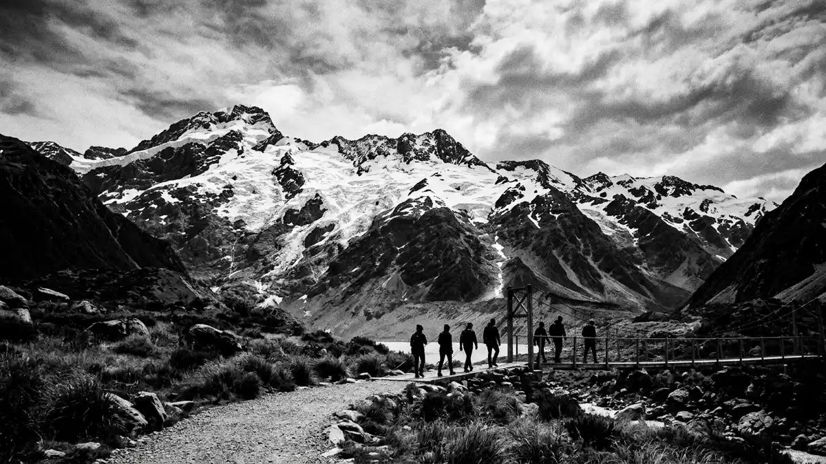
Aoraki / Mount Cook National Park in New Zealand’s Southern Alps is an alpine park built around the country’s highest mountain and a dense concentration of glaciers. The park was established in 1953 and forms part of the Te Wahipounamu World Heritage area, placing Mount Cook Village at the edge of a protected high mountain landscape shaped by ice and steep rock faces.
An alpine park dominated by Aoraki / Mount Cook
Aoraki / Mount Cook National Park lies in the Canterbury region of the central-west South Island, following the crest of the Southern Alps for several dozen kilometres. The park covers about 707 km² (273 sq mi), a compact area where ridges, valleys and glaciers crowd together in a narrow belt of high peaks.park covers about 707 km² It shares a long boundary with Westland Tai Poutini National Park along the Main Divide, linking it into a continuous chain of protected alpine terrain.shares a long boundary with Westland Tai Poutini National Park
The park takes its name from Aoraki / Mount Cook, the highest peak in New Zealand, which reaches 3,754 m (12,316 ft) and dominates the surrounding valleys and glacier basins.highest peak in New Zealand More than 19 peaks rise above 3,000 m (9,843 ft), creating a skyline of sharp ridges and snow-covered summits that frame Mount Cook Village far below.more than 19 peaks rise above 3,000 m Despite the village’s small size, its position inside the park makes it a base surrounded on all sides by high mountain scenery.
Glaciers, valleys and high mountain geology
Aoraki / Mount Cook National Park is known for extensive glacier systems that flow down from the Southern Alps into long, steep-sided valleys. Around 72 named glaciers have been identified in the park, and ice covers roughly 40 percent of its surface, giving the landscape a bright, broken texture of snowfields, crevasses and darker rock outcrops.around 72 named glaciers These glaciers include some of the largest in New Zealand, and they sit above valley floors where moraines and glacial lakes mark the slow retreat and advance of the ice.some of the largest in New Zealand
The park extends for about 40 miles (65 km) along the main range, but at its widest point the eastern boundary lies only around 16 km (10 miles) from the divide, so the distance from valley floor to summit is short and steep.extends for about 40 miles along the main range Aoraki / Mount Cook rises among more than 140 peaks over 2,000 m (6,562 ft), creating a compact cluster of high mountains within the park boundary.more than 140 peaks over 2,000 m For travellers based in Mount Cook Village the surrounding terrain appears as a series of layered ranges, with lower rock slopes leading to bright glacier surfaces and then to higher ridges carrying cornices and permanent snow.
World Heritage landscape and dark sky reserve
Since 1990 Aoraki / Mount Cook National Park has formed part of the Te Wahipounamu – South West New Zealand World Heritage area, together with Fiordland, Westland Tai Poutini and Mount Aspiring National Parks.Te Wahipounamu – South West New Zealand World Heritage area This designation reflects the global significance of the Southern Alps’ glaciated landscapes, their geology and their native ecosystems.
The wider Aoraki / Mackenzie region, which includes Aoraki / Mount Cook National Park, is recognised as an International Dark Sky Reserve, giving Mount Cook Village unusually clear night skies when conditions are favourable.Aoraki / Mackenzie International Dark Sky Reserve Away from major urban centres, artificial light is limited, and the surrounding mountains and glaciers form a backdrop to wide views of stars and the Milky Way. Alongside the natural attributes, the park’s protection status shapes how land can be used, and Mount Cook Village, officially named Aoraki / Mount Cook, sits entirely inside this national park framework.Mount Cook Village sits entirely inside this national park
Visiting Aoraki / Mount Cook National Park: what travellers from Western Europe should know
- Aoraki / Mount Cook National Park lies in the central-west part of New Zealand’s South Island, with Mount Cook Village reached by road at the end of State Highway 80.
- The terrain around Mount Cook Village is mountainous, with walking tracks that cross uneven ground and approaches that can involve sustained gradients and exposure near valley walls.
- New Zealand’s official language is English and the currency is the New Zealand dollar.
- Entry requirements depend on your nationality; UK travellers can check the FCDO travel advice at gov.uk/foreign-travel-advice, Irish travellers the Department of Foreign Affairs at ireland.ie.
Searching for Aoraki / Mount Cook National Park on social platforms
These links open searches for Aoraki / Mount Cook National Park on each platform.
Frequently asked questions about Aoraki / Mount Cook National Park
Where is Aoraki / Mount Cook National Park?
Aoraki / Mount Cook National Park is in the Canterbury region of New Zealand’s South Island, along the crest of the Southern Alps, with Mount Cook Village inside its boundary.
What can visitors expect on a visit to the park from Mount Cook Village?
Visitors encounter an alpine landscape of high peaks, extensive glaciers, steep valleys and walking tracks that start from Mount Cook Village and nearby roadheads.
What makes Aoraki / Mount Cook National Park distinctive among New Zealand’s national parks?
The park combines New Zealand’s highest mountain, a dense concentration of glaciers, Te Wahipounamu World Heritage status and inclusion in the Aoraki / Mackenzie International Dark Sky Reserve.


