
Aoraki / Mount Cook National Park shaped by ice and rock
Published on 09/23/2026 at 21:14 | Editorial responsibility: Rafael Müller, Editor-in-Chief AD HOC NEWS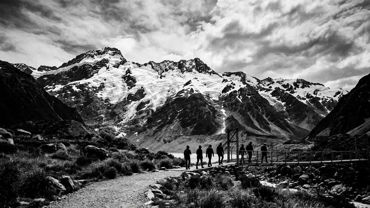
Aoraki / Mount Cook National Park is a landscape of ice, rock and high alpine valleys on New Zealand’s South Island. Aoraki / Mount Cook rises above the park at 3,724 m (12,218 ft), while glaciers occupy much of the terrain around Mount Cook Village.
Aoraki / Mount Cook National Park and the Southern Alps
The park lies in the Canterbury region along the eastern side of the Southern Alps, known in M?ori as K? Tiritiri o te Moana. Its valleys extend towards the Mackenzie Country, while the main divide forms a high western boundary.
The protected area follows the mountain chain for about 65 km (40 miles). Its landscape includes the Tasman, Godley, Murchison, Hooker and Mueller valley systems, each associated with ice, rivers and steep mountain walls.
Aoraki / Mount Cook National Park in ice and rock
Glaciers give the park its dominant physical character. The Tasman Glacier occupies the broad Tasman Valley, while hanging glaciers cling to mountainsides above the main valleys. The park’s alpine landscape includes New Zealand’s highest peaks and extensive ice fields.
Aoraki / Mount Cook is part of the Southern Alps and reaches 3,724 m (12,218 ft). The summit rises above the Hooker and Tasman valleys, with ridges, snowfields and exposed rock forming the surrounding mountain architecture.
Aoraki, Mount Cook and a protected landscape
The mountain carries two established names. Ng?i Tahu named it Aoraki, while the name Mount Cook was given in 1851 by Captain J. L. Stokes in honour of Captain James Cook.
Aoraki / Mount Cook National Park was established in 1953. The protected landscape forms part of Te W?hipounamu – South West New Zealand World Heritage Area, inscribed in 1990 for its natural features. The park’s World Heritage setting links its mountains and glaciers with neighbouring protected areas.
The park covers about 707 square kilometres. It contains high peaks, glacial valleys, alpine rivers and vegetation adapted to severe mountain conditions, creating a continuous landscape from valley floor to summit ridge.
Visiting Aoraki / Mount Cook National Park: what travellers from Western Europe should know
- Mount Cook Village lies within the park near the head of the Hooker Valley. State Highway 80 connects the village with the Mackenzie Basin and Lake Pukaki.
- The terrain is alpine, with steep valleys, exposed rock, glaciers and high mountain routes. The summit of Aoraki / Mount Cook reaches 3,724 m (12,218 ft).
- Short walks near Mount Cook Village include routes through the Hooker Valley and towards alpine viewpoints. Longer routes enter steeper terrain and require mountain experience.
- The official language is English and the currency is the New Zealand dollar.
- Conditions on the mountain change with the seasons; the local cable-car operators and alpine clubs provide information.
Searching for Aoraki / Mount Cook National Park on social platforms
These links open searches for Aoraki / Mount Cook National Park on each platform.
Frequently asked questions about Aoraki / Mount Cook National Park
Where is Aoraki / Mount Cook National Park?
The park is in the Canterbury region of New Zealand’s South Island. Mount Cook Village lies near the head of the Hooker Valley, close to Aoraki / Mount Cook.
What can visitors expect in the park?
Visitors encounter mountain valleys, glaciers, alpine rivers and tracks near Mount Cook Village. Routes range from valley walks to demanding mountaineering terrain.
What makes the park distinctive?
Aoraki / Mount Cook National Park combines New Zealand’s highest mountain with extensive glaciers and the dual M?ori and English naming of Aoraki / Mount Cook.


